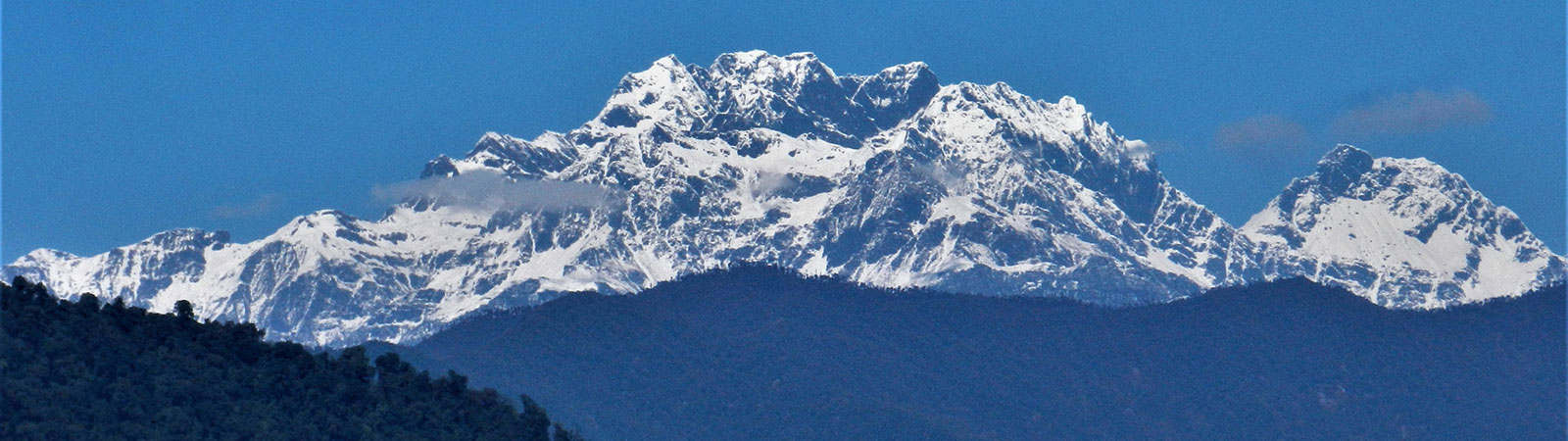
Holy Takpa Siri mountain
Share on Social
THE LOHIT VALLEY
By HARISH KAPADIA
2007
Neither me nor my husband are economists, but we believe firmly that good memories are the soundest investment . That belief was our justification for setting out in 1950 on a major plant hunting expedition to the borders of Assam and Tibet, on a wicket that financially was none too sound. At the time we started there was a considerable gap between our estimated expenses and the funds we had raised to cover them. When we returned, after ten eventful months the gap was wider. Some would say we were improvident. Perhaps we were, but we have no cause to regret our improvidence, which as long as life lasts will go on paying us rewarding tax-free dividends.
(Mrs) Jean Kingdon-Ward. My Hills So Strong, page 13. (Jonathen Cape, London, 1952)
We were standing in front of what Mishmis called a ‘bridge’. It was thin tree fallen across the Sat Ti river. To cross, one had to jump with light foot from a branch to another. To make matters exciting the river was flowing above the bridge at centre. Despite of months of planning, excitement and desire to reach the Diphu la it was impossible to persuade ourselves to go across. A wrong jump or breaking of the thin branch, would make you reach somewhere ‘higher’ than the pass ! To keep records straight, I, with my age and wobbly knees, was the first one to back out, followed by Sangeetha despite her training and youth justifying my fear. That left only Sashindran to carry on but he decided otherwise.
There were other reasons too influencing our retreat. The porters talked of more such dangerous bridges (two of them) ahead, one particularly terrifying at almost 100 feet above the river. Porters were carrying far less rations than that would be required for our next 10 days, as we were slow. They were reluctant to go down to ferry rations up and their leader, called GB (Gaon Bura), was not assuring their safe return. If the unreliable porters did not return with extra rations as intended, we will be stranded in the upper valley with rickety bridges to stop our quick return
The final base camp in this Sat Ti valley was still 3 days away. From here one had to climb to the watershed ridge with the Dichu valley which in the north. The trail went past few lakes to reach a high point and then descend to the Taluk pass. The return would be to climb back to the high point and past the lakes and finally to descend to the base camp – overall about 2330 m (7600 ft) in 20 km in a day ! There was no camping available near the lakes. For us it would require at least two camps on the higher plateau to reach the pass as even acclimatisation was an issue. Obviously were one valley south of the pass and there was no easy route to Diphu La from this valley, though were just 10 km short of the pass. Such a long day was for a very fit army officer or jawans or our troublesome but fit porters!
Discretion is better part of the valour, always, and we decided to return – to be safe rather than sorry and cause an, like we did in the Dibang, due to a freak storm. [1]
But all was not lost, it never is. We had travelled through a historic area and had been enchanted by lay of the land and sense of history.
The Lohit valley, in the eastern Arunachal Pradesh (formerly NEFA) is deep and thickly wooded. It is the easternmost valley of India. At its eastern extremity the borders of India –China and Burma meet at what is called the ‘Tri-Junction’. To the north of Tri-Junction is Jechep la (pass), leading to China and to the south lies the Diphu la (also known as Taluk pass) which leads to Burma.
The Lohit Valley and people
The Zayul chu and Rongdo chu flow from the north into the vast valley which becomes gradually plain as it reaches Rima.[2] It is such a remote valley that the Chinese had made Rima a penal settlement. Later as the prisoners married the local Tibetans the population grew. Both the rivers meet at Chayul and flow past Rima to Kahao. From here, in the Indian territory, it is called the Lohit river. It plunges down towards plain fast and taking many turns.
It takes an almost 90 degree turn towards the west starting at Minozong (present day Samdul) and completing at Changwity, not many major rivers are known to take such a bend. With many twists and turns it emerges into the Assam plains at the holy site of Parshuram Kund. At Hayuliang two major tributaries merge with it. The Delei and the Dau rivers originating near the Tibetan borders, enlarge the Lohit. Towards its east the Sat Ti (at Dong) and Ghalum (at Samdul) flow from the border with Myanmar (Burma). Each of these valleys lead to a pass which crosses into Burma. Once in the plains it spreads out and is a robust river, specially in the monsoons. The Lohit meets the Dibang and the Siang river almost near Sadiya, and then on is called Brahmaputra.
One of the important features of these valleys are its people. Lower valleys are inhabited by Mishmis, a troublesome, fearless and violent tribe in the past. Christian fathers were killed by them and they were known to bring slaves from the Assam plains to be sold at Rima. Situated on the northwest extremity of the Great Triangle, they have access to much opium and are generally on a high. There were no roads in the upper Lohit valley (almost till early 1970s) and they were isolated and law into themselves.
Few settlers crossed the Diphu pass from Burma into the Lohit valley. They settled in the upper reaches of the Lohit and are called Meyors. They are quiet, farmers and gentle tribe. Unlike in the other border areas, Meyors and Mishmis have not much contact with the Tibetans at Rima or elsewhere. In the plains, on the bank of the Lohit the Theravada Buddhism flourishes at the village of Chonkham, reputed to be one of the richest villages in the northeast. There are pagodas, people of Burmese origin, of unique culture mix which has kept the religion alive such far away from home.[3] When we passed the village it was in festive mood celebrating Thadinyut. [4]
Exploration
The Lohit valley is of historical significance for many reasons. Many famous names in the exploration visited the valley, specially for its natural wealth, but more to discover the path to the Zayul province which is easily approachable from here. The track is all along the river without having to cross any high pass.
The earliest traveller was the Pandit explorer A. K. (nicknamed ‘Krishna” or Rai Bahadur Kishen Singh). The British, unable to enter Tibet, had trained and sent native explorers to the forbidden areas. They brought back wealth of information for the empire. AK entered the Zayul province from the north, having crossed Tibet for many miles. He halted at Rima and finally went down the Lohit to the Assam plains. He calculated heights of most places, by the boiling point of his thermometer. As later explorations confirmed it, these were very near to the accurate heights. F.M. Bailey, who was with Sir Younghusband on the great Tibet expedition (1903-04) was in the Lohit valley in 1911-12. [5] He entered the Dichu valley near Kahao and stayed put at Hot Springs. His accounts of shooting of takins in the valley are hair raising. He also explored the Delei and the Dau valley, making inroads till its head and in the case of the latter, crossing the Dau-Dakru pass. The race to search for the best route to China brought next few explorers here. T. T. Cooper, William Griffith, Mr. Williamson, Dr Gregorson (last two were murdered by the Abors) were amongst the few.
The person who paid vigorous attention to the Lohit and its surrounding valleys was Frank Kingdon-Ward. He was a naturists of great repute and was usually sponsored by the Royal Geographical Society, London. He explored the Lohit, the Zayul and crossed the Dichu valley and Diphu pass (Taluk pass) three times to Putao (Fort Hertz) in Burma. To him we owe much information about the flora and fauna of the area. His observations, samples of plants and geographical descriptions were faithfully recorded in books and stored at the records of the RGS. In one of his later trips his wife Jean Kingdon-Ward accompanied him. Walking from Tezu they reached Kahao, spent some delightful days in the Dichu valley at Hot Springs. They also visited Rima from where their supplies were obtained through very troublesome and opium-fed porters. While they were at Kibithu the giant earthquake of 1950, which destroyed much of the eastern Arunachal, hit the area. They had harrowing time to retreat through broken trails, lack of any supplies and no porters ready to come with them. One of the advantage for the science was that rarely such a trained person as Kingdon-Ward is present in such a calamity, and lived to tell the tale. His writing on effects of the earthquake, are finest record for science.[6]
1962 – Indian China War in the Lohit Valley
The 1962 Chinese invasion was a tragic watershed in the military history of India. It exposed an inept Indian state both militarily and politically. But for most of the war, the fighting qualities of the Indian jawans and the young officers remained unchanged. Without a mention of the heroic resistance offered at Walong, no story of the 1962 war will be complete.
On mid night of 22 October 1962 the Himalayan calm was shattered as the Chinese attacked the Indian posts. Till 13th November fierce battles raged at many points like on the Dong hill, east of the Lohit, Ladders area, and the Lachhman Ridge. After paying a heavy price in terms of men lost at the Namti plains, the Chinese made a diversionary move to reach the ‘western Tri-Junction’ above Walong. The Indian troops were ill-equipped and ill-prepared for such battles and finally had to withdraw paying a heavy price.
Some managed to get back through the treacherous terrain. But many never got the orders. They slugged it out to the last man, to the last bullet. As Brigadier N.C. Rowley said, ‘6th Kumaon at Tri Junction fought and fought and fought till there was nothing left. After this there was eerie silence.’ Sikhs, Kumaonis, Gorkhas and Dogras fought shoulder-to-shoulder to the bitter end. Two months after the cease-fire when the Indians returned they found that the Chinese had marked the positions of the dead. Many of the bunkers showed the dead where they had last manned their weapons. The best tribute to the Indian soldiers was paid by the TIME magazine which wrote: ‘At Walong. the Indian troops lacked everything. The only thing they did not lack was guts’.
The Burma Hump
The area between the Ghalum and the Dichu pass is a high altitude plateau with several lakes. This plateau was nick named ‘the Hump’ by the pilots in the Second World war. These rickety transport planes flying from Chabua, Mohanbari and other airfields in Assam were supplying material to Kunming in China. They had to rise above the Hump to clear it, which few old machines failed to do so and crashed. As per offical records 706 planes crashed in Burma, China and some on the Hump. Of these 324 crash sites have not been located. There are survival stories of pilots who walked down from the Hump to the Changwity village on the Lohit and lived to tell the tale. Today expeditions are organised from Burma to climb up the Hump and locate the crash sites.
Walong Inscriptions
The British developed interest in the Lohit valley. They knew its importance for trade and defence. Hence administrators and later road builders were sent here.
Ronald Kaulback, who was member of the party with F. Kingdon-Ward in 1932 had written about makings on a big rock.
‘Next morning (March 29, 1934) we passed the Boundary Stone, on the right bank of the river, 2 miles south of the village Tinnai. The stone has an English inscription marking the end of the road built in 1912 by Sappers and Miners, though the road itself has been swallowed by jungle long since. There is also a Chinese notice on the rock showing the limit of their claims when they overran Tibet in 1910. I say “Boundary Stone”, but no one seems to have any clear idea as to where the boundary is actually is in the Lohit valley.’
The Geographical Journal, (of the Royal Geographical Society, London) (Volume LXXXIII, No 3, March 1934, p.180). Article ‘The Assam Border of Tibet’ by Ronald Kaulback.
We made inquiries to locate this rock, now almost after a century. We visited Tinnai village on the left bank and walked along the bank but nothing was found. Then suddenly in the bazaar of Walong one late evening we met Bamphak Meyor lama. He talked of such a rock in thick foliage near his fields. In deteriorating light, murmuring to himself all along in inebriated state, but sure footed, he us led down a steep hill tract and pointed out a rock. It had several Chinese letters written in red ! Again to keep the rercords straight one must give the credit to Bamphak Meoyor, his drinks and opium for this discovery!
It was a huge rock, coverd by foliage near to the helipad. Next day we returned with some equipment and porters and on clearing the surroundings the red letterings of the Chinese markings (written before 1910 ) were seen clearly and were photographed. [A] (see end-note)
The beginning
It was time to start on our trek. It was our aim to reach the Diphu la (the Taluk pass) which stands at the head of the Dichu valley. This pass leads to Burma to the south and the Tri-Junction of the borders of India-China and Burma in the northeast. Many explorers like Kingdon-Ward and others had travelled on this route often and apart from early difficulties the Dichu valley follows the natural line to the pass. However the present day political conditions dictated that the Dichu valley cannot be approached. Hence as an alternative we had to follow the Sat Ti valley to its south.
We arrived at Walong on 17 October 2007 when the festival of Dusherra was being celebrated. This Hindu festival has made inroads into this Meyor and Mishmi country, – any excuse is good for a bit of fun, gambling and drinking. The young in the area, who later came with us as porters, have not much activity, education or income. They survive on the wages provided by the army when they work for them. For many months when it rains heavily, they have nothing to do but smoke opium which is easily available. Many sell opium to make a living. We spent our time usefully, visiting the army memorial where the names of soldiers, who had laid down their lives in defence of the Lohit valley in 1962, are written. There is an official memorial and epitaph near the helipad. At the ‘Helmet Top’ the remains of the gallant Indian defenders are kept. Such places should be made a compulsory visiting for the younger generation of Indians so that they realise what sacrifices have been made by our valiant soldiers so that they can today sit on their computers peacefully.
We walked to the ‘Millennium Point’ at Dong, where, amongst few other places, the receiving of the first sun rays of the present Millennium to the Asian Sub-Continent was celebrated. Dong, with only a few houses, is well known and considered by annylists as an example in political divisions of territories.
At Dong – that Arunachal Pradesh tourist brochures advertise as the place to see the first sunrise in India but where the Indian Army does not permit anyone to go – it must feel as if this world ends. Less than 50 km away is Zayü, accessible only with a visa and by airplane from Beijing. Correspondingly, the Sakongdan village, Burma can only be accessed via Rangoon. (The militaries of neither country are likely to allow a visit to these places at their border zones anyway.)
(‘Territorialities yet unaccounted’, by Karin Dean)
Porters
It was impossible to obtain porters till the festival was over on 21st October. However later too we never managed to gather enough porters required for the trip. As a result we had to redistribute loads and some rations were to be brought up later. This was similar situation as faced by Kingdon-Ward six decades ago ! In fact Ward had to stay a week at different places to gather porters and supplies. At one point he had to time the return journey to accommodate Mishmis returning down to their country. Not many things had changed in these areas.
Of slaves and Takins
- M. Bailey, the British officer, who spent few months is this area, writes about a mysterious Blue Man who was with the Chinese soldiers near Rima. He finally met him. He was a Bengali from Calcutta and was almost black in complexion, that impressed the Tibetans and Chinese and resulted in many myths. He was a worker from tea gardens near the Mishmi hills and was captured by the Mishmis 20 years ago and sold to the Tibetans at Rima. With arrival of the Chinese, along with the slaves of Tibetan nationals, he was released but as could not return to his home he was enlisted as a Chinese soldier. Bailey offered to take him back to Calcutta (now Kolkata) with him but ‘nothing would persuade him to go among Mishmis again’, even under Bailey’s protection. In fact Bailey writes that ‘my own position among the Mishmis would, I thought, be so precarious that I did not want to take him unless he himself persuaded me to do so.’
Later, during an Tibetan uprising in late 1910 the Chinese garrison at Chikong and Rima were eventually captured by the Tibetans and they threw them all into the river. Presumably the Blue Man perished at the same time.`.
Bailey spent weeks in the Di chu valley on shikar. He shot many takins, ‘the largest measured 53 ½ inches in height at shoulder and was 78 inches long from nose to the end of the short tail’. The Tibetans near Rima called takin “shing-ma”, while their Mishmi neighbours call them “kyen”. Takin is the name given by Mishmi tribes near where the Lohit river leaves the hills through whom they first became known to the world. The Tibetans of Po-Me and Kongbo call them “kyimyak” or “tsimyak” and this is the name more generally used in Tibet. The French missionaries at Tatssienlu used the Latin name and called the animal “le budocras”. ‘ (Bailey-p.137)
Later Baliey caught two takins alive in Bhutan and with kindness of the Maharaja took them to England. One was presented to London and Edinburgh zoo each. One takin died soon after arrival while the other lived in London for 12 years and died only in 1935. [7](Bailey-p. 137)
The Bridges
On the 23rd October, we started the trek from Dong, a village 6 km to the north of Walong and on the left bank of the Lohit. The first thing on the trail was to cross single log bridge about 100 feet above and across the Sat Ti. We had crossed many bridges in the Arunachal treks in the past (‘Foot Suspension Bridges’) which were scary enough, but in this less trodden valley such ‘single log bridges’ were singularly dangerous. Kingdon-Ward has written about dangers of such bridges, particularly when the upper bark had worn out due to usage. They are slippery hell !
The trail ahead otherwise was through thick jungles and with many steep ups and downs as usual. First day we camped at the ‘Slip Camp’ on a moraine slip which had occurred and reached till the river. The vegetation in these valleys was thick and unique as surveyed by Kingdon-Ward. In one sweep near our camp we could see banana trees, palms (both found at sea-level), the Indo-Malayan forest (found at about 200-600 m) and the pines (generally at 1800 m) !
Near to the camp was another single log bridge which had its bark worn-out due to use, making it very slippery, and it was at an angle. We fixed ropes and with care managed to go across but it was a scary affair. While the Mishmis, even though high on opium, could go across with nimble foot, others had to do it carefully.
Bees
As we were in autumn months dim dim flies, snakes, leeches or malaria bearing mosquitoes were less to be feared. At few places we saw huge but abandoned nests of bees. Baliey had written about such nests of different types; rock honey and wood honey (tree honey). Rock honey is poisonous unless cooked. ‘This honey is mixed with tsampa (parched barley flour) to give it substance and solidity, and this cooked forms a delicious kind of toffee which besides being eaten as a sweet was very useful in the absence of sugar for sweetening the food.’ Sir Joseph Hooker (Himalayan Journals) mentions about such nests looking like huge bats suspended by their wings and that they are poisonous in summer by rhododendron flowers. Kingdon-Ward had a similar experience, and his companion, Lord Cranbrook, went off into a trance when he took some poisonous honey.
On the 25th, continuing for five hours through forest and sometimes on the boulders near the river the Patta (leaves) camp was reached. It could have been named the ‘scorpion camp’ the original habitants of this camp in the forest. Next day, 26th October, after an hour of trekking we reached the ‘Final Bridge’ and our trek was abruptly over. If you pardon the paradox, much water was flowing over the bridge to go over it ! However short the trek, our ‘investment’ was safe and returns just beginning !
The area has much promise for future explorations. The Delai valley, north of Hayuliang has some population and many villages. It has no record of present day visit by trekkers or explorers. Similarly the adjoining Dau valley leads to the Dau Dakru pass which descends to Kibithu, perhaps making it difficult to obtain permission. The Dichu valley, very steep at the beginning, leads to Hot Springs and naturally to the Diphu pass, the old gateway to Burma. Proceeding along the McMahon Line the Dichu valley will remain sensitive for decades. The long and deep Ghalum valley starts from Samdul and leads deep inside. A branch turns south to Khumjwang pass on the Burma border while the main branch leads to some lakes.
However one will have to wait till the political situation allows for such a free movement, but it will be worth a wait for the future explorers. For the present we returned with memories of this great valley.
Here lies one who meant well, tried much, failed a little; surely that may be his epitaph, of which he need not be ashamed !
(With apologies to Robert Louis Stevenson ! From A Christan Sermon)
Area: The Lohit Valley, Eastern Arunachal Pradesh.
Period: 14th October to 2nd November 2007
Members: Harish Kapadia, Wing Cdr. V.K. Sashindran and
Ms. Sangeetha Sashindran. (Drs. Kamal Limdi and Ms Nandini Limdi left before the trek began due to personal reasons.
[1] See ‘The Promised Land’, by Harish Kapadia, H.J. Vol. 63, p.
[2] The famous Rima Gap, where within 100 kms of each other three great rivers, the Salween, the Mekong, and the Yangtse flow, is not far from here. It takes its name from this village.
[3] Theravada (terally, “the Way of the Elders”) is the oldest surviving Buddhist school, and for many centuries has been the predominant religion of Sri Lanka (about 70% of the population) and most of continental Southeast Asia (Cambodia, Laos, Burma, Thailand). It is also practised by minorities in parts of southwest China (by the Shan and Tai ethnic groups), Vietnam (by the Khmer Krom), Bangladesh (by the ethnic groups of Baruas, Chakma, and Magh), Philippines, Malaysia, Nepal (amongst the Newari people) and Indonesia, whilst recently gaining popularity in Singapore and Australia. Today Theravada Buddhists number over 100 million worldwide, and in recent decades Theravada has begun to take root in the West and in the Buddhist revival in India. (from Wikiepedia website)
[4] The place is at its liveliest during the great Burmese festivals – Thingyan, the water festival that inaugurated the Burmese new year; Waso, which marked the beginning of Thadin, the annual three-month period of fasting and abstinence, and Thadinyut, the festival of light, which celebrated its end.
(The Glass Palace by Amitava Ghosh, p.384)
[5] China-Tibet-Assam, by F. M. Bailey
[6] ‘Aftermath of the Great Assam Earthquake of 1950’ by F. Kingdon-Ward
(The Geographical Journal, Vol. 121, No. 3 (Sep., 1955), pp. 290-303)
[7] China-Tibet-Assam, by F. M. Bailey.
[A] References to the Inscription of Stone at Walong
By the end of 1913, the British had explored much of the Assam Himalaya. The British had inspected the Chinese boundary markers near Walong and put up British markers beside them. In the eastern Lohit Valley, the boundary retreated northwards from Walong (where both Chinese and British markers had been placed) to Kahao, 20 miles north. It simply appeared that the British wanted the boundary alignment northward to permit good defensive points in ranges far enough north to eliminate any Chinese influence into Assam.
In January, 1914, T. O’Callaghan, assistant administrator of the Eastern Sector of the North East Frontier, was sent up the Lohit Valley. Just below Walong, he found both old Chinese boundary markers, writing on a huge rock and a new marker placed in 1912 by the Chinese Republic. O’Callaghan removed some of the markers which were loose, took them upstream, and simply replaced them near Kahao, just below the McMahon boundary! He then went to Rima, conferred with Tibetan officials, and found no Chinese influence in the area. O’Callaghan proposed a road to, and a post in, Walong; but his superiors showed no interest in his proposal.
The serious fighting of the 1962 China-India Border War extended from October 10, 1962, until November 20, 1962. While the entire border was the issue, the actual fighting occurred in three widely separated areas: Walong, Tawang, and Aksai Chin. It is significant that while over 47,000 square miles of frontier were in contention between China and India, that the fighting was confined to areas where the Chinese felt that they had legitimate claims. In Walong, the British (O’Callaghan, in 1914) had moved the previously agreed British and Chinese border markers northward.
(From The China – India Border War (1962). By Calvin, James Barnard, Lieutenant Commander, U. S. Navy. Publisher: Marine Corps Command and Staff College, Quantico, Virginia USA. April 1984).
Deciphering the Walong Inscriptions
(see photo)
One of the important discoveries on this trip was finding of the rock with Chinese inscriptions. The antiquity of the figures on the rock, what it represents and its connection to Kaulback’s mention of a Stone inscription 2 miles south of Tinai, on the right bank of the Lohit (which is exactly where this rock is situated).
The inscriptions on the Stone were made with a kind of red dye (made out of mineral dyes, probably iron ore) and the pictorial depictions needed to be deciphered. A 1927 edition of the book Chinese Characters by Dr. L. Wieger and S.J Darmet (available to researchers at the Bhandarkar Institute of Oriental Studies, Pune, India) provided clues on what the upright characters could have represented. According to the book, such characters were the origin of the Chinese script and the book dates the characters to the pre-Christian era.
The clockwise Eastern Swastika character “Fang” (right) represents the four regions of space of two dimensions. The extended meaning could be square, regular, correct or a rule. It can specifically mean : ”this region”.
The anti clockwise Western Swastika Character may represent “Chi” meaning seven, a numerical sign. “Chi” is a less angular character than the one on the stone. The slanted swastika between the two clockwise swastika was not found in the book but is similar to “Chi” as represented in the book.
The man like character with a shallow bowl-like head (left, top) represents an ancestor and the figure with a circle for the head represents a man (if upright as in figure on left 2 bottom) and a son (if kneeling). If the man is below the ancestor it represents an offering. The character with a split head and horns (left top on the picture on right) is similar to “Shu” which represents glutinous grain or rice.
This writing could mean ”This region is the land of farming of our ancestors”. However find of this rock is of great significance and opens up exciting possibilities for further research.
(Ms. Sangeetha Sashindran)