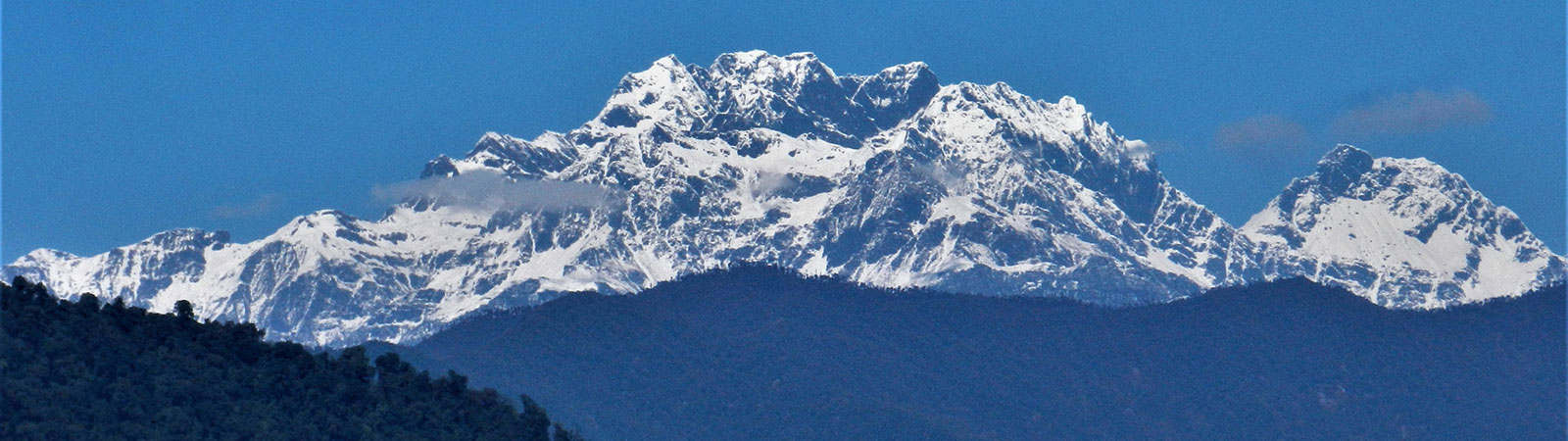
Holy Takpa Siri mountain
Share on Social
SECRETS OF SUBANSIRI
On Pilgrim Trail of Takpa Siri
2005
HARISH KAPADIA
“Say Hi 2 snakes 4 me,” was a short SMS message on my mobile. Keeping up the modern time, the remote town of Daporijo had a mobile tower and we were about to give up the comforts of civilization. But the message was not too wrong for within next two days we travelled to Tame Chung Chung, aka, (‘also known as’) ‘place of snakes’, in short ‘TCC’. These valleys of Arunachal Pradesh like almost anywhere were full on snakes, dum dum flies, which if beaten takes fifteen days to heal and leaves black marks for long. However, we were assured that there are no snakes now at Tame Chung Chung and no dum dum flies would bite us in the autumn season. However, our Doc. Wing Comdr. Sashidran had prescribed malaria pills and like all the units in the army in the area, it was Tuesday it was day to take malaria pills. None of us fell sick.
We had traveled 850km from Guwahati to reach the starting point of our trek. (This is no exaggeration and a major achievement in itself, considering poor roads, bad vehicles and sometimes-even non-availability of vehicles. But we managed.) These road journeys are not without its fun for you look around life of people, pass through …… forests and go through areas, which almost look like memories from the past. However, it is ……. dangers on return on that so called National Highway 52, our maniac driver was about to bang into a stationery truck. He severed but came up to line again, missing an on coming truck. As it becomes dark by almost 4.30 p.m. one has to sometime travel or trek in such poor light. Despite all that we were about to do, that was the scariest experience of this trip.
We traveled from Itangar (where we collected our inner line permits) to Kimin, Ziro and Daboridjo, only large places en route. Daporijo means ‘a flat land, ringed by mountains’. At Daporidgo we saw a stone with two Mithuns carved out on it. This stone was erected as an agreement of truce between two warring tribes solving the dispute over land. In the bazaar the Gandhi Ashram established another foundation stone. The stone was laid by the then Governor, Shri. B. K. Nehru. Today only electric pole and some garbage surrounded it and in this land of Tagins, who kill and eat everything. The non-violence theory of Gandhi doesn’t seem to hold water.
Each a small township now growing widely and in complete uncontrolled manner. Ahead of DaboriJdgo there was a small village, Taliha. It was till here that the Indian army had withdrawn when the attack from China was launched in 1962. But on the opposite bank was the village of Achingmori, which was in famous for an incident in 1956.
Achingmori Incident
En route we passed village of Talliha. On the opposite bank across the Subansiri was village of Achingmori, spread over the slope and the main village on the banks of the river. This place played an infamous part in the history of the area.
As the British left India, this area was largely left alone until 1953, when an infamous incidence of massacre occurred at Achingmori at the Siang Frontier Division (now known as Upper Subansiri). A party of Assam Rifles was resting in this village with their weapons stacked at one side. They were unarmed and were distributing salt as a gesture of goodwill. Hostile Tagin tribes inhabited these valleys and they had a distrust of visitors. All of a sudden, locals attacked them and they were massacred to a man. The main reason was that this party had employed porters from another Abor sub-tribe, whose members while accompanying the previous column had caused much harassment to the villagers. The Assam Rifles were out for blood and the retribution for such hostile acts was burning of entire villages, a practice well established since British times. But the then Governor Jairamdas Daulatram, on advice of Nari Rustomji, an administrative officer who loved and understood tribals, ordered not to act aggressively. The culprits were arrested and punished but villages were not burnt. Locals were waiting for their houses to be burnt and were quite surprised when this did not happen. This allowed for the first inroads of acceptance of Indian officials in the area.[1] Six culprits were arrested and each was sentenced to life imprisonment as per law. The last surviving prisoner died in 2001.
The road ended at present at Limiking and after traveling on a rough patch for next 14km, our trek began. The first point of interest was the grave of Shere Thapa. The first point was the grave of Shere Thapa, a valiant soldier of the Indian Army who held back a major assault by the Chinese in 1962. His supporters were all killed but alone with a light machine gun he killed several Chinese soldiers as they tried to come down the steep slopes in front. Though Shere Thapa was ultimately killed in the battle, his body was buried respectfully by the Chinese who left a small note praising his bravery.[2]
A similar incident happened during the Indo-Pak war in Ladakh. A large platoon of Indian army was held at bay by gunfire from a Pakistani picket. They could see that it was only one man who was fighting valiantly. After few hours, it was suggested that he could be bombarded to finish the resistance. To this the man in charge stated, “No he is a tiger, a great fighter and he must be taken alive.” Finally when his ammunition finished, this Pakistani soldier came out with a white flag, “I have done what I should have done for my country. Now you do what you like with me.” He was taken prisoner, but treated humanly and with honor and returned to Pakistan like a real tiger.
But what slope Shere Thapa had stopped the Chinese, we had to climb and descent on the return of course. That was the first challenge we faced and immediately we were introduced to foot suspension bridges and the steep ladders over rock cliffs. The trail crossed a ‘Foot Suspension Bridge’, a typical bridge made out of steel wires with wood and bamboo spread at its foot. We were to cross such FSBs at several places, each one of different sizes and quality. Some were tilting at sides making it difficult and dangerous, while some had planks suddenly missing at the bottom. If you are not careful your leg may slip through it. After this FSB the trail climbed almost vertically at first, there were several wooden ladders, first of many such ladders which we were to cross, both on ascent and descent during the trek. These wooden ladders were generally made of two large blocks of wood and other smaller wood nailed into them. Some of them were as high as 60 m while some were erected across entire rock face with river flowing dangerously below. We climbed up these wooden ladders to the top and after some refreshments, reached TCC (1835 m – 15 km). We were assured that there were no snakes in the area, particularly in autumn.
Ancient Trails
We were here in search of ancient pilgrim route of Takpa Siri. There are three pilgrimages in Tibetan Buddhism which every Buddhist is urged to perform once in life time. The Kora, or circumambulation around Kailash in the western Tibet has a special place in heart of Tibetans. The Pemako area through which the Tsangpo flows and passes between the peaks of Gyala Peri and Namcha Barwa is lined with many monasteries. These gompas form a circuit which devote Tibetans undertake. It extends in to the Yang Sang Chu valley near Tuting, India. The third major pilgrimage is Kora around Takpa Siri peak north of the Subansiri valley. Both the later pilgrimages routes extended south into the Lopa country (North East Frontier Agency or the present day Arunachal Pradesh). Kailash pilgrimage was undertaken by hundreds of Hindus from India too. The koras and pilgrimages were followed by Tibetans and Indians freely across both countries. The political borders were drawn later. The political upheavals stopped the Kailash pilgrimage for the Indians (and by some extent for Tibetans too) between 1959 to 1982. Pemako and Takpa Siri pilgrimages were forbidden by the Chinese even for Tibetans for same period. The tradition of Takpa Siri pilgrimage stopped since 1953 and as the route is divided between India and China, it remains forbidden after the Indo-China war of 1962. It is hard to imagine what faith had driven them to such an arduous pilgrimage. These Tibetans were not well versed with movements in jungles, facing the dangers of animals, snakes and insects. Though they employed Tagins to accompany them and use them as guides, this journey of faith was remarkable.
The area of Subansiri and the pilgrimage of Takpa Siri were initially well written about by Bailey and Ludlow FOOT NOTE About HJ refernces to Bailey and Ludlwo articles Both of them undertook the Rinkor and Kinkor and that was one of the earliest records of the pilgrimage. However, it was Tony Huber who wrote a doctorate thesis for Canterbury University about the Takpa Siri pilgrimage, its concepts, religious significance and the routes. This book was most authoritative reference to Takpa Siri. FOOT NOTE about The book
Along the Tsari Chu
First we were to trek along the Tsari Chu (Gelen bung) valley. As we started from TCC, first there was a descent of 5200ft down to the banks of Tsubansiri, which flows quietly at the foot of the hill. Arunachalis have one peculiar habit, may be because of thick forest, all trails are near vertical. There are no zig-zags, like in other parts of Himalaya. Thus though the slopes are covered quickly, but it becomes very tiring on knees while going down and on your heart while coming up. As we pass the small village of TCC, the ladies were on their morning chores and few of them were nodding their heads, murmuring “you will never reach down and if so, will never come up, at least not easily.” And how true they were. That steep descent was one of the hardest one can do and catching roots of trees, slipping and getting down steeply, we finally reached the banks of Subansiri. Little ahead at Gelensiniak (830 m – 4 km), Tsari Chu was merging with this main river. Across the first FSB on this route, stood a small temple, though in traditional style, it was not more than few decades old as it was renovated by the local units who had stayed here. And now we were on the typical pilgrim trail. Though we were never much above the river, but the trail constantly climbed up and down and through thick forest, making it very humid and sweating and tiring as on average our height was not more than 600 m.
We crossed FSBs with regularity; some were in great shape, while some tilting and with some foot planks missing. We were assured, that during rainy months, when the rivers are in spate, the wet bridges with waters touching to the foot of it, is an experience that no light hearted person can undertaken. As it became dark by 4 o’clock, we got into one large cave to spend the night. Such caves or bamboo shelters near clearings were called Tsuchhakang, which were built by the local Tagins during the pilgrim season. They stocked wood, which was plenty around and good deal of food so that the pilgrims do not have to carry those. During the season, the pilgrimage literally continued for three months and thousands undertook these trails. Galemo (1790 m – 17 km) was only few hours away next day and I part myself in the small inspection bungalow while Sashi with his wife Sangeeta Sashindran and Pratik Deb, a moviemaker from Mumbai proceeded to Bidag. Route ahead was a bit gentle and Bidak (1800 m – 6 km)was also situated in a large clearing. The trail went ahead to Maja, which was the last point approachable from India and it crossed across the McMahon line or the ‘Line of Actual Control’ to Bissa and finally to Longju and Migiyutin.
Indo-China war, 1962
The Indo-China war in 1962 changed everything for NEFA, now known as Arunachal Pradesh. The Chinese had never accepted the McMahon Line as drawn in 1914 at Shimla Conference. The Chinese delegates were present at the negotions but the declaration was signed by the Indian and Tibetan delegations only. The Chinese later repudiated the line totally and claimed the entire NEFA as their own. When the negotiations about demarcating the international boundary failed, on 20th October 1962 the Chinese attacked Indian army at several places, the major thrust being at Tawang.
In the Subansiri valleys the main Chinese thrust was from Longju. In 1960s the roads had reached till only north Lakhimpur, more than 500 kms away from the present border. The Indian Government ordered a party of Assam Rifles to proceed along the Tsari Chu and make a post at Longju which was near Migiyutin. This was under the ‘Forward Policy’ and against the advice of the defence forces. The Chinese protested and finally the post had to be withdrawn. Strong differences of opinion emerged between India and China on what was known as the ‘Longju Incident’. During the 1962 war, a strong party of Chinese came down from Longju, Bissa and down the Tsari Chu valley until they had a major fight on their hands at the Shere Thapa heights. They proceed further down reaching almost Nacho village en route. The Indian forces had withdrawn till Talliha.
From Menchuka valley, which is to the east of Tsari Chu, a party of Indian soldiers tried to flee down on an unchartered forest trail in to the Tsari Chu valley. The party was trapped in the forest, exhausted and four officers from their party died of exhaustion, including their Commanding Officer, Lt. Col. D. A. Taylor.
In 1959 as the Chinese troops took firm control of Lhasa, the capital of Tibet, the Dalai Lama, spiritual ruler of Tibet fled to India. After travelling for days on horses in cognito and protected by his guards, he reached the Indian border at Khinzemane, in western corner of Arunachal Pradesh. He was received by a Gorkha soldier and escorted to India and given asylum. Many of his followers crossed over to Arunachal Pradesh. This infuriated the Chinese
As if to state a point the first attack was in the region of Khinzemane from where the Dalai Lama had entered India. One of the routes the Chinese army followed was the Bailey Trail in India to bypass the army posts. They ran down to plains of Assam quickly as the Indian army was not prepared to face such a massive attack. The Chinese withdrew to the McMahon Line but had awakened the area. Roads were built, the Indian army moved to the border and thus the hidden land was well connected with rest of India.
People
After our experiences in the Tsari Chu valley, we climbed up to TCC for a day of rest. We had met one shikari, the lonely occupant of a hut at Galemo. He was building a intricate bamboo hut almost similar to Tsuchhakangs that were built for pilgrims. But as we entered his residence, suddenly you are in a primitive world. There were skulls of many animals that he had killed, particularly skulls of many monkeys that he had killed like many Tagins in this area. (Here they are all Tagin mara tribe.) He was literally living on the forest and the animals. There was traps set up to catch rabbits and rats and even snakes. In fact there is a belief that a young Tagin boy catches a snake, which is cut open, and almost the live throbbing heart is put in his mouth to make him brave. It is said that eat anything that walks except human beings and anything that flies, except aeroplanes. Lower in the valley they do no milk cows, as milk is considered an inferior product. But the cows are reared for their meat. Apart from meat, the forest gives them everything. However, with these traps, we had to be careful, for some of these traps were made as long distance arrows to kill an animal at a distance. And if you happen to trip over one you could be an unlikely target. Because of this remoteness, they had not seen certain plain products a few decades back. They were given sugar, which because it melted in water was looked with great suspicion, while soap was boiled and they were about to eat. Salt was the most important commodity as the nearest source was in Tibet. That was the reason for the interaction with Tibetans, their visits there and the trade with Tibetans.
The best gift to locals is to distribute salt, for them little else like cloth, fresh vegetables or milk mattered much. At Galemo I inquired whether we should hang all our food items in air, as it was quite common for such precious cargo to be eaten by rats. “Where there will be rats at Galemo. Locals have nearly eaten them all”, the caretaker explained. They eat birds and kill snakes by caterpillars stroke. The only time we saw one snake on our trail and the Tagin porter with us literally jumped ahead with him daha, which every Tagin carries and gladly butchered it, for that meant food. However it was thrown away, as only the meat of a poisonous snake is more delicious. Sometimes, we wonder and call them primitives for eating such food, isn’t a head of monkey, soup of snake and many other such items delicacies in restaurants in Hongkong, Japan or almost all over South-East Asia. It is only that their culture is different which we coming from India were finding it difficult to understand.
Along the Subansiri River
Soon we were ready to embark on the second part of our trek following the Subansiri upto Taksing village. The pilgrims from Gelensiniak proceeded along the Subansiri to the frontier village of Taksing. To catch the pilgrim trail we again steeply descended to the Subansiri River and proceeded along it. Once again, few FSBs were crossed and the trail went up and down with regularity and particularly in this section crossing many wooden ladders and bridges, across rocky slopes with river flowing below. After about nine hours of walking we reached Dajobung (1640 m – 14 km) late in the afternoon, but in darkness, as during winter in this eastern part of India, the darkness came by almost 4 p.m. Next day (30th November) the trail ahead started with a very steep climb to top of a ridge and then constantly proceeded up and down along the river. It was late in the afternoon, again dark when we reached Dadu (1650 m – 18 km), a small village of few houses and stayed here for the night. It was another 9 hour walk for us. From Dadu a steep climb led us to Reding and from here a newly constructed motor road led us to Taksing (2450 m – 18 km).
Taksing literally means the place of tiger. This is a well-known concept in Buddishm like the Takstang Monastery in Bhutan where it is believed that a lama wrote on flying tiger to establish a monastery high up on rocks.
Taksing was a large village mainly consisting of Monpa community (more akin to Tibetans) and the people seemed to be relying on supplies from Government for much less agriculture could be seen. The Tibetan frontier lies short distance from Taksing. Little ahead from Taksing, the Chayul Chu (Nyarshi river) flowing in from south west Charme Chu from north west and Yume Chu (Hari Siko) flowing from north meet to be called the Subansiri river. The pilgrim trail from Taksing climbed up along the banks of the Yume Chu into the present day Chinese (Tibetan) territory. The pilgrims worshipped at the Yume Gompa (monastery) considered most holy in the area. The pilgrimage ended here and from this gompa, pilgrims proceeded to the respective villages.
We spend next day at Taksing, gathering information about the ancient Takpa Siri pilgrimage, looking at various local customs and visiting a church and the foot imprints of Guru Padmasambhava in the villageTaksing was a small village with few habitants who distinctly looked different from the Tagins lower down in the valley. They were Mumphas and initially had much interaction in Tibet. Elders, very few of them have been left now, remembered the pilgrims of Tapa Siri and we could gather information from them. This is last of people who may have undertaken the pilgrimage from India and who remember them. We were lucky to have some first hand explanations.
Takpa Siri Pilgrimage
Takpa Siri is a massive ridge running north to south approximately 20 kilometres north of village Taksing. The highest point is Point 5735. At the base of the ridge and close to Keju la lies a small lake called Purang or Potrang. The lake and the ridge are both considered sacred by the Tibetans, and a yearly pilgrimage called Kingkor is made around the ridge from July to September.
As per the Tibetan belief, a mountain with four hills/passes and four water bodies is considered sacred. Takpa Siri Ridge, consists of four hills/passes and hence called ‘Rejincey’. The passes are Keju la, Sangyo la, Kangyo la, Sagam la and Chuma la (Longju). Similarly, the four water bodies, or the ‘Chujincy’, is formed by Yume Chu in the west, Tsari Chu in the north, Hembrang Chu in the east and Taktsang Chu in the south. The Tibetans consider a yearly pilgrimage around such a mountain to be sacred. As per a Tibetan belief, there are three lakes. While Purang, or Potrang is called the ‘Husband’ Lake, Kyomu is called the ‘Wife’ Lake and Umbare is called the ‘Son’ Lake. Out of the three Purang or Husband Lake is considered most sacred, and is worshipped by pilgrims from all over Tibet.
Ringkor, called ‘Logar’ by the locals of Taksing, is the longest, with a frequency of once in 12 years. FOOT NOTE: Nanda Jat or Raj Jat pilgrimage of Nanda Devi also takes place every twelve years as same time as both Buddhists and Hindus follow moon based calender. Both pilgrimages have many similarities in high trails it follows and fact that no women are allowed. However, there are no records of this pilgrimage after the 1962 Sino-Indian conflict and last it was performed in 1953. As per tradition, only male members participate and people from all over Tibet carry out the pilgrimage. The route followed is Chosam, Tsari Chu, Longju, Gelemo, Gelensiniak and along Subansiri to Taksing and hence to Yume. Pilgrims undertaking the Ringkor were sacred to enter the Tagin areas of the Subansiri Valley, as the local tribals would set traps and loot them en route. As a result, they resorted to buy protection and guides from the Tagins by way of 13 yaks, 50 Dao (Dah), 108 Muni (bead necklaces) and food grains.
These guides escorted the pilgrims up to the junction of Chayul Chu and Yume Chu, where a feast was organised prior to the departure of the pilgrims. They were seen off with Apong (local brew) and other food items. The pilgrims traveled ahead from Taksing to the junction where Subansiri is joined by Yume Chu from northwest. Subansiri flows from Chual a largest town and is also joined by Charme Chu, a nala flowing south of Sangacholing, one of the earlier holy places. From this junction, the pilgrim route followed Yume Gompa, a monastery of a great holy stature where prayers were offered and the pilgrimage was over. From Yume Gompa villagers went in different directions towards their home.
Kingkor, called ‘Lunger’ by the locals of Taksing, is a yearly pilgrimage, which again is undertaken by males only. The Purang or ‘Husband’ Lake is worshipped during this pilgrimage. It involves a smaller circuit around the Takpa Siri, near its base, along the track Chickchar, Mipa, Sagam la, Tamlangonga to Purang. The return route is not clearly identifiable. However as per the locals, it goes via Tumdan, Chakta Changu, Karkyu la to Yume.
There are four rivers which start from the slopes of Takpa Siri, draining into the Tsari Chu and the Yume Chu, on the east and west respectively, of the mountain. The lake of Potrang considered holy by the Tibetans forms the centre of this pilgrimage for this circumambulation. A detailed study of this pilgrimage was published by Tony Huber in his book, The Cult of The Holy Crystal Mountain.
The early travellers to this area had knowledge of the Takpa Siri pilgrimage. F. Kingdon-Ward, the famous botanist who studied the forest of Tibet . His article in HJ. and Burma, visited this area and has written about the fauna. F. Ludlow, another botanist, followed in his footsteps and photographed the various aspects of Takpa Siri, its route during his travels. F. M. Bailey with H. T. Morshead were deputed by the British Government to survey the northern range of the Arunachal Pradesh (then called NEFA) and Tibet borders. Based on their survey and observations, the McMahon Line wad drawn at the Shimla Conference in 1914. F. M. Bailey and Morshead undertook the Kingkor or the shorter pilgrimage around Takpa Siri, which allowed them to see all the sides and crossing of Dorlma la. Ludlow and others wrote about the Ringkor, the longer version of circumambulation around Takpa Siri .FOOT NOTE: No passport to Tibet and Assam-China-Tibet
The McMahon line of the line of actual control runs along a high ridge opposite Taksing. Today Tasksing remains one of the last outposts along the Subansiri. One can wonder the people living here who nowadays seem less of agriculturists, but living more of Government handouts and food. FOOT NOTE: An Indian air force plane had crashed in the Yume Chu valley on 3rd January 1960 killing all nine occupants.
Christianity
At Taksing within few kilometers of the Tibetan frontier and bastion of Buddhism, there was a small church. This was in keeping with the spread of Christianity in the valleys of Arunachal Pradesh. In the plains historically, the spread of Christianity and other religions like Muslims are looked down upon. There is no concept of conversion in Hinduism and for its mind difficult to understand how Christians would convert a tribal to faith of Christ. However, in such primitive valleys things appeared different to us.
The tribes of Arunachal Pradesh were steeped into the local traditions, which was a form of animistic or nature worship religion, known as Donyi-Polo, literally worship of ‘Sun and Moon’. They worshipped nature, but in a primitive and superstitious mode. Their dead were either left open to be eaten by vultures high up on the cliffs (a prominent Tibetan custom) or they were buried with bamboo funerary towers erected over it, decorated with dead birds. More richer and important person he was, more birds would be killed and hanged on this structure. These people knew less of hygiene and had no formal religion as such. However, they were honest, strong and firm believer of nature.
It was in such a scenario that the early Christian Fathers came to these areas. They spread the Gospel of Christ and initially supplied all the necessities like education, transport and medicines to these tribals. This won them over. Soon many were converted and many small and large Churches were built. The huge Churches are lower down in the valley at Ziro, Hapoli or Daporijo and almost every village had a church including one near the Tibetan border at Taksing. The Hindus never came here to reform them or accept them. There were no Muslim invasions to convert them with sword and surprisingly no Buddhist influence filtered down to them from Tibet. Thus like in North-Eastern India, it was left to Christian Missionaries to work here. In last few decades, the inner line regulation does not allow any foreign priest to preach here. However, now there are locally trained priests who continue with spread of religion. The churches have good attendance, Preaching is in local languages and ceremonies are also localised. Christmas was being celebrated and carols were being sung. Priests run several social centres, though the main forms of service like education, medical and transport are now taken over by the Government. Generally the people who converted to Christianianity were found to be more civilised and better educated. Though with such conversions the other aspect of life styles like food habits remained the same and it is said that a Tagin would eat anything that flies, except the aeroplanes and would eat anything that walks, except the human beings !
It remains a question how this Christian influence spread into such deep areas. There are churches of Baptists faiths, Revival Churches and of Catholic faith. The situation here is almost akin to the spread of Christianity in the African sub-continent. The whole concept of Christian preaching can be seen here and it remains a matter of conjuncture what would be the development or what different shape of development these people would have taken if there was no Christianity here. FOOT NOTE: The usual questions: conversions vs. old religion – was Donyi Polo was better and should be left alone? Has priests taken advantage or led them to change that is modern? What is “modern” and should they be allowed a generation or two to change their own religion? All these points will never be fully answered.
FOOT NOTE: I remember a lovely Cartoon in Punch. In a party of wild youngsters with a long hair, torn clothes and wild loud dancing, one gentleman was sitting in a corner in most formal suit with tie and shining shoes. A reporter walks straight to him and asks: “Dr Livingston I presume?”
By the way you know when Stanley met Livingston and said this sentence, it was a well rehearsed phrase, not on spur of a moment. It was for the headlines in THE TIMES. Same with Armstrong’s one small step for man sentence, it was planned much ahead.
On the return, we trekked shorter distances to make it less strenuous and more enjoyable, by staying extra nights at Reading and camping on the banks of the Subansiri. On 7th December we climbed back steeply to TCC (mercifully for the last time !) (1835 m – 8 km) to end our following of the pilgrim trail. With this our time in the Subansiri valley was over and were fortunate enough to learn some of its secrets.
Arunachal Three Valleys
Over the years I have now visited three valleys of Arunachal Pradesh where the rivers flow into India originating in Tibet. One more remains for the next year.
The western-most was Kameng rivers with Namka Chu coming in from Tibet. FOOT NOTE: Two articles of mine from HJ as ref. I found this valley complicated, many criss-cross rivers and wild terrain and with intervening ridges. Not a smooth valley. But it was here that Dalai Lama entered India and in 1962 Chinese attacked India and massacred many. Is it due to that I feel this? Mind Games?
Then there was Tsangpo- Brahmaputra. It falls steeply from the Tibetan Plateau and flows very fast into India. It appeared terrifying, mysterious and something you have to be scared of. Is it mind games again? As this river has had a long history of exploration and mystery which took a long to solve.
Then this year, first the Tsari Chu river, which issues from the Crystal mountain -Takpa Shiri. It appeared gentle, serene and wonderfully clear. It felt peaceful to sit next to it. On the other side flows 2 rivers- Yume Chu and the Subansiri (the hidden river). Yume Chu is where the Takpa Shiri round ends. There is a huge Gompa there – now in China and it appeared again very serene. The Subansiri flows from further west and is dirty. It comes from a large military Garrison town of Chayul in China. The Subansiri takes in Yume Chu early, then eats up Tsari Chu and is ultimately herself is eaten up by the Brahmaputra or The Tsangpo. Kameng also flows into the Brahmaputra.
Dies it mean that holy rivers or holiness gets into muddy waters (Subansiri) and it washed down by the force of God? (Fast Tsangpo?) And the bloody waters of Kameng (which saw much fighting and slaughters of the Indian soldiers) is purified by the force of Tsangpo- the Brahmaputra? Thus is Daivam a a force which takes in all the dirt, blood and even holy spirit?
Or is it am just playing mind games knowing the area and its history?
Finally we reached the town of Tejpur where a first sensible restaurant was situated. We were tired and looking forward to flying home. But in the evening light, Sangeeta pointed out a huge mountain rising and bathing in evening sunlight. It was Kangto and immediately our thoughts and spirits were drawn back to those verdant valleys, the forests and the holy pilgrimage. We had followed the trek of faith and it had become our God, aka, Takpa Siri.
The Subansiri Valley Expedition, 2005
Period : 15th November – 13th December 2005
Members : Harish Kapadia, Wing Commander P. K. Sashindran, Ms. Sangeeta Sashindran and Prateek Deo.
Travel route:
A long journey, of almost 870 kms was undertaken to reach the starting point for trek towards this holy mountain. Spread over three days we proceeded to Tezpur (202 km), Itanagar (198 km) to collect permits, (Hapoli) Ziro (175 km), Daporijo (141 km) and to Limiking (142 km). 14 kms ahead of Limiking at Orak the road ends at present. Descending to the banks of the river the trek began.
References:
- The Cult of The Holy Crystal Mountain , by Toni Huber.
- India’s China war, by Neville Maxwell.
- No Passport to Tibet, by F. M. Bailey.
- Assam-Tibet-China, by F. M. Bailey
- The Fantastic Fifth, by Col. Anil Shorey (Retd)
- ‘The Forests of Tibet’, by Capt. F. Kingdon Ward, Himalayan Journal, Vol. VII, p. 103
- ‘The Sources of the Subansiri and Siyom, by F. Ludlow, Himalayan Journal, Vol. IX, p. 144 and Vol. X, p. 1
- ‘Arunachal Pradesh’ by Doug Scott, Alpine Journal, 2001, p. 59
[1] See Enchanted Frontiers, by Nari Rustomji, p. 128 for full details.
[2] See details of the 1962 Indo-China war.