Kone Khang peak, North Sikkim
Share on Social
KANGCHENJUNGA MASSIF : A BRIEF HISTORY
2000
No visitor to Darjeeling can fail to notice the mighty range of mountains on the horizon. Whether moving on the mall or sitting at Chaurasta, one would certainly notice this great range of mountains. In fact, it is one of the prime reasons for many tourists to visit Darjeeling. Most of the hotels are built facing this great mountain range and you can sit down on a terrace or at a coffee shop and look at this great range of peaks.
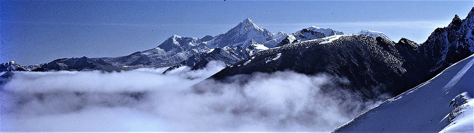
Kangchenjunga, is the easternmost of the 8000 m peaks. It is called ‘Five Treasures of Snow’, after its five high peaks. The highest of these five is the third highest summit in the world and the highest peak possible to be climbed from India. The peaks stand in some isolation from the main axis of the Great Himalaya.
Kangchenjunga has always been worshipped by the people of Darjeeling and Sikkim as God. No one was allowed to climb it until recent decades. Until now every climber or climbing group that has reached the summit has stayed at least 5 ft. below the top. There are basically two major approaches to climb Kangchenjunga or reach near its base. The approach from India is via Sikkim. One can go to Gangtok, and proceed to Chumathang and Lachen. From here a little difficult trail leads to what is known as ‘Green Lake’. The Green Lake has now almost disappeared and there is only a vast camping ground on the banks of the Zemu glacier, one of the longest glaciers in eastern Himalaya. From this eastern approach one can see the huge east face of Kangchenjunga rising hundreds of feet above. In fact the face is so stupendous and rises so steeply that despite being attempted first in 1929 by a German team it was not climbed till 1977. The other approach is from Nepal and it is the eastern-most peak of the Nepal Himalaya. Rising from the Kangchenjunga glacier the peak is surrounded by many other glaciers. As Siikkim was closed to foreigners till very recently, this approach from Nepal became rather popular with trekkers, explorers and mountaineers. It was by this route that the summiit was climbed for the first time.
Before 1949, when Nepal was closed, all approaches to climb Kangchenjunga had to be made through Sikkim. As the Sikkimese worshipped the peak as a deity, no climbers were allowed in the areas near the Kangchenjunga massif, let alone climb the peak.
When the ‘Chogyal’ (the King of Sikkim) was asked for permission to climb Kangchenjunga from the Indian side, he was told that the first summitters of the peak had stayed 5 ft. below the main summit, and thus the Gods of Sikkim were not offended. The Chogyal, little angrily replied, ‘ Yes I know that. But the summitter was 6 ft. tall so actually his head was 1 ft. above my God.’ Whether it is true or not that the Gods were offended, after the first ascent, plenty of bad weather and rains devastated Sikkim.. However, since then major expeditions have climbed Kangchenjunga via many different routes and it has remained one of the most beautiful and prized objective for mountaineers.
The mountain had been attempted from two different sides and was climbed only thrice by two expeditions at 22 years interval. Six men have stood just short of the summit – the first, almost 50 years after the earliest attempt on the summit.
The total height to be ascended from the Zemu glacier (Green Lake) is 3300 m, and from the Yalung glacier (British Base Camp near Pache’s grave), about 3100 m.Though Kangchenjunga is the presiding deity for the people of Sikkim, for the British it was an object of curiosity and exploration. With their sense of inquiry in all matters, British explorers were attracted to Kangchenjunga as a mountain. Thus began the exploration of a route to the Kangchenjunga area and finally routes to the summit.The first explorer to arrive in the area was J. D. Hooker One of the greatest of British botanists. He made two remarkable journeys in 1848 and 1849. These explorations were to take him on an almost complete circuit of the Kangchenjunga range. He reached almost 22 km from the peak itself, and was the first to describe the Kangchenjunga massif in some detail. He also made a sketch of the peaks from Mon Lepcha. Dr. Campbell, Superintendent of Darjeeling accompanied Hooker at times on his journeys. Both were good friends and interested in Sikkim and its people. Hooker travelled up the Teesta valley and almost reached the Zemu glacier before heading NE to Bam Tso and the Donkhya La (5600 m). His explorations are recorded in his famous books Himalayan Journals.
Next to be interested in Kangchenjunga was Capt. W. S. Sherwill , a British Revenue Surveyor, who crossed the Singalila ridge from the Kulhait river to investigate the geological structure of the Kangchenjunga range. He also carried out a survey of the area west of Dzongri and Kabur. Like a scientist following an explorer he made a map of the headwaters of the Ringbi, Yunga and Yalung rivers.In 1855 one of the three Schlagaintweit brothers (German), Herrmann von Schlagaintweit was put in charge of the Magnetic Survey of India. But he failed to obtain permission to travel in Sikkim. On the advice of Dr. Campbell, who was still Superintendent of Darjeeling, he set off to follow the Singalila ridge northwards. He climbed the small peak of Tonglu and reached the high point on the ridge of Phalut. It was from here that Schlagaintweit painted panoramas of Everest and Kangchenjunga. These panoramas are today, rare pieces of art of those times available to researchers. He wanted to proceed further towards Kangchenjunga but soon his party was turned back by Nepalese soldiers.
Surveyors continued their interest in the range. From 1878 to 1881 Capt. H. J. Harman (British) began the regular survey of the Sikkim Himalaya. He also attempted to climb some of the high mountains, including Chomoyumo (6836 m) and reached Donkhya la. In 1881 he tried to reach the foot of Kangchenjunga but due to a dense forest en route he contracted an illness and died the same year. But he had sent his findings to the Survey of India and a map of his survey (1 inch = 16 miles) was published in 1882. To carry out a further survey, the Survey of India selected two Indians. The Chogyal was reluctant to let foreigners roam the area. Thus, two Pundit explorers, as they were called, were sent to the area during the period 1879-1881. They were Lama UgyenGyatso, a Tibetan teacher in Darjeeling, and Babu Sarat Chandra Das, headmaster of a school in Darjeeling. They travelled extensively from Darjeeling through the regions of Dzongri, Kang La, Yalung, Kangbachen and reached Chorten Nyima la north of the main massif and the northernmost point of Sikkim. A map of the district north of Kangchenjunga (1 inch = 16 miles) was later published.
Around the same time the first views about the possibilities of climbing the peaks were expressed. Major J. W. A. Michell, an Englishman read a paper before the Alpine Club in London on Kangchenjunga and in conclusion added that he saw no reason why an expedition to the Himalaya, under the auspices of the Alpine Club, should not succeed in climbing Kangchenjunga. His was a rather naïve opinion on the possibilities of an ascent of Kangchenjunga. In his article published in the Alpine Journal he stated, “one of its northern spurs at any rate seems to present no insuperable obstacles”
Rinzin Namgyal (Bhutia), another pundit, assisted W. Robert of Britain in 1883-84 in exploring the Talung valley. The following year he returned, first to explore the Yalung glacier, ascending to 5800m. He then followed Chandra Das’ route north to Jongsong La and Chorten Nyima La, returning down the Lhonak river valley and, via Lachen, to Darjeeling. He thus completed the first circuit of the Kangchenjunga massif. His map of the country ‘map of Kangchenjunga’ (1 inch = 16 miles) was subsequently published.
The first actual climbing in the neighbourhood of Kangchenjunga was undertaken by W. W. Graham (British) in 1881, accompanied at different times by Swiss mountaineers (professional guides) Joseph Imboden, E. Boss and Ulrich Kaufman. A number of peaks around 6000 m were claimed to have been climbed including Jubonu (5936 m) and Kabru (7338 m) from the SE. There is considerable doubt as to whether in fact it was Kabru that they ascended and not Fork Peak (6108 m) Graham also crossed the Guicha La from the south and visited the Talung glacier. But all claims by W. W. Graham were not seriously believed and he was considered an eccentric traveller who claimed anything he saw. Previously he had claimed that he had climbed Changabang (6864 m) – a most difficult and impossible looking peak on the rim of the Nanda Devi Sanctuary. In claims made by him he narrated that his climbs were achieved with no great difficulty, including peaks in Sikkim. Thus Graham’s claim to fame as one of the first climbers in Sikkim was always doubted.
During the beginning of the last decade of the 19th Century, two British officers paid much attention to Sikkim and the Kangchenjunga massif. First was J. C. White , who was the Political Officer in Sikkim and resident in that country for some 20 years. He made several journeys of interest. In 1890 he travelled from Dzongri over Guicha La to the Talung glacier. In 1891, accompanied by T. Hoffmann, a photographer from Calcutta, he travelled to the Zemu glacier to reach a height of 5350 m. White then continued on his own northwards up the Lhonak valley to Naku La (5540 m) on the Tibetan border. Hoffmann had taken the first photographs of the northern face of Siniolchu (6887 m) during this journey. Both of them popularised Sikkim in their own way. Hoffman gave a lecture with his brilliant photos at the Royal Geographical Society in London while White wrote his classic book Sikkim and Bhutan.
Another book that made Sikkim well known was Among the Himalayas by Major W. A. Waddell of the Indian Army Medical Corps, who had made several journeys of exploration in Nepal and Sikkim. In 1896, accompanied by Kinthup (a great name in exploration, of the Tsangpo/Brahmaputra episode) as Sirdar, he travelled to Dzongri and the Semo La (2 km west of the Kang La). From a knife-edged ridge above it he enjoyed a magnificent panorama of the massif though Kangchenjunga itself was blocked from view. As a Government official, Waddell did not risk descending into Nepalese territory to set foot on the Yalung glacier and felt obliged to turn back.
In 1899 came one of the major explorations of the Kangchenjunga massif. A party of six, brought together by D. W. Freshfield of England, included Prof. E. J. Garwood and C. Dover, both from England. But more importantly it included one of the finest photographers of that time, Vittorio Sella, and his brother Erminio, both from Italy. They were accompanied by Pundit Rinzin Namgyal who was already familiar with the area. The party made a seven-week autumn circuit of the mountain in the direction opposite to that followed by Rinzin in 1884. The entire route followed unknown areas, much of it at a great height. Having travelled up the Teesta valley and along the Lachen river, they climbed along the Zemu glacier reaching 5350 m. Freshfield was most impressed with the surrounding beauty as they camped on the glacier. Photographs of this area published by V. Sella are still considered classics of black and white photography. Freshfield, who had seen many great mountains in the world, was so impressed by the beauty of Siniolchu peak that he described it as ‘the most beautiful mountain in the world’.
The party then crossed into the Lhonak valley and proceeded west over Jongsong La into Nepal to descend along the Kangchenjunga glacier. From here they trekked to Kangbachen and ahead to Tseram. Finally they crossed back into Sikkim by crossing Kang La and returned via Dzongri. An excursion was made to the summit of Kabur (4825 m) from where they had an extensive view of the southern face of Kangchenjunga and the upper part of the unexplored Yalung glacier. A second excursion was made to Guicha La before the party headed south again down the Rathong valley back to Darjeeling. Freshfield’s classic book Round Kangchenjunga, contains most of the information with many photos, and panoramas by Sella. It is the most standard reference to the Kangchenjunga massif. Unfortunately a great fire destroyed most copies of the book and only about 50 copies of the original edition survived.
With the turn of the Century came the first serious climbers to attempt Kangchenjunga. The first attempt was made by a small Swiss party in 1905. Dr. J. Jacot-Guillarmod, C. A. Raymond and A. A. Pache were under the leadership of A. Crowley of Britain, who also invited along an Italian hotel-keeper from Darjeeling, R. de Righi. From the head of the Yalung glacier (on the never before ascended Nepal side) they proceeded up the SW Face (one of Freshfield’s suggested routes) and established Camp 7 at 6200 m. The high point reached was about 6500 m. On 1 September Guillarmod, Pache, de Righi and three Sherpas were descending to a lower camp when they met with an accident. Pache and the three Sherpas were killed, while de Righi lay half buried in the snow. Raymond descended alone on hearing the survivor’s cries for help but Crowley remained in his tent drinking tea. He later wrote “a mountain accident of this sort is one of the things for which I have no sympathy whatever …..Tomorrow I hope to go down and find out how things stand.” He considered that “the doctor is old enough to rescue himself, and nobody would want to rescue de Righi”. But despite Crowley (who was the self styled ‘Great Beast’ and a controversial figure) all was not in vain. This was the first serious attempt from the Nepal side and much detailed information of the Yalung glacier basin was obtained and subsequently incorporated into Garwood’s map. The expedition also brought back additional information and useful photographs on the climbing prospects of this side of the mountain. Pache and companions today are part of history. A monument to their memory was erected on the Yalung glacier near the Base Camp, and even today, after almost 100 years, “Pache’s Grave” is marked on the map and every visitor to the base camp makes it a point to visit it.
An Englishman, Dr. A. M. Kellas, visited the Sikkim Himalaya several times. His association with Kangchenjuga area was to leave a permanent mark in the exploration of the area. He made four trips to the range, on each occasion spending a long time and visiting many different valleys. The first two trips, between 1907 and 1912 were mainly undertaken to the east and north of Kangchenjunga. He reached Zemu Gap (5880 m) from the north and the Simvu Saddle (5390 m). He made three attempts on Simvu (6815 m) and Nepal Gap (6400 m) exploring the Langpo and Kangchenjunga glaciers. Dr Kellas generally travelled alone, with local Lepcha and Sherpas as support. His list of achievements are outstanding. In 1910 alone, he made ten ascents of peaks over 6000 m. In 1912 he was back again and after climbing Kangchenjau (6889 m) he visited the area to the immediate east and north of Kangchenjunga; Green Lake, Tent Peak Pass and the foot of Jongsong Peak.
Kellas made two more visits to the Sikkim Himalaya in 1920 and 1921. He was in the area south of Kangchenjunga, visited Kang La and Kabru and made an ascent of Narsing (c. 6100 m). During his explorations this tireless but modest mountaineer had taken many valuable photographs of the glaciers to the east of Everest and most of the still unknown high mountains to its north. Of course he covered almost all peaks of the Kangchenjunga massif. Immediately after returning to Darjeeling in 1921 he set off with the first Everest Expedition but died of heart failure at Kampa Dzong. What Kangchenjunga gave him, Everest took away !
In the 1920s other smaller British parties too were active around Kangchenjunga. H. Raeburn paid two visits to the area south of Kangchenjunga. The first was with Lt. Col. H. W. Tobin, who later was the Editor of the prestigious Himalayan Journal. They crossed Guicha La to reach the Talung glacier and ascended the Tongshyong glacier in an attempt to reach the Zemu Gap from the south. The second trip was with C. G. Crawford, (later, President of the Himalayan Club) to visit the Yalung glacier and its surrounding areas. From about 5800 m on the spur running westward from the Talung Peak they had a discouraging view of Kangchenjunga’s SW slopes. They returned over the Rathong Pass (5197 m). In 1925 a photographic expedition to the southern glaciers of Kangchenjunga was undertaken by N. A. Tombazi who was stationed at Bombay. He had twice been to Sikkim (1919 and 1920), on one occasion visiting the eastern glaciers (where he had reached height of about 6000 m). With porters, he left Darjeeling in April and trekked north across Dzongri and Guicha La. They crossed the Talung glacier and ascended the Tongshyong glacier. Zemu Gap was reached ,for the first time from the south. Tombazi concluded that it would not be possible for trekkers to reach Zemu gap.. After climbing Kabru and visiting the Rathong glacier Tombazi returned down the Singalila ridge. He brought back a fine collection of photographs of the mountains.
In May,1926, Capt. J. E. H. Boustead crossed Zemu Gap via the Guicha La and re-crossed it. This would have been the first complete crossing but H. W. Tilman who reached the Zemu Gap in 1936 doubted whether the Col that Boustead had crossed had in factbeen the Zemu Gap and not another Col, one at the very head of the Tongshyong glacier.
E. F. Farmer, an American, visited the Yalung glacier from the Kang La during May 1929. He had a secret intention of climbing Kangchenjunga alone. Camp 3 was pitched at the foot of the mountain. On 26 May Farmer set off with Lobsang and two porters to begin the climb. Despite poor weather he continued climbing, instructing three porters to wait for him. He did not return that night. The following day he was seen climbing again (apparently towards the Talung Saddle, 6685 m). He was never seen again.
With these explorations much was known about Kangchenjunga massif and its surrounding peaks. Now it was an attractive prize for climbing parties. As Nepal was closed to foreigners the Sikkim side was the only approach open.. With the British in control of India it was possible to obtain permits easily. Moreover Calcutta was the headquarters of the British Raj and within a short journey one could reach Darjeeling and start for the mountains rather quickly.
1929 – 1931 were busy years for Kangchenjunga. A German expedition of nine members, came to make the first resolute “attack” on the mountain. Its leader was Paul Bauer. Base Camp (Camp 3) was set up on 18 August 1929 not far from the Green Lake (Zemu glacier). The plan was to “attack” the mountain via the NE Spur. The crest of the spur was reached on 16 September. Camps 8, 9, 10 were all made in ice-caves, the last being at 7100 m. The high point reached by them was about 7400 m. A difficult retreat had to be made under bad weather conditions. The second German expedition with 10 members and same leader, Paul Bauer came in 1931. They followed the 1929 route and an advanced base (Camp 6) was established at the foot of the NE Spur on 13 July. Continuous bad weather delayed the placing of Camp 11 (an ice-cave at 7360 m) until 15 September. During this period, H. Schaller and Sherpa Pasang were killed in a fall while climbing up to Camp 8 and Sirdar Lobsang and porter Babulal died from illness. But with resolute approach, the “attack”, continued.
A few days later the highest point of the NE Spur was reached (7700 m). But to reach the summit they had to cross to the north ridge. Between the NE Spur and the main N. Ridge there lay a depression and then a steep snow slope up to the ridge. With its ice-flutings it was in too dangerous to attempt, so once again the climbers were obliged to retreat. Thus the dream of Germans to climb Kangchenjunga was not fulfilled. After decades Will Bauer organized an Austrian expedition to climb Kangchenjunga via the same route. Here too the team was unsuccessful, not reaching any higher on the mountain. They were thwarted by poor weather and illness.
Little before the time when Paul Bauer was attempting the peak of his dreams for the second time, an International expedition consisting of five Germans, three British, two Swiss and one Austrian attempted the peak from the West. Its leader was Prof. G. O. Dyhrenfurth who had managed to receive permission to pass through Nepal. They left Darjeeling in early April and crossed Kang La and Kangbachen. Base Camp was placed close to Pangpema on the Kangchenjunga glacier. The plan was to attempt the north ridge from below the North Col (by the N. W. Face). On 9 May while proceeding to establish Camp 3 on the first snow terrace above the ice-cliff, E.Schneider and Sherpa Chettan were caught in an avalanche and Chettan was killed. Another memorial was added at the Base Camp of Kangchenjunga. The expedition then tried the N. W. Ridge with the hope of climbing up from below Kangbachen. U. Wieland and Schneider reached 6400 m before giving up.
After few years, in 1937, a small British party planned and organized by C. R. Cooke which included Lord Hunt and Mrs. Hunt decided to enjoy the North Sikkim areas. One of their principal objects was to examine the North Col of Kangchenjunga and to assess whether it was a feasible route as an alternative approach to Bauer’s 1929 route. Between November 14 and 19, Cooke and two Sherpas set off from the Twins glacier and tackled the 760 m high wall of rock and ice. The difficulties proved too much for such a small group and Cooke was obliged to turn back. The route was not thought to be a practicable one on account of its difficulties and dangers.
With this the first round of explorations ended as the Second World War intervened. There were no climbing or a major trekking parties visiting the area till 1953.
Explorations After the Second World War
- Frey (Swiss) and Sirdar Tenzing made a reconnaissance of the Yalung glacier and its tributaries in October 1951. They, with G. C. G. Lewis and J. W. R. Kempe returned to the Yalung glacier during May 1953. From Darjeeling they went up the Singalila Ridge and crossed Chhiya Bhanjang. During their reconnaissance they were able to examine the S. W. Face of Kangchenjunga closely, and came to the conclusion that despite F. S. Smythe’s adverse view in 1930, a possible route up the face might indeed exist.
Armed with the report of this expedition the British were now greatly interested in this route and were planning to make the first ascent of this mighty peak. In 1954 J. W. R. Kempe returned with a six member British Reconnaissance Expedition. Their object was to discover a practicable way up to the great ice-shelf running across the S. W. Face. Three possible routes were investigated during May. One to the left of the main icefall facing the mountain, another from below the Talung Saddle, and third more centrally in the vicinity of the main icefall. A safe route was worked out nearly to the top of the lower part of the icefall via a rib, at the top of which Camp 7 was placed (5790 m).
First Ascent of Kangchenjunga
The British reconnaissance set the stage for the final ascent of Kangchenjunga and with the team led by Lord Hunt having achieved the historic first ascent of Everest on 29th May 1953, they turned attention to Kangchenjunga.
An expedition of nine members, led by Dr. R. C. Evans, left Darjeeling early in March and approached the Yalung glacier through Nepal. Sikkim was now closed. An attempt was made to force a route up from Kempe’s 1954 Camp 7 site by N. D. Hardie (New Zealand) and G. C. Band. This was found to be too difficult and was abandoned. A new base camp was made just below Pache’s grave.
The route ascended the snow and ice slopes to the left (west) of the ‘ Western Buttress’, crossing ‘The Hump’ to the upper icefall and to the ‘Great Shelf’. From here it continued up by the ‘Gang-Way’, to the right (east) of Freshfield’s ‘Horseshoe’, which they now referred to as ‘The Sickle’. Camp 6 was placed at the top of the ‘Gang-Way’ at 8200 m. From this high camp, on 25 May 1955, George Band and Joe Brown climbed to the summit. They stopped short of the summit as per the promise given to the Maharajah of Sikkim that the top of the mountain would remain inviolate. The following day, 26 May, Norman Hardie and H. R. A. Streather repeated the climb. Oxygen was used both times. The only sour note to this great achievement was that Sherpa Pema Dorje, exhausted after his carry to Camp 5, died at Base Camp a few days later.
The Ascent from the East
Kangchenjunga peak was left alone for many years thereafter as after its first ascent climbers gave attention to other unclimbed high peaks. It was in 1977 that Paul Bauer’s route from the NE Spur was climbed by an Indian Army expedition led by Col. N. Kumar. Sikkim had now become an Indian State and the authority of Chogyal had diminished. Thus permission was obtained to attempt Kangchenjunga from the east, the Sikkimese side. The team established Base Camp at Green Lake on the Zemu glacier with much equipment. On the lower section of the route Havaldar S. Singh was killed in a fall while descending fixed ropes below Camp 2.
Finally they crossed the N. E. Spur (1931 route) and reached the N. Ridge 24 May 1977. Their highest camp was placed on the ridge at 7990 m. From there Major Prem Chand and Naik N. D. Sherpa established a high bivouac on 30 May. On the following day they continued to the top, stopping just short of the actual summit. Thus the German route was now climbed.
With this, Kangchenjunga was climbed by two routes. Now climbers attempted and climbed peaks in the Kanchenjunga massif from all sides. The main peak was climbed by the North ridge route by Doug Scott and his team, and teams traversed other peaks of Kangchenjunga, climbed several routes and the mystery surrounding the peaks no longer existed. But the challenge remained, for Kangchenjunga would never be an easy peak to climb.
Kangchenjunga is a beautiful high mountain and the presiding deity of the Sikkimese people. It stands beautifully above North Sikkim and towers over hills of Darjeeling and surrounding areas. Now after being explored and climbed it still retains its awe, majesty and beauty. It always will. With Sikkim opening its doors for visitors, Kangchenjunga and its surrounding areas are most attractive for everyone to visit.