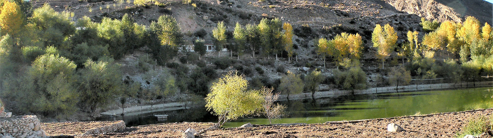
Nako Lake
Share on Social
THE MOUNTAINS OF MIDDLE KINGDOMS
KULLU – LAHAUL – KISHTWAR – KASHMIR
Mine are the torrents and timeless hills, The rock-face and the heather and the rain,
The summits where the life-wind thrums and thrills, And, answering, the glad heart sings again;
The good grey rock that loves a grasping hand, The stress of body, and soul’s rebirth
On the tall peak where god and men may stand Breathless above the kingdoms of the earth.
Showell Styles, The Mountaineer’s Week-end Book
The middle mountains of the Indian Himalaya constitute the ranges of Kullu, Kangra, Lahaul, Kashmir and Kishtwar that connect the plains of India to the trans-Himalayan regions of Ladakh and East Karakoram. These ranges may be smaller, on an average about 6,300 m high, and easier of approach, but they contain some challenging peaks, and a great variety of flora, fauna and grasslands. They are bounded in by the five tributaries of the river Indus, with the Satluj river forming their southern limit. The Chenab and the Beas rise north and south of the Rohtang pass in Kullu. The Ravi and the Jhelum rise south and north of the Pir Panjal range. Flowing in a westerly direction, each river merges with the Indus, and between these five rivers lie these ranges, the most beautiful and complicated, though not very high.
Kullu and Kangra
The fertile valleys of Kullu in Himachal Pradesh are to the south, and this area boasts of several fruit orchards. To Kullu’s south-west lies the Kangra valley, from where the Dhaula Dhar, (white ridge) a 100 km long ridge and one of the earliest ranges to be observed in the Indian Himalaya, rises suddenly and steeply to 5000 m, its snow cover making for a dramatic view from the plains of Punjab. At the foot of this range passes the Kangra Valley Railway, which was constructed in 1929.
In 1884, Sir Francis E Younghusband, a British explorer, observed the Dhaula Dhar from the plains of Punjab while on his way to Kashmir. General Charles G Bruce, a notable British mountaineer, passed its foot while journeying to Kullu in 1902 and was amazed by its precipitous walls and the absence of foothills. The several passes across this ridge connect the Beas valley in the south to the Ravi valley in the north, and the ridge itself descends to the Ravi basin, rising again to join the Pir Panjal range in Kashmir. Some of the well- known places on the Dhaula Dhar are Dharamsala and Dalhousie, and seeing the sun set on the hot and parched plains of Punjab from these cool vantage points is an undeniable pleasure.
Mon, Dromedary and Dhaula Dhar Matterhorn, at 4,971 m the highest summit in Dhaula Dhar, are some of the several peaks on the ridge. These mountains are easier to approach and can be tackled by smaller teams in much less time than it takes for the higher peaks. In the 1930s, Lieutenant P R Oliver and Colonel J O M Roberts, British mountaineers stationed in the Dalhousie cantonment, would often take to the mountains, and they climbed many peaks such as Two-gun, Arthur’s Seat, Toral, Mon and Cairn.
Their trips went something like this. After finishing their military duties at Dalhousie cantonment nearby, a staff car would deposit them at Dharamsala on Friday evening. They climbed up as high as possible same night with heavy rucksacks and climbed peaks in the weekend. Descending back to waiting car by late evening they will drive back in the night and after shower and shave will be reporting for the Monday morning parade, illustrating the easy accessibility of this range.
Dharamsala is now the home of the Dalai Lama, the spiritual guru of the Tibetans. He has settled in the upper reaches at McLeod Gunj with many of his followers and has built several institutions, libraries and monasteries to keep the faith alive in political exile. These Kangra valleys are no strangers to outsiders. During the second World War the British brought here many Italian prisoners, to keep them away from the European war theatre. They stayed in an open-air jail in the valley and were allowed to roam the area during the day. In evening the British guards will blow whistle and shout ‘To Your Own Locations’ signifying end of freedom for the day and the prisoners should return to the barracks. Not knowing English the Italian officer will shout ‘To YOL’ and the prisoners will follow him. The prisoners left after the war ended but today a village name ‘Yol’ is settled here with as a monument to the Italians!
These mountains are the home of the gaddis, Hindu shepherds with large flocks of sheep and goats, who descend to the lower hills and sometimes to the edge of the plains when snow threatens. With the return of spring, they turn their steps homeward, reaching the higher pastures and the hamlets, with their families to re-warm the hearths by June. Gaddis are a hardy race, given their strenuous centuries-old occupation, and they are expert mountaineers with an uncanny sense of direction, making invaluable guides to climbers who need not feel a sense of inferiority in following their footsteps blindly over sharp ridges and mountains. They speak different dialects and can be found in Kumaun, Garhwal and Himachal Pradesh.
Other summer visitors to the hills are the gujjars, a nomadic Muslim pastoral tribe living in the lower valleys, some of them owning pieces of land. Although it is the lower reaches of Dehra Dun and the lower Gangotri valley that have a strong gujjar population, these energetic travellers can be seen in the higher pastures of Kullu, Lahaul, Kishtwar and Kashmir in summer. They seek pastures for their herd, generally cows and buffalos, in various parts at different altitudes and live mostly by the produce of their cattle. It is may be matter of few decades that these traditions could disappear. With spread of education and settled village life, the younger generation of gaddis and gujjars are reluctant to spend months in wilderness with their flock.
The town of Kullu today resembles a large crowded bazaar, extending haphazardly from the Bhuntar airport. About 50 km north-east of Kullu, amidst the mountains, nestles the unusual village of Malana, governed by its own rules and almost a republic in itself. Walking in certain temple areas and sitting on a temple parapet is prohibited and the village council can fine visitors for anything it considers a violation of law. Adjacent to this village is Manikaran, situated on the river Parvati, and it boasts of a large Sikh gurudwara. In 1884, the British traveller, L W Dane, pioneered a route along the Parvati valley, across a high pass to the Pin valley in south-west Spiti. The high pass is now known as the Pin Parvati pass and is popular with trekkers. Near Manikaran lies the small, forested village of Pulga with a large grazing ground amidst thick pine and deodar forest flocked by gaddis and gujjars each summer. Opposite Pulga is the Uchich village, where silver mines existed in 1810, during the time of the Sikh invasion, when most of the mine shafts were filled-in, hidden and never opened.
Between 1961 and 1967 the Kullu region witnessed a great deal of exploration and climbing. If one person has to be credited for this, it has to be Robert Pettigrew, a British mountaineer living in India, who was particularly favourable to Kullu, which he made his climbing ground (1964-67). South-east of Manali on the Jagatsukh Nala, he made the ascents of Deo Tibba (6,001 m), attempted the difficult mountain of Indrasan (6,221 m), climbed Solang Weisserhorn (5,928 m) on Manalsu nala, now called Hanuman Tibba, and Kullu Pumori (6,563 m) in Lahaul. However, one of the best climbs of his career was the ascent of Papsura (6,451 m) in 1967, the ‘mountain of evil’. The nearby Dharamsura, the ‘mountain of good’ is climbed often. As per legend one of this peaks will be higher depending on situation in the world between good and evil. It seems world is towards the latter as not Papsura is higher but also killed a lady aspirant returning from its summit in 2005.
Lahaul
A long ridge continues north-west from Indrasan peak, dropping to its lowest point at Rohtang pass (3,980 m), which along with the Hampta pass on the same axis, was the original route to Lahaul in the 19th century. The Manali- Leh highway running through Rohtang pass now offers an easier access to Lahaul. The area was under subjugation from all sides: Muslim invaders from the eastern Kishtwar, Tibetan Buddhist kings from north and Hindu Rajas from Kullu. The Lahauli kings built several small forts for defence, like one at Gondla. The population mix today reflect the historical fact as there are some Hindus, some Muslims, with majority Buddhists in different valleys.
As one stands on the crest of Rohtang pass, a vast panorama of mountains opens to view. These are the peaks of Lahaul, never high but steep and difficult to climb. In front is Gepang Goh (5,870 m), named after the legendary king Gepang who is worshipped in Lahaul as he is said to have introduced barley, wheat and buck-wheat to this barren land. The mountain was first climbed by General Charles G Bruce in 1912. To the east is the Chandrabhaga mountain group, flanked by the two rivers Chandra and Bhaga. The Chandra river originates east of Baralacha La in north Lahaul, flowing past the lovely tarn of Chandra Tal and passes at the foot of Rohtang pass. The Bhaga river, its source at Suraj Tal west of Baralacha La, flows southwards, passing Keylong. Both rivers meet at Tandi, forming the Chandrabhaga river, known as the Chenab in Kishtwar, which finally merges with the Jhelum and Indus in Kashmir.
Lahaul has major glacial valleys. Feeding into the Bhaga, north of Keylong and seen from the road to Baralach la are the Mulkilla glaciers (M group), Koa Rong (KR group), Milang and Tela (T group), each consisting of about ten peaks of various heights. North-west of the Chandra Tal valley lies the Samuder Tapu glacier, the longest amongst all. The area which has traditionally been the climbers’ training ground is the Barashigri glacier in southern Lahaul. It is a favourite with climbers because it has many peaks with known approaches. On this long glacier stands the highest peak of the area Kullu Pumori (6,553 m).. Today, several expeditions are active in the mountains of Lahaul, particularly in the Chandrabhaga group as it contains many smaller peaks that are easily approachable from the road that descends from Rohtang pass towards Spiti, across Kunzum La. North of the Barashigri is the serene lake of Chandra Tal, which is surrounded by many peaks, specially to its west, named the CB group (Chandra Bhaga group) and are popular with climbers.
In the Bhaga valley, north of the confluence of the rivers Chandra and Bhaga on the Manali-Leh road at Tindi, is Keylong, the district headquarters of Lahaul. It is a small sleepy town from where one can descend to cross the Bhaga river and climb to the famous Kardhing monastery, established in 12th century and rebuilt by Norbu Lama in the early 20th century. Now a road joins the monastery with Tindi. Two Nuns from Switzerland (converted to Buddism as Nonos, female lamas) stayed at this monastery for decades, as it is famous for its scholarship. The famous ‘Chhitkul Lama’ (Sonam Gyatso) studied of Kinnaur studied here under his guru and legendary Csoma de Koros spent time here.
Further north, the Manali-Leh road crosses the Baralacha La, entering the completely barren terrain of the Zanskar valley. A popular trekking route to Phuktal and Padum in the Zanskar valleys begins from Darcha in Lahaul, situated near this pass.
Once Lahaul was ruled by the King from Guge dynasty of Tibet, specially the ‘Patan area’, the rich southern valley. Travellers to Guge, specially Jesuits, introduced potato seeds in this area and due this crop Lahaul is famous for its potatoes, and when the roads are open it is not uncommon to see them being transported across Rohtang to far away places, near Mumbai and south India.
Of all the Himalayan regions, Lahaul is probably the most prosperous and it has the best network of roads and a high level of education. But still some ancient traditions continue. There is a temple dedicated to the demon- goddess Hidimba and in an annual festival a procession of drunk villagers visit it and garland the statue with old shoes and throw garbage and curse it, with a hope that the goddess will be angered and send some storms and rain, which is very scant here and crops depend on rain. Next day when sober, they perform ablations in front of the goddess asking for forgiveness and blaming rowdy behaviour to alcohol.
Kishtwar
Situated on the north-east banks of the Chenab river (the Chandrabhaga of Lahaul), with Kashmir to the west, Zanskar to the north and Lahaul to the south-east, are the verdant valleys of Kishtwar such as Bhadarwah and Doda. Frederic Drew, a British representative was a avid traveller, wrote appreciatively about Kishtwar in 1875: “The sight of such a valley as this of Kishtwar gives one peculiar pleasure; the secluded space, so well adorned with verdure and with flowers, and enclosed by great mountains, will from everyone who sees it gain admiration.” These serene valleys are today closed off to tourists due to security reasons.
In the 17th century, Kishtwar was governed by Raja Bhagwan Singh, and the Rajput dynasty remained in power till the mid-18th century. One of the Rajput kings, Girat Singh, as an expression of his allegiance to Emperor Aurangzeb, embraced the Muslim faith, which lead to the introduction of Islam as a religion in the area. Gulab Singh, the Raja of Jammu, conquered Kishtwar in 1826, and by 1834, it was an integral part of the Jammu empire. Zorawar Singh, the great Dogra general of Gulab Singh, who invaded Ladakh, Skardu and Tibet in the 1830s, started out for his conquest from the Kishtwar valley. The mix of culture in Kishtwar is striking. From the Umasi La in Zanskar to the Machail in its south, there is a concentration of Buddhist population, with a distinct Hindu population towards Gulabgadh on the Chenab river and approached by road. Further ahead towards the west, in Kashmir, Muslim population dominates.
Kishtwar has innumerable valleys, several passes such as Umasi La, Hagshu La, Dharlang La, Santhan and Manthan, and a sheer variety of rock and ice peaks that are easily approachable. Ideal for small teams, it has small but challenging mountains, enough to satiate even the most ardent Alpinist. When opened this area is now easily accessible as a road now joins Kishtwar with the valleys of Lahaul. It will be soon possible to drive from Manali to Kashmir via Kishtwar, a rough road but with magnificent views.
The first mountaineers to visit Kishtwar were the Austrians, Fritz Kolb and his friends in 1947. They explored the eastern approach to the Sickle Moon (6,574 m), the highest peak in the area, from Machail. They went to Muni La, Dharlang Nala and to Poat La, crossing into Zanskar and returning to Kishtwar via the Umasi La. Charlie Clarke, a British doctor who surveyed the Brammah valley in west Kishtwar in 1965, 1969 and 1971, attempted Brammah I (6,416m) in all the three trips but failed to climb it. It was climbed by British mountaineers, Sir Chris Bonington and Nick Estcourt, who took on the challenge of the difficult and broken south-east ridge in 1973. Real success, however, was achieved by an Indian Army team that made the first ascent of the steep Sickle Moon in 1975. Their triumph was marred by a tragic accident in which one of the members was crushed to death by a huge boulder that rolled down the north-west ridge, halfway up the
Rob Collister, a mountaineer from Britain, who was in love with this area, made an alpine ski tour across Kishtwar in 1982. He was followed by many climbers like Stephen Venables and Dick Renshaw who scaled Kishtwar- Shivling (6,000 m) in 1983, Simon Richardson, a British mountaineer, explored eastern Kishtwar twice, in 1983 and 1988. Soon after that these once peaceful valleys of Kishtwar in Jammu and Kashmir have been sealed off owing to the disturbed and volatile situation here and they wear an almost deserted look today as hardly any explorers or trekkers visit them. The peaks such as Barnaj, Agyasol, Brammah, Arjuna, Chiring, Hagshu, Sickle Moon and Gharol wait for mountaineers and for peace to return.
Kashmir
To the north-west of Kishtwar lies the Kashmir valley, unparalleled in beauty, and with a distinct location in the Himalaya. Famed for its lakes and rivers, and its forests of chinar, it is a wide valley enclosed by mountain ranges on all sides, with the Pir Panjal range to the south, the grand Nanga Parbat (8,125m) to the north and the Nun Kun in Zanskar to the east. Its height, approximately 1,830 m, gives it an ideal climate that is free from the heat of the plains and from the severe cold that afflicts the lofty plateaus and the barren valleys of Ladakh.
The valley of Kashmir was the final refuge for travellers making the arduous journey from Central Asia, across Ladakh to Sonmarg, via the Zojila pass, a deep long stretch with mountain walls on both sides. After the desolate landscape of Ladakh, the first view of the fertile green valleys of Sonmarg, the ‘meadow of gold’, would have lifted their spirits. Possibly standing at Sonmarg after a year long journey in barren landscape, the Chinese traveller, Huan Tsang was moved to exclaim, ‘If there is paradise on earth, it is here, it is here, it is here’,
The Kashmir valley could be approached from the south, Jammu, through the Pir Panjal and the Banihal passes, which is now the main motorable approach into the valley. During the days of the Mughal empire, in the mid-16th century, the old Jhelum valley cart road (same as Banihal pass today) was frequented, especially by travellers from Punjab. The motor road over the Banihal pass was completed in 1922, and, later, in the 1960s, a tunnel was built, which allows traffic all through the year.
Kashmir has many attractions and its many lakes are a joy to behold. The Dal Lake and its house-boats are famed. The largest amongst them, Wular Lake is in the north and the Jhelum river issues out of it in two directions. Amarnath Cave near Sonmarg is visited by pilgrims for centuries. Inside the cave a ice- Lingam (in shape of Shivling) forms naturally during holy days, generally in August. With the global warming the Lingam forms shorter in height and duration. The cave has to be cooled with air-conditioners, operated by generators, to keep the sanctity and attraction of the pilgrimage ! Even with terrorism pilgrims flock the area under watchful eyes and protection of the Indian army.
The three main mountain groups in Kashmir are Kolahoi, Haramukh and Koh- i-Nur, climbed and explored during the late 19th and early 20th century. In 1882, two British doctors, Arthur and Ernest Neve, came to Kashmir and made it their home, working in the Mission Hospital in Srinagar, trying to spread health care to the remote villages in the region. Between the two of them they explored every valley in the area and scaled most of the higher peaks of the Pir Panjal and the five main summits of the Haramukh group Haramukh (5,143 m) the highest peak in this group of five peaks, and the holiest mountain in Kashmir as it is the abode of Shiva, was first scaled by Dr Ernest Neve and G W Millais, a doctor at the Kashmir Mission, in 1899. Ernest Neve along with Kenneth Mason, Assistant Surveyor General of India from 1928 to 1932, attempted the Kolahoi (5,425 m) in 1911, and returned to climb it in 1912.
One of the major climbing areas in Kashmir, within easy reach of Sonmarg and Pahalgam, is near the Thajiwas glacier, which leads to Kolahoi. Though there are no summits above 6,000 m in Kashmir, there are plenty of lower peaks. Dr C H Tyndale-Biscose, an educationist who established the Biscose Schools in 1910, introduced many students to the pleasures of mountaineering in these valleys. John Jackson, a Welsh mountaineer and instructor, spend many summers here and wrote a major reference book, A Climber’s Guide to Sonmarg.
It is difficult to capture the beauty of Kashmir in words. For centuries, several travellers, traders, shikaris and mountaineers passed its lush valleys on their way to Karakoram, and were fascinated by the chinars, pines and poplars, its lakes and mountains. However, in the present times, the political realities eclipse the region’s splendour. The trouble started in 1947, after India gained independence and Maharaja Hari Singh of Kashmir, after hesitations for a while, seceded to India. Hostilities broke out when Kashmir was invaded by Pakistani soldiers, but the attack was repelled by the gallant action of the Indian forces. The ceasefire line came into effect in 1949, and it has been a bone of contention between the two nations with bitter wars being fought in 1965, 1971, and as recently as 1999. The ensuing political turmoil and terrorism has put the state out of bounds, particularly since 1989. It is hoped that the dust settles and the political realities that prevail today change soon, for Kashmir with all its beauty and grandeur was not meant for war or terrorism.