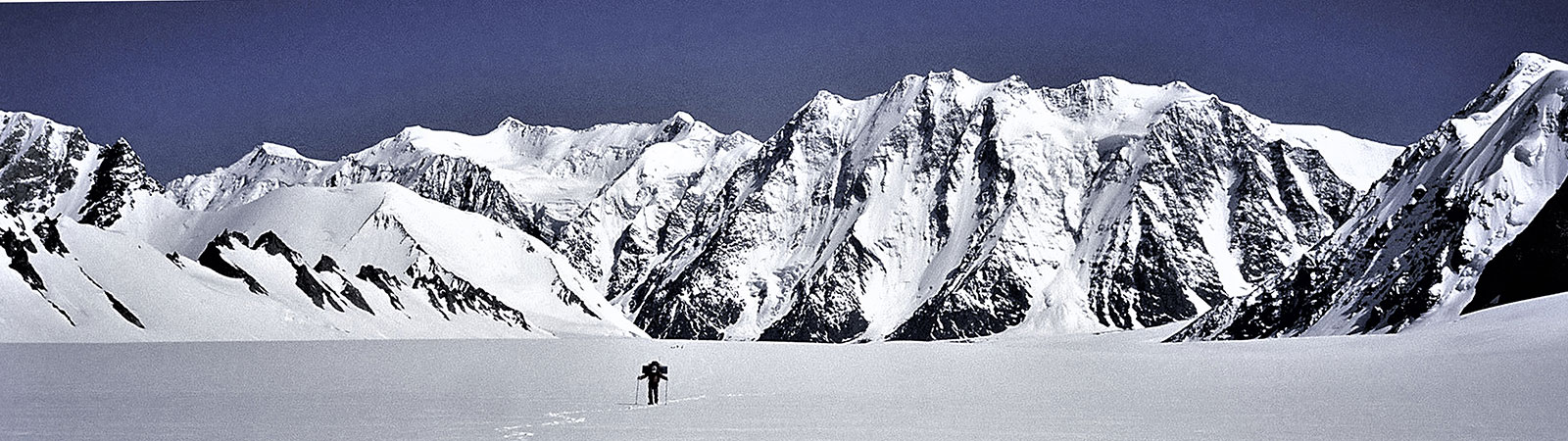
Exploring Teram Shehr Plateau
Share on Social
THE SIACHEN GLACIER HURDLE
(1996)
An expedition consisting of five Indian mountaineers was organised to climb in the Siachen glacier area, which at present, is a scene of conflict. After several delays, the team entered the Terong glacier valleys, one of the subsidiary glaciers of the Siachen. Halfway through the expedition schedule our permission was cancelled and the team was called back and asked to vacate the area. This is the story of the expedition and of this famous glacier and the war on it.
The Area
The Siachen glacier in the East Karakoram is one of the longest glaciers in the world. It has a number of peaks, side valleys and at its head lies the Indira Col, the divide between Southern Asia and Central Asia. The Nubra river drains the glacier and ultimately joins the Shyok river near Khalsar. To the west lies the West Karakoram (now under Pakistani control) and towards the east is the Shyok basin, forming a border with China. The northern slopes of the Indira Col leads to the Shaksgam valley. The Siachen glacier has not been visited by the mountaineers in the recent years due to an ongoing conflict on its heights between India and Pakistan.
In the 1970s and early ’80s Pakistan permitted several mountaineering expeditions to climb high peaks on this glacier. This reinforced their claim on the area and the mountaineers thus had a different role to play in its history. In 1984, when the Indian army positioned itself on the heights of the Siachen glacier, the Government of India as a policy decided to encourage mountaineering expeditions to this glacier from the Indian side. Expeditions consisting of Indian mountaineers or joint expeditions with foreign mountaineers were to be allowed there. We, the mountaineers from Bombay, applied for permission to climb on this glacier in 1996. After due consideration for six months, permits were granted. We made preparations which were expensive, as everything, including the porters, had to be flown to Leh because the roads were closed. Finally on 5 June 1996 the entire team of five Indian mountaineers was in Leh.
Expedition of 1996
Our expedition had two broad aims. The first was to attempt peak Chong Kumdan II (7004 m). This peak rises above the South Terong glacier, one of the tributary glaciers of the Siachen. We had observed the peak from three directions during earlier expeditions and it seemed feasible. The other major aim, however, was to traverse the Siachen glacier fully and to reach the Indira Col, at present the northernmost point of India, apart from being a historic divide. In another side valley of the Siachen, the Teram Shehr glacier, lies ‘Col Italia’ so named by an Italian expedition (led by Prof. G. Dainelli) in 1929 who had made the only reported crossing of this col.
Ours was an experienced team, with at least three members having climbed in the East Karakoram before. Bhupesh Ashar and Vinay Hegde formed the lead team of climbers. Both were experienced mountaineers with several high peaks to their credit. The former had climbed five high peaks around the Chong Kumdan glacier in 1991, while the latter had climbed technically difficult routes on the Gangotri glacier mountains. Vijay Kothari and I (leader) had shared two expeditions to this range before and had several years of experience of high mountain climbing and travel. Nawang Kapadia, a student, completed the team. With us we had five trusted porters from Kumaon and to supplement the climbing strength we hired three Sherpas from Leh. We employed 15 Ladakhi porters for a few days during the approach.
We were received at the Leh airport by our liaison officer Captain Jashwant Lakra, an officer from the army ordnance unit, who had volunteered to join our team. He was an English literature graduate from Delhi. We established contact with the army and submitted letters approving the expedition from the Ministry of Defence and the Indian Mountaineering Foundation. We were told that they would need clearance from their own channels. But that would be forthcoming, we were assured, and were allowed to proceed to the Nubra valley. The expedition leader met the General Officer Commanding of the area and the Brigade Commander.
Siachen Hurdle
After two days of travel we established ourselves at tiny hamlet of Warshi on 12 June. The first aim of the expedition was to open a route through the Warshi nala, which drains into the Nubra about 22 km below the snout of the Siachen glacier. For the next two days we tried to penetrate the Warshi nala, which looked broad on the map, but in reality sloping rock-slabs on both sides made the going rather difficult. After a detailed recce, it was felt that going through this nala with the entire expedition luggage would be a difficult task. The other possible approach was through the South Terong glacier. For this approach we had to cross the army base camp at the snout of the Siachen glacier.
As we had clearance to cross the base, or so we thought, we opted for this route. Little did we know what troubles we were going to face.
The army clearance from the ‘official channels’ had not arrived. From 15 to 17 June we camped on a sandy area, about a km before the base camp. The only news we received was that clearance was being obtained. Finally we were allowed into the camp when to our misfortune, the weather closed-in for three days. We had to wait in our tents amidst rain while Ladakhi porters were being arranged for.
Finally we could move on 20 June, now almost 10 days behind schedule.
Terong Valleys
As part of the Indo-British expedition I had entered this valley in 1985. Now we camped at the same camping ground, Gyazgo, at the turning into the Terong valley. Next day we had to cross the river, which during the return in 1985 had posed many difficulties. We found some old ropes strewn across the river tied to expansion bolts. Ashar carefully went across these old ropes and on 22 June we fixed new ropes. Slowly the entire team with all the luggage went across the Tyrolean traverse and camped on its right bank. About 4 km ahead was the snout of the Terong glaciers. We had to turn south to enter the South Terong valley and hence chose the left bank moraine.
Halfway through, our Ladakhi porters, known for their difficult temperament, called it a day and we were stranded in the middle of the moraine on the 23rd. For next two days we ferried loads to the beginning of the South Terong glacier. On the 25th we established ourselves on a picturesque ground with lakes, ibexes and greenery.
We did not waste any time and by 27 June pushed our camp ahead. This camp was established about 3 km below the Darrah Chushku camp of 1985. Chong Kumdan II looked tentatively close and inviting. In next two days we would be at the foot of the mountain we wanted to climb. We hoped to finish the climb in a week. But, alas, that great leveller, the Karakoram weather intervened. It snowed heavily for next two days, 29th and 30th, and to conserve stocks we all decided to move down to the Terong lakes. The weather cleared on 1 July but by then we had other considerations.
We were 14 days late as per our schedule. Hegde, who is an advocate in Bombay High Court had to return home. There was a discussion about either going back to Chong Kumdan II or trying our strength on the Siachen glacier. It was felt that the permission for the Siachen glacier and to reach the Indira Col was rarely given and therefore must be made use of. We could climb peak or two on the Teram Shehr glacier. It was agreed that we could withdraw from here and try our luck on Siachen.
Shelkar Chorten Glacier
This glacier is situated between the two Terong glaciers. In 1985 Stephen Venables had entered this glacier, alone. He traversed the icefall and climbed a peak, Chorten (6050 m), at its head. We had three days in hand and it was thought that we could climb a peak or two here. On 2 July we moved on this glacier early with food for three days. All went well till 11 a.m. We zigzagged through a fascinating icefall weaving our way through seracs. Suddenly we reached a point where the side moraine was completely broken and the centre offered no escape. It would have been possible to open a route, but not in a hurry. It was no place to rush through for a three-day climb. We had to return and camp at the junction with the North Terong glacier.
North Terong Glacier
On 3 July, I moved up this glacier to visit the site of the 1985 base camp which was near a moraine lake. This lake was mentioned from the time when Dr. Ph.C. Visser visited the glacier in 1935. The North Terong glacier had many ice-penitents and 11 years before I had to weave a way through them, having fun on these 6-feet high ice-towers. Now there were none! The entire valley was flat, icy, and looked very different. The moraine looked completely changed and black. At the old base camp site there was no lake either. What had existed for five decades at least was gone. Perhaps these were the signs of global warming or effect of the human intrusions in the area.
However one thing that had not changed here was the view of the majestic Rimo group of peaks. Two of the high peaks of the group could be seen towering above the glacier.
By afternoon the lower camp was wound up and after a long day the party withdrew near ‘the ropes’. Crossing the river on pulleys once again we settled at Gyazgo. Hegde with porters carrying our extra equipment left for the Siachen glacier snout. They were to meet us at Camp 1 of the army with fresh supplies. We were all eagerly awaiting to start the best part of our trip on the Siachen glacier.
Siachen Impasse
It was drizzling in the afternoon of 5 July. We all relaxed in tents. Suddenly a porter arrived from the army base camp with a note. It was from Hegde.
‘There is some shocking news. After we entered the Terong valley someone in the army has cancelled our permits for the area. Please come down, we have been asked to vacate the area’.
Angry, fuming, but helpless, we rushed down to the army base camp. There was talk of sending troops to pull us down. No one in the field had the authority to help us as the orders came from a higher officer. All attempts to contact higher authorities were futile. We had to return to Leh.
We made representations to army authorities at Delhi from Leh but nothing seemed to be happening for the next two days. We sold our balance food stuff and wound up the expedition at Leh. On 10 July 1996, an evening before we were to fly from Leh, the army approached us wondering whether we will be interested in going back to the Siachen! We had to decline, explaining to them that we were not soldiers on duty but mountaineers. Faced with many questions, heavy expenses and puzzled at the turn of events, we returned to Bombay by 13 July.
Siachen Tragedy
India’s claim to the Siachen glacier is disputed by the Pakistanis and the conflict in this area is well-known to the international community. In 1984, when the Indian army first landed on the glacier, a Japanese expedition was approaching the area from Pakistan to climb Rimo peak, rising over the Terong valley. They were stopped and in 1985 we organised an Indo-British expedition to the same peak. At the height of the conflict we had full support from the army.
Until now Pakistan has allowed more than 18 expeditions to climb on this glacier, and even allowed some trekkers there. India has managed to allow only one expedition (American, joint with the Indian army) on the upper glacier (Teram Shehr and in its vicinity). One expedition jointly led by the world-famous climber Doug Scott (with Commandant Sonam Paljor of the ITBP) was diverted to the Terong glacier from the base camp by the army.
It is essential that India’s national security interests are reinforced by other means, such as visits by Indian mountaineers. These ‘other means’ are cost and result effective. More civilian (Indian and foreign) expeditions to this range must be encouraged. They will go a long way to reinforce the claim over the area and sovereign rights over the entire East Karakoram belt. Civilians are also patriotic and serve the nation in many different ways. Our experienced team of Indian citizens would have been of great advantage. We, as mountaineers, understand the harsh environment conditions, security considerations and bravery of the Indian soldiers. As Indians (speaking the same language), we could have supported them by hoisting proudly the national flag wherever we went.
There is openness amongst India’s neighbours as regards permission to mountaineers in the border areas. The Chinese in 1996 gave a quick clearance to the Indo-Tibet Border Police team to climb Everest from Tibet. The ITBP has the word ‘Tibet’ in their name and the force was specially raised to protect the borders from the Chinese! Travelling on the disputed Aksai Chin road, Japanese tourists camp on the Pangong lake, partly controlled by India. In 1993, French skiers reached foot of the Indira Col from the north, visiting the Shaksgam valley without even a liaison officer. Pakistanis allow mountaineers to climb peaks near the Siachen, overlooking the glacier. Trekkers were allowed to visit the area of conflict from Pakistan, and at the height of 1971 war, the author Dervla Murphy was trekking on the Shyok. Such examples should be eye-openers and should make everyone rethink ‘security’ in the days of satellite technology.
Environment
The entire area of Ladakh and the East Karakoram seems to be undergoing a changing weather pattern. East Karakoram is no longer a rain shadow area and it receives several inches of rainfall. In 1995 there were heavy downpours and the Manali-Leh road could not be opened in 1996 due to landslides.
The Siachen glacier snout has receded by about 800 m in the last 11 years. The glacier looked more barren and without snow cover. The Terong glaciers, particularly the North Terong glacier seemed to be receding fast and most of the ice-penitents and lakes have disappeared during the last decade. Icefalls of the Safina valley (which we had crossed in 1985) and the Shelkar Chorten valley seemed to be more broken.
The sias (roses) from which the glacier takes its name, were seen in plenty near the snout and in the Nubra valley. Inside the Terong valleys they grow even higher up on the rocky slopes. Some herds of ibexes were noticed in the Terong valleys, but none on the main glacier.
With so many humans living on the glacier the accumulation of garbage is in abundance. The worst offenders are the tetrapacks in which fruit juices are stored. These aluminium foil packets, which cannot be burnt or destroyed, line the routes which are traversed and are a major eye-sore. Some serious thinking needs to be done about the environment on the Siachen glacier.
Power of the Dream
The 1996 Atlanta Olympics has adopted the theme, ‘Power of the Dream’. Let us share the dream about which Aamir Ali has written. It is hoped, someday soon there will be peace on the Siachen glacier. Roses (sias) will grow wild, ibexes will roam freely and mountaineers will explore and climb.
What is very sad is that the Siachen glacier should now be the stage for a stand-off between the armies of India and Pakistan. Soldiers face each other, both sides have artillery, though the rarefied atmosphere makes nonsense of ballistic data; millions of rupees are spent daily to maintain these forces where casualties due to the altitude and cold are nine times higher than those due to combat. And when we complain about the garbage dumps at mountain-eering expedition base camps, can we imagine what the dumps must be like in these high altitude army camps?
To the layman, all this seems like utmost folly, but then, when did warfare not seem thus?
Men must harbour dreams sometimes, even foolish dreams, ‘I have a dream,’ said Martin Luther King in the greatest of his speeches 30 years ago. So let us also dream that the mountaineers of the world persuade India and Pakistan to withdraw their armies and to establish an ‘International Park of the Rose’(sia).
(Aamir Ali)