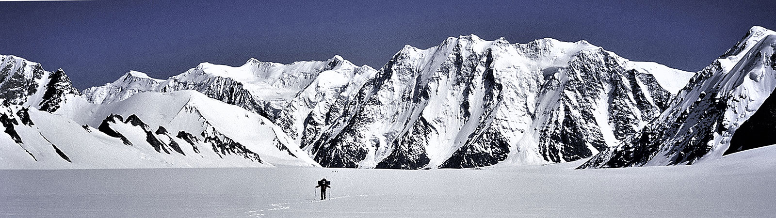
Exploring Teram Shehr Plateau
Share on Social
LOTS IN A NAME
A Study of Names in the Eastern Karakoram
1991
THE EASTERN KARAKORAM, which is the northern part of Ladakh consists of two major valleys, largely uninhabited. On the east the Shyok valley runs from the Karakoram pass to the Khardung ridge in the south. In the west the Nubra valley consists of the Indira col and the Siachen glacier in north to the Khardung ridge again in the south. Except for few villages down in the Nubra valley there are no human dwellings. But still every peak, glacier, camping ground and feature has a name. Who gave them and how did they originate where no humans lived? On the east along the Shyok valley, caravans from Central Asia or Yarkand travelled across the Karakoram pass to cross Saser la to the Nubra valley on their way to Leh. They gave a Yarkandi nomenclature to the route till they reached the Nubra villages. Up towards the Siachen the area was part of the Balti legends. People at the villages in the west had heard of the area, though never visited it in the known past. They went there as porters with explorers and surveyors. Thus the names followed the Balti influence. In Nubra all the names are in Ladakhi, which is based on the Tibetan script. Thus the nomenclature here has created an interesting situation with Ladakhi, Balti and Yarkandi names, borrowed from Muslim and Buddhist scripts and the legends of the area. As a simple example, ice-peak (mountain) would be called differently. To Yarkandis it means Muztagh, to Baltis prefix Sar signifies that, while Ladakhis know it as Kangri. But ‘Kangri’ is a very genuine Balti name too! So there can be no clear demarcation.
The Land of Gapshan and Burtsa
Much before any maps were drawn, people have travelled. Know-ledge about the route passed from generation to generation by explaining the place, drawing a ‘word map’ of the route. This in turn led to the nomenclature of the route, by the description of the travellers and their experiences. This is nowhere more true than on the Central Asia Trade Route between Yarkand and Leh. Yarkandis travelled over this uninhabited area for trade and pilgrimage to Mecca. Their descriptions gave the names (mostly Yarkandi which is of Turki dialect) to the halts and features on the route.
Imagine an old Yarkandi giving directions to a caravan proceeding south to Leh. He would describe how from the barren plains they must climb the ‘pass of black gravel’, (Karakoram pass). Ahead they reach Polu (‘temporary shelter’) at its foot. Not a place to linger around.1
Cross a river which is ‘very quiet’ (Chip Chap) to reach the place where ‘Daulat Beg had died’ (Daulat Beg Oldi, Oldi: died, or Daulat: rich, Beg: great, where a very rich person died). On the east is the Galwan nala, named after Rasool Galwan of Ladakh who travelled to Central Asia with many explorers.2 The valley bears his name. Going ahead you come across a ‘long open space after a slope’ (Depsang plateau). Before a descent is the ‘kitchen run by a Qazi’ (Qazi Langar). As the route descends down to a nala you will find plenty of burtsa shrubs. It burns faster than the wood and has medicinal properties also. This is the Burtsa camp. Now comes the difficult section of the route. ‘Gateway of darkness or hell’ (Murgo, Mur: hell, go: gate). But after passing that you turn east and after a long march camp near the only ‘big stone’ (Chhongtash, Chhong: big, Tash: stone) seen enroute. You cross Shyok (‘the river of death’, Sheo: death), and ahead you camp at a ‘temporary camp’ at the foot of Saser la (Saser Brangza, Brangza: temporary camp).
There is a winter route separating from Daulat Beg Oldi. Turning west one reached the meeting place of Chip Chap and the Rimo river at Gapshan or Yapshan (‘type of wood or shrub’). Further west rises a huge mountain ‘colourful and like a drawing’ (Rimo: beautiful lines or striped). Going down along the river you reach a lake where the river is blocked by Chong Kumdan (‘big dam’). A little ahead is a ‘smaller dam’ (Kichik Kumdan). This drains water from a ‘long flat glacier which has herbal medicines’ or ‘the glacier of healing’ (see Mamosto legend, Thangman glacier). When these dams were breached the flood in the river caused death and destruction. The ‘River of death’ (Shyok river) originates from here.
Ahead where one sees Aq Tash (‘white rock’) turn west to join the summer route at Saser Brangza. The only prominent white rocks (Aq Tash) are to be noticed in the land of Karakoram (‘land of black gravel’).
Now comes the ‘pass of the golden earth’ (Saser la, Sa: earth, ser: golden). The ‘mountain of golden earth’ (Saser Kangri, Kangri: Ice-peak) rises to the south of it. Ahead on the track there is grass and the ‘grazing ground of wild donkeys’ (Skyangpoche, Skyang: donkey, poche: ground). To the south rises the ‘mountain of thousand devils’ (Mamostong Kangri) based on a Yarkandi legend.3
Ahead is Tulum Puti la (‘the long narrow steep pass’). It is here that Ali Hussain has built a good rocky route to help travellers to go over the steep and narrow route.4 You come down to the Nubra valley (Nubra: western valley) or Dumra valley (Dumra: ‘valley of flowers and and trees’). You reach the ‘new earth’ (Sasoma, Sa: earth, Soma: new or virgin). This is the first village in the valley, and appropriately Yarkandis see it as the end of the major difficulties. You will also find Sakang (‘raised ground/house’ Sa: ground, Kang, raised, high) and a ‘place of cave’ (Phukpoche, Phuk: cave, Poche: place).5 From the ‘village at the foot’ (Kalsar) there are ‘two temporary shelters’ (north and south Polus) and one crosses the Khardung la (pass of lower castle; la: pass, Khar: castle, dung: lower or Kharzong: castle). Finally one reaches the ‘plain’ where caravans meet Leh (Leh: plateau). They are in Ladakh, ‘land of passes’.
There is a little variation of this route going south along the Shyok. Its first halt is at Sultan Chushku (‘Sultan resting place’, Chushkun: resting place). Ladakhis call it Chyushku (‘water at corner or small lake’) Ahead is Mandalthang (‘Plain of Mandal’, mandal: round wheel, thang: plateau). Finally the route passes Darbuk (‘flourishing village inside a valley’, Dar: flourishing, buk: inside), and Tankse (‘higher ground’) to cross the ‘northern pass’ (Chang la, Chang: north, la: pass), to reach Leh.
Well quite a detailed, if complicated description by one Yarkandi to another! But it explains in their language how all the names of the places originated on this East Karakoram historic trade route. In a broader sense names of the large areas in the surrounding valleys also describe the same. Chang Chenmo (Chang Thang) is the ‘big northern plains’ (Chang: north, Chenmo: big), or Lingzi Thang (‘Central plains’, Lingzi: central; Thang: plains). Lingzi has a more philosophical meaning also, ‘centre of the universe or four different worlds’. Hence you find Lingzi Thang plains between Ladakh in the south, Central Asian plains in the north and Tibetan plateau in the east. Aksai Chin, (Aksai: eastern, Chin: China) has of course a simple interpretation.
More broadly entire countries were named. China was Gyanak (Gya: area, nak: black, difficult, ‘where people wear black clothes’). India was Gyagar (gar or kar: white, ‘where people wear white clothes’). Here ‘white’ and ‘black’ signifies the difficulties of living. Life appeared more grim on the Tibetan plateau or the Chinese Central Asia, while they had always heard of warm and pleasant life in the Indian plains.
We leave the Yarkandis here and their ‘name game’. They must go back soon over the high passes. If caught at Leh for the winter they can return only the next year, for it is ‘. . . . impossible to cross the pass till the “apricots are ripe’’ ’ (Longstaff, p. 165).
Note
Most of these names mentioned in the article were identified by different scholars, Yarkandi traders at Leh and lamas. Most of the names were found to be distinctly Yarkandi. It is of course difficult to correctly interpret the meaning of the names which are more phonetic and have various meanings. However, the above interpretation is correctly suited to the trail, which many have now travelled. These are Muslim and Central Asian names. A common Ladakhi did not recognise many of these names or could not tell the meaning. But as one consulted them about the names in the Nubra valley and to the south of it, Ladakhi scholars or even an educated muleteer could identify the meaning. Once down in Ladakh even lama scholars far away at Darjeeling also gave the same interpretation of the names as a Ladakhi, signifying that they were based on the Tibetan script and the Buddhist culture.
The names for the peaks suggested recently are given at the end with their meanings.
Where Rose is Sia
Going up the Nubra river one enters, what F. Bullock Workman called ‘the ice-wild of Eastern Karakoram’. This is the Siachen glacier with high peaks, glaciers and the valleys of both the sides. This is the ice-wilderness whose exact location, boundaries and connections were established after many explorations and surveys. Locals never travel-led here for there were no passes to trade across. But they had heard of these areas and had heard the legends about it handed down to them through generations.
How does the nomenclature in such an area get established? First it was through the legends as narrated by the locals to the first explorers. And the rest were given by the explorers themselves, or after consulting the local pundits.
As we returned from the Terong valley in 1985, at a sharp turn Dave Wilkinson barred my way. ‘What is ahead? The most prominent feature of this glacier?’ After a thought and fumblings I replied,‘A rose’, ‘Wrong, its a Sia’. Unbelievable as it may sound this glacier has many rose plants on the moraine rocks, edges and walls surrounding it. And as in Balti ‘rose’ is ‘sia’ the glacier gets its name. Dr. A. Neve appears to have heard of it spoken of by the Nubra people as the Siachen and Dr. Longstaff gave it this name on his sketch-map. F. Bullock Workman gives a detailed explanation.
Upon much inquiry, I learned that the meaning of Siachen is, literally, rose-bush, Sia is the Balti name for jungle rose and Chen means a collection of thorns. Such wild rose-bushes are legion in the nalas and flourish in pink splendour to the tongues of the glaciers in Baltistan and Nubra. From Dr. Thomas, the Tibetan scholar, I learn that the Tibetan Se- Ba-Can means ‘having rose-bushes’. So, probably, the Balti meaning is derived from the Tibetan. As is well known, Baltistan was subject to Tibet in the eighth century.6
We were in the Terong valley, the first eastern tributary of the Siachen glacier as one goes up from its snout. Though it contained three large glacier systems, it was unknown to the people of Nubra. They called it simply Terong (‘that valley’, Te: that, rong: valley). Scholars interpret it as (g)ter: hidden, rong: gorge (‘hidden gorge’). Shelkar Chorten glacier in the valley goes southeastwards between the two Terong glaciers. Possibly this glacier takes its name from, Shelma: crystal and Chorten: Buddhist symbol, stupa, ‘glacier of crystal chorten’. These glaciers were explored by Dr. Ph.C. Visser’s expedition in 1929-30. Surveyor Khan Sahib Afraz Gul with them possibly decided on these names.
A lake on the North Terong glacier, is the ‘lake of bones’. This was so called after a legend that people had died here and the bones were discovered in this lake with poisonous water.
Rimo (striped) group rises in the northern part of the Terong valley and also overlooks the eastern glacier systems called ‘Rimo glaciers’. Dr. Ph.C. Visser had explored these glaciers during his visits from the east. Thus he linked up both his surveys and exploration.
All other names in this valley are of recent origin and are explained at the end.
For the peaks ahead on the Siachen glacier and the Karakoram in general Survey of India had a policy.
The numerous peaks which have no native names have been numbered in a scientific way after the astronomical system. The mapping of India has recently been placed upon a new basis as more peaks of the Himalaya and Tibet are becoming known and it has been thought advisable now to name all peaks according to the map in which they fall.
—Colonel Sir Sidney Burrand
Thus all the peaks had numbers. Some remain till today like K2 and, on Siachen, K12 and K36 glaciers.
The Workmans’ expeditions, 1911-12, with surveyor Grant Peterkin, named many peaks without the Survey numbers as ‘King George Peak’, and ‘Mt. Hardinge’ (after the Victory of India). They called the entire group the ‘King George V group’, and claimed that this was done with the permission of the Queen and the Viceroy. But the Survey of India to their credit, even in the times of British colonial India, did not accept these. Though, the rejection of these names was done with some diplomatic charm.
We suggested the name Sia group, partly because of the name Siachen and partly because of the connex-ion of the rose with British royalty, thus giving some recognition to the wishes of the explorer.
—H.J., Vol. X, p. 101
These peaks were called after their natural names like Sia Kangri, Sherpi Kangri and Saltoro Kangri, and the group as the Siachen Muztagh.
The other names that the Workmans gave to the smaller peaks were based on local legends, and the shapes of mountains or their locations. Thus we have Hawk peak, Junction peak (at Teram Shehr—Siachen junction) and Tawiz peak.
Tawiz: Workmans found that the porters were unwilling to accompany them to the Siachen glacier due to the hardships involved.
After our arrival, I noticed the odd tawiz, or magic amulets, hanging by bits of cord from the coolies’ necks. They were said to contain petitions to the gods to bring storms or other calamities, that might limit our stay in the snows, and force us to return and leave the Saltoro valley.
Tawiz here were worn for ill-omen, unlike for the good or cure in the present days.
Towards the centre of the Siachen glacier at the junction with the Teram Shehr glacier there is a plateau. The naming of this saw bitter exchange of written words between Workmans and Dr. Longstaff, the other explorer responsible for the nomenclature of this area.
The now deserted Ghyari nala was in ancient times densely inhabited to the tongue of the Bilaphond glacier. The Baltis of that time were supposed to have crossed the Bilaphond la and met the Yarkandis of Tarim Shehr with whom they played polo. Polo always plays a great role in Balti saga. The learned men did not say how the people of Turkestan came to be in this distant ice-region, only reported that a large city was said to stand on this present site to Tarim Shehr. The Baltis feared the Yarkandis, who are said to have often crossed to the Ghyari nala to ‘loot’ cattle and property and abduct women from the villages. An important mullah, Hazrat Ameer gave the engaged Baltis the tawiz magic amulet, and told them to put it at once on the summit of Bilaphond pass, and ordered them after doing so not to return home the same way, but to go around via Yarkand.
The Baltis, having placed the tawiz on the pass, disobeyed the priest’s orders and returned to their villages the same way from the pass. Soon afterwards a great storm visited Tarim Shehr, and the snow from the mountains slipped and fell upon the city, destroying it. The Balti priests say the calamity would have been even greater had the avenger of the woman gone around by Yarkand home, and that today not even grass and burtsa would be found to mitigate the rocky desolation of Tarim Shehr.
Workmans called it Tarim Shehr (oasis city, Tarim: oasis, Shehr: city) as it was before the storm. Dr. Longstaff called it Teram Shehr (‘destroyed city’, Teram: destroyed). This led to war of words. Today it is known as Teram Shehr and the peaks nearby as Teram Kangris. Dr. Longstaff seems to have won the battle.
The name Teram Kangri was given in Dehradun by Dr. Longstaff with the approval of Sir Sidney Burrard, Surveyor General, from the only locality place name, Teram, in the region. The alteration of spelling to Tarim by the Workmans for the glacier tributary of the Siachen is incorrect.
—H.J., Vol. X, p. 102
The Italians who visited the glacier in 1930 under Giotto Dainelli also narrate a tale of raiders from Yarkand to this city and of its destruction.
They named the col leading in the east to the Rimo glaciers as ‘Col Italia’ or Passo Italia after the mountaineers and scientists from Italy who had worked in the Eastern Karakoram.
At the head of the Siachen glacier, there are two passes. One to the east is Turkestan la (as it leads to Turkestan). Francis Younghusband had reached this pass from the north while trying to locate the Siachen glacier. He thought that he was on Saltoro pass (present Bilaphond la). Dr. Longstaff called this pass ‘Younghusband’s Saddle’ but the present name was established by Workmans. They also named the northern col as Indira Col.
Indira Col: This is the northernmost pass on the Siachen. There was a confusion in the recent days that this pass is named after India’s late Prime Minister Mrs Indira Gandhi. In fact both the pass and Mrs Gandhi were named after goddess Laxmi. (Indira: one of the names of Laxmi, goddess of wealth).
North and northeast of Siachen glacier are four glaciers, each draining to the Shaksgam river in the north. These glaciers were visited by Francis Younghusband in 1889 and Dr. U. Balestereri of the Duke of Spoleto Italian expedition in 1929. They named these glaciers. The groups and peaks above are also known after the names of these glaciers.
Urdok is the first glacier going down from the Indira Col. Younghusband named it after a duck he saw on the glacier. (Urdok in Turki means duck). (Wonders of the Himalaya, p. 149). But scholars give a different interpretation too (Ur: high, dok: solid, or tok: top, thus ‘high solid glacier’).7 Possibly Younghusband named it after Urdokas (‘high solid place or place of ducks’) from where he had come. The next glacier by which Younghusband reached Turkestan la was called Staghar glacier (‘many coloured’) after colours of its moraine by the Spoleto team later.
Singhi (‘difficult’) glacier (or more correctly Singye) is next with Singhi Kangri (‘difficult ice-peak’) overlooking the Siachen glacier. Kyagar (‘whitish’) is the last glacier to the east. Both these were named by the Duke of Spoleto’s team. They also named Kharpo Gang (‘white glacier’). The range rising between the Teram Shehr and the northern Kyagar glacier was named Apsarasas (‘place of fairies’, Apsara: fairy, sas: place) by Grant Peterkin of the Workman expedition having surveyed the group from the Siachen glacier.
On the western rim of the Siachen glacier after the obvious Sia Kangri and Sia la (‘ice-peak and pass of rose’), from a plateau rises peak Ghent. This double summitted peak was so named by the Workmans, ‘. . . . which at the suggestion of Mr. W.P. Cresson, F.R.G.S. I have named after the Treaty of Ghent, which terminated hostilities between Great Britain and the United States in 1814’. Somehow this name has remained.
After The Hawk, Peak 36 glacier drains from two of the highest peaks of the area, Saltoro Kangris (Saltoro: giver of light). This name is given after the Saltoro region in the west Karakoram which they overlook. There is Sherpi Kangri (‘ice-peak of Sherpi’) with the Sherpi Gang glacier (‘snow glacier of Sherpi’). Little to the south of it is the Lolophond glacier. Is it named after Dr. Longstaff who had firmly established the extent of the length of the Siachen glacier by visiting it from different directions. Dr. Longstaff wrote in the Geographical Journal, (February 1912, p. 145) that the coolies named it ‘Loloff’. But perhaps he meant the pass, not the glacier.
Dr. Longstaff was inclined to naming the features and species after himself. ‘However, I had already collected a very pale coloured weasel, a new species, which was handed down to posterity as Mustela longstaffi’
—Longstaff, p. 169
About the glacier he writes
Apparently they (coolies) did me the honour of christening this glacier after me. The Workmans were the next visitors and put the name Lolophond glacier on their map. Loloff was the nearest the Baltis could get to my name.
So Longstaff credits the Workmans to have honoured him with this name officially. How these explorers, so critical of each other’s exploits, still scratch each other’s backs!
However, this name, Lolophond rhymes with Bilaphond which is the name of the glacier and the pass to its west. Bilaphond is ‘bright coloured butterfly’ in Balti and suits the terrain well.
Bilaphond Glacier and La
When in 1911 the Workmans inquired through their Parsee agent, Byramjee, what porters call this glacier one and all said, ‘Bilapho’ and spelled it without ‘nd’. They said that the word was a Balti one, meaning a small bright coloured butterfly. Upon further inquiries they discovered that the reason for this name was not because many butterflies were seen on it, but that, in former days, this name was given on account of the shape which the glacier assumes as Naram. This definition presupposes an intelligent and poetic fancy not present in the Balti people today. Perhaps in the past someone standing on an eminence above Naram (Naram: soft, soft rocks) on a clear day, bearing in mind the pretty ideas can easily make the main glacier and its affluents picture to his mind’s eye a monster ice-butterfly’ (from the Workmans, p. 131).
However, Dr. Longstaff prefers more ordinary explanation. ‘The glacier, which had been called the Saltoro glacier by the Khans of Khapalu is locally known as Bilaphond (nasal, d mute), which we understood to mean “butterfly”. Swarms of migrating butterflies killed by storm, are often seen on glaciers and this suggest a possible origin for the name’. Dr. Longstaff originally called the pass as the ‘Saltoro Pass’. Now it is called Bilaphond la.
Further down is the Gyong (tough, difficult) la (la: pass) (Or rGyong) which links across with the Chumik (‘spring’) glacier in the west. As we near the Siachen glacier snout, and the civilization again, we have two glaciers with names descriptive of the difficulties on the passes above them. Langongma.‘above the pass’, la: pass, gongma: above) and Layogma (‘pass of wind or snow-storm’, la: pass, yogma: windy, storm). These glaciers were surveyed by the Visser expedition in 1929-30 (see G.J., October 1934).
As the Nubra river emerges from the Siachen glacier snout, it is called (still on the maps) Yarma Tsangpo. Literally Yarma means ‘superior’ but scholars think it was originally called lema meaning ‘wonderful’. A small but wonderful gompa of the same name in the Nubra valley (opposite Warshi) is supposed to be as old as the Potala of Tibet. South in the Nubra valley is Charasa village and the gompa.
Charasa used to be the capital of the ancient principality of Nubra. The people are of mixed blood and not pure Ladakhis, though, like them, predominantly Buddhist. It was captured after hard fighting by Muhammad Haider in 1532 ‘and the vapour from the brains of the infidels of that country ascended to the heavens’.
—Longstaff, p. 181
The place is situated a little above the junction of the Nubra and Shyok rivers and is approachable from four sides. Thus its name is apt. Char: four, sa: place, ‘the place (visited) from four directions.’
The only name which is an ‘outsider’ in the lower Nubra-Shyok valley is Partapur village. Zorawar Singh of Jammu had captured the valley in 1829. He gave this name in the honour of his Dogra king Maharaj Pratap Singh. Now Partapur is an important point in the valley with an airport. It is in the Shyok valley after its junction with the Nubra river. This valley received the full blast of the Shyok floods and there are songs in the Nubra valley about the destructive powers of Shyok (‘river of death’, sheo: death).
The present day hostilities on the Siachen glacier between the Indian and Pakistani armies have been responsible for new nomenclature and legends. The Indian Hindu soldiers have erected a temple of the Siachen glacier mata (‘Goddess of the Siachen glacier’) who is worshipped with Hindu rites. A legendary fight on the shoulder of K12 has been given the place the name Bana Post (after the fighter Sub. Bana Singh) and we have Kumar Post. Many glaciers are simply known as numbers like G1, G2 and others. All these are of course best avoided at present, but who knows sometime in future they may be permanent features, like others. That’s how legends grow.
The barrenness, difficulties and the remoteness of the glacier is total. Still the nomenclature of this area has been established by various means by the travellers. As long as people travel or know of the area, there will be names. In fact sometimes these names and legends attract one to the area and to face the difficulties. As the Balti philosophical saying goes about life:
Whatever the hardships,
Whatever the names, let me
O’Allah, return thither again.
Peak Names of Recent Origins
1985: Proposed by The Siachen Indo-British Expedition in the Terong valley (see H.J., Vol. 42, p. 68 for their locations).
Sundbrar — A beautiful place.
Sondhi — A sudden beautiful appearance. There is a place by the name of Sundbrar in Baltistan. Kashmiri Brahmins and Hindus along with several thousand people used to gather at this place on a certain day in June. They would worship the Hindu Goddess Laxmi and wait for the rising of water, praying for it to appear. At an appointed time a stream would fill the basin and the multitude would shout ‘Sondhi’.
Above all, this phenomenon portrays the prevalence of the Hindu rituals deep inside the Muslim Baltistan (See Gazetteer of Kashmir and Ladak, 1890,’ p. 801).
Lharimo — Holy painted mountain. Lha: holy
Doab — Meeting place of two waters. Do: holy
Safina — Boat. In Balti philosophy this is a special boat which carries one to heaven.
Saigat — Leopard’s leap. This peak, particularly tilts (leaps) towards the giant Rimo peaks.
Chorten — The Buddhist symbol.
Ngabong Terong — Ngabong: bactrian camel—the famous double-humped camel of Yarkand. A few are still seen in the Nubra valley.
Siab Chushku — Siab: meeting place of three waters (North and South Terong and Shelkar Chorten glaciers). Chushku: resting place.
Doab Chushku — Camp at meeting place of two waters. (Two branches of North Terong glacier).
1989: Proposed by the Chong Kumdan expedition in the Aq Tash and
Chong Kumdan valleys (see H.J., Vol. 46, p. 76 for their locations).
Lokhzung — Eagle’s nest.
Chathung Thung — Black-necked cranes.
Chogam — A box to keep holy scriptures.
Stos — Goat which gives Pashmina wool.
Skyang — Wild horse.
1991: Proposed by the Chong Kumdan Indo-British expedition in the
Chong Kumdan valley (see H.J., Vol. 48 for their locations).
Laknis — Vulture of two (glaciers). Lak: Vulture, nis: two (peak rising between the Central and North Kumdan glaciers
Landay — Ghostly or Scare of ghost (a scary peak).
REFERENCES
- Gazetteer of Jammu and Kashmir, The Superintendent of Government Printing, Calcutta, 1890.
- Workman, Fanny Bullock and Willian Hunter, Two Summers in the Ice-Wilds of Eastern Karakoram (T. Fisher, Unwin Ltd., London, 1915).
- Longstaff, Tom, This My Voyage, (John Murray, London, 1950).
- Younghusband, Sir Francis, Wonders of the Himalaya (John Murray, London, 1924).
- Geographical Journal (as mentioned in the article).
- Mason, Kenneth, Karakoram Nomenclature (H.J., Vol. X, p. 86).
- Shakspo, Nawang Tsering (Leh), Historical Perspectives of Nubra in Ladakh.