Exploring Teram Shehr Plateau
Share on Social
A PEACE PARK FOR SIACHEN
2000
In 1947-48, at the time of India’s independence and its catastrophic partition with Pakistan, the Muslim-dominated kingdom of Kashmir, ruled by Maharaja Hari Singh, faced an invasion from Pakistan. At that time Kashmir was still an independent kingdom, as its ruler had not ceded initially to either India or Pakistan. Once he signed the ‘Treaty of Accession’ to India, Pakistan army invaded Kashmir to forcibly occupy it. The offensive was thwarted by the valiant action of the Indian troops who dislodged the enemy from the vantage passes they occupied connecting Kashmir to Ladakh, and from the Basgo fort, a few kilometres to the west of Leh. A ceasefire line was drawn in 1949 under the ‘Karachi Agreement’, however it has become a contentious issue with the two nations having fought wars in 1965, 1971, and as recently as 1999. The Himalayan region of Arunachal Pradesh (called North East Frontier Agency –NEFA then) in the east, has not been free of strife either with a border war being fought between India and China in 1962.
After the 1971 war with Pakistan the conference between two Prime Ministers, Mrs. Indira Gandhi and Zulfikar Ali Bhutto, drew up the ‘Shimla Agreement’. It confirmed a Line of Control (LOC) along the borders of Kashmir and Ladakh. The agreement stopped the demarcation at ‘border stone NJ 9842’ and it was only vaguely mentioned that the line shall follow ‘thence to glaciers’. It did not specify which glacier and in which directions. Taking advantage of this lacuna Pakistan encouraged foreign mountaineering expeditions, specially the Japanese teams, to cross over into the Siachen glacier from their areas, thus taking a de facto control over the glacier. Each expedition was accompanied by a Pakistan military officer as LO and hoisted the Pakistani flag on the summit of the peaks climbed. Soon maps were published in the west where the border line from NJ 9842 was extended till Karakoram Pass, ceding the entire Siachen Glacier to Pakistan and linking it up with the Chinese held territories. Pakistan finally prepared to land troops on the Glacier to establish posts and capture it permanently. To thwart their designs the Indian army landed on the glacier on the 13th April 1983 and captured major passes.
This battle for control of the Siachen glacier has been raging between India and Pakistan since 1983. Indian soldiers have shown exceptional valour at high altitudes to maintain control over the entire area, sometimes at too high a price. The difficulties have not eased since. A soldier going up to any post sometimes as high at 21,000 ft (6200 m), has to contend with severe winter, high altitudes, and cold injuries like frost-bites. Soldiers stay at this post for a few months each with only a small wall made of snow or jerry-cans guarding them against enemy fire. Studies conducted on these men staying at such high altitudes continuously for few weeks have thrown light on the debilitating psychological and physiological effects, which even reduces their life-span.
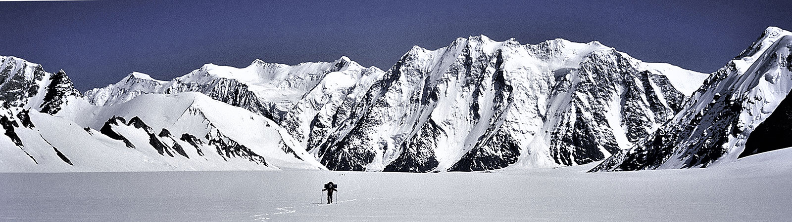
It is surely odd that while everyone expresses concern over the protection of the environment of this spectacular region of the Himalaya, destruction and pollution continues to be wreaked. The Siachen, one of the longest mountain glaciers in the world, surrounded by an imposing array of the world’s highest summits, is the casualty of a military stand off between India and Pakistan. And the irony is that neither country wants this twenty-two year old conflict to continue.
Since 1983, many men have been killed due to the sporadic fighting in the area, however thirty times more men have been the victims of the altitude, with posts at over 6000 m and with temperatures dipping to -50 C. The cost of maintaining thousands of soldiers in such an environment is astronomical; for India it has been estimated at a million US dollars every day, for Pakistan, it is less, but nevertheless heavy.
There have been discussions between the two countries at the highest levels between Foreign Ministers, Secretaries and even Prime Ministers, on de-escalating tensions along the border and on more than one occasion, agreement on withdrawal of troops in order to establish a zone of peace seemed to be close at hand, particularly in 1988 when both countries were about sign an agreement to that effect. Although both sides are anxious to end this surreal conflict, neither can afford anything that might smack of loss of honour and dignity. Mutual suspicions have so far proved stronger than the desire for peace.
The solution can probably be arrived at through a mutual agreement to establish a ‘Peace Park’, dedicated to the cleaning up and preserving of the environment. The area will be uninhabited and modern technology can provide an effective means for surveillance.
Boundary Parks are not a new idea. The first one, Waterton Glacier International Peace Park between Canada and US was established 70 years ago and today there are 169 such parks, involving 113 countries. Several of these trans-boundary parks are specifically designated as Peace Parks, which are intended to provide a peaceful solution to a conflict or a potential conflict or rehabilitation of an area after a conflict, such as La Amistad Peace Park between Costa Rica and Nicaragua, the Peace Park between Greece and Turkey on the Evros River, the Nature Reserve on the frontiers of Hungary- Yugoslavia-Croatia, and the Prespa Park between Albania-Greece-Macedonia. In Asia and around India the concept of trans-boundary parks is well known for there are parks between India and Bhutan, India and Nepal, Pakistan and China and Nepal and China. There has been a dramatic increase in trans-boundary parks in the recent years, a demonstration of their viability and usefulness. In 1988 there were 50 parks as against 169 today. There are plans for few more trans-boundary parks.
A Peace Parks Foundation was established in South Africa on 1st February 1997 largely through the efforts of one individual, Anton Rupert, a tobacco millionaire. The Kglalagadi Trans-frontier Park, about the size of Switzerland, which merges adjacent parks in South Africa and Botswana, was set up in May 2000. A trans- frontier park between South Africa, Mozambique and Zimbabwe was established in November 2000. One of the latest parks was established in 2001, the area of Aletsch, the longest glacier in the Alps, was designated as a World Heritage site. The South Asian Association for Regional Cooperation (SAARC) has shown an interest at its conferences in trans-frontier conservation zones and it could play a vital role in encouraging the establishment of the Siachen Peace Park.
Both India and Pakistan have the experience of administering national parks in the Himalaya. Expert advice on trans-frontier parks is readily available; the World Conservation Union (IUCN), established in 1948 to protect the environment, has its headquarters in Switzerland. It has provided technical advice to about 181 governments (Europe, Africa, Asia) on many such parks, often in very sensitive situations. A Siachen Peace Park would solve a seemingly intractable border conflict by allowing both armies to withdraw without compromising their honour and integrity. It would save hundreds of lives and millions of rupees and facilitate further agreements between the two countries. But more important than anything else, it would save a marvellous area of our Himalayan heritage.
We do not want our future generations to suffer the fate of the soldiers today, stationed on the high and forlorn Saltoro ridge bordering the Siachen Glacier, rising each day to fight empty wars and faced with the grim prospect of battling for survival against nature’s fury.