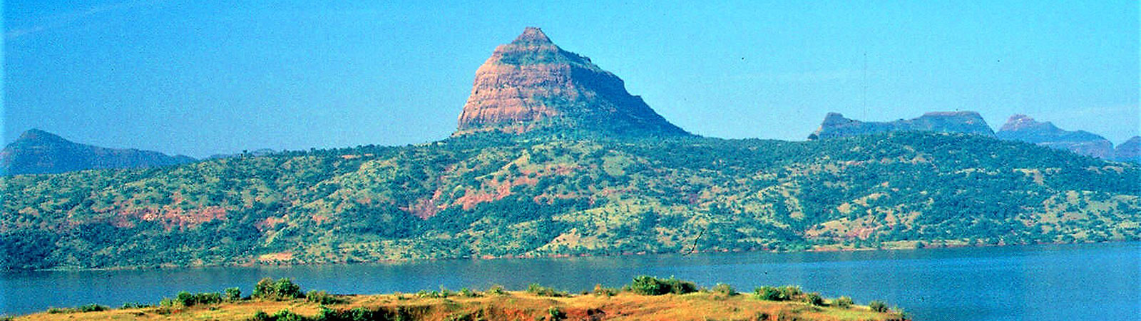
Tung fort and Pawna lake
Share on Social
MAHABLESHWAR
Far from the Maddening Crowd, Driving and Trekking around Mahableshwar
(Harish Kapadia)
“Mahableshwar on long weekend? Half of Mumbai will be there, and there will be no place to walk on the streets”, usual comments from outdoor enthusiasts. As this book portrays, there is far more to Mahableshwar than the bazar, the hotel and the solitary lake.
To appreciate and enjoy a mountain area like Mahableshwar it is essential to understand its geography. This vast plateau almost divides the Sahyadris of the Western Ghats into two sections. The Krishna River starts from the Old Mahableshwar temple, flows towards north into the valley and is soon joined by the Walki river near the Dhom temple. Towards the south, the Koyna river starts from the Mahableshwar plateau. One of the largest dams of Maharashtra is built on this river, forming a vast reservoir. Soon the Koyna merges with the Krishna at Patan. The river Krishna, flows east cutting across the entire Deccan Plateau to flow into the Bay of Bengal, a long journey for a river that starts from the Mahableshwar plateau.
There are many places to escape to in these river valleys using Mahableshwar as the base and to appreciate its geography and history.
THE WAI AREA
Towards north and just few kilometres,on Pune-Mahabaleshwar road, is the town of Wai, which is a major base for many interesting drives and treks.
Dhom Dam and temple: A dam was built on the Walki and Krishna rivers. There is an exquisite temple at Dhom, near the dam, well connected by road from Wai. One can trek up to Pandavgad by climbing up from Menavli, 5 km from Wai. A road from here climbs to the plateau of Mandhardeo, a popular temple with a great view.
The temple at Dhom is said to have been founded by the ancient sage Dhom Rishi. It is built in the rare Hemadri style. Its carvings, location and sanctity are something to behold. A pillar with figures of the five Pandavas in the temple premises is unique.
Kamalgad fort can be viewed from many places in Mahableshwar and Panchgani. Standing in the center of the valley, it is the divider between the Walki basin in the north and the Krishna basin in the south. There is a village amongst the thick forests on the top. On the rocky top, there is a deep shaft leading some 30-m into the ground, said by some to be a quarry for the red geru stone, which is in abundance here.
The approaches to Kamalgad are many and are all easy treks. There are regular bus services and the roads along both the shores of Dhom lake lead to the base of Kamalgad. Towards the Walki river basin (northwest), the road goes to Wasole. The other road (southwest) goes along the Krishna river basin, passing Nandgaon (below Panchgani), to Jor (for Chandragad and old Mahabaleshwar). All are excellent scenic drives and can be combined with treks. For Kamalgad, the best trekking routes are from Panchgani and Kate’s Point of Mahabaleshwar. Descend to the Krishna basin. A bridge over the river allows easy access to Kamalgad.
THE BHOR AREA
A little off the Mumbai-Pune-Mahableswar road is the town of Bhor, from where many interesting treks start. Easiest of them is to Vichitiragad (Rohida), a small fort six km south of Bhor. For the drive to Bhor, take a road towards Ambode khind, which climbs from Wai. Turn west to Hatnushi. An easy ridge climbs to the top, where there is a small temple on the plateau and water is available.
Situated southwest of Bhor is Raireshwar, a prominent eight km long plateau steeped in Maratha history. At the temple here, Shivaji as teen-aged boy vowed to establish Swarajya. The best route is via the Rairi village in the north by road (via Nigudhar and across the Nira River) at its base. A good track, almost motorable, leads to the top. During the rains, the Plateau is full of flowers. At its eastern foot at Ambavde, adjoining the road is an aesthetic Shiva temple built by Shankarji Narayan, the founder of the Bhor Pant Sachiv Dynasty. Kenjalgad fort stands on the ridge, joining from Raireshwar. This is a dividing line with the Kamalgad valley in the south. Easy approach to it is from the south (Wai) from Vadvali village by road.
KOYNA LAKE AREA
Pratapgad is a historically important fort near Mahabaleshwar, connected by a direct road. It has many fortifications, particularly the tomb of Afzal Khan. He was killed by Shivaji in this fort on 11th November, 1659. It was a brave attack on the Bijapuri forces by Shivaji and a daring episode in the Maratha history. This fort, built by Shivaji in 1656, always remained with the Marathas until 1818, when the British took over control after a treaty.
Makrandgad or Madhugad has a direct road approach from Fitzgerald Ghat (Mahad Ghat) bifurcating near Paratpgad, reaching Ghonaspur at the base of the fort. By this road approach, it is an easy day trip to the fort. On the upper plateau, there is a cave, full of water supported by four pillars. The locals believe that this is a cave without a visible end! People living here are of the rare Jangam tribe and build memorial stones over their dead, which fill up the area.
A challenging route is from Zolai khind, on the road to Tapole. From Zolai khind go down to Zanzwadi on the Koyna River and cross the river to Chaturbet. A 10 km climb up to Ghonaspur, goes through a beautiful forest.
One of the great advantages of a visit to Mahableshwar is a boat ride on the vast Koyna Lake. Drive to Tapole on the shores of the Koyna Lake. Small or medium boats are available here for hire and one can take a round on the lake, which is a great experience. You can go to the eastern shore of the lake to Bamnoli and go to Kas plateau which in monsoon is full of a variety of flowers.
Subject to permission from the Forest Department, a boat ride from Tapole (below Mahabaleshwar) to the Koyna dam, in a long day would be an enjoyable option.
To climb Vasota, on the western shore of the lake, permit from forest department will be required Ferry boats from Tapole, or Bamnoli are available to reach Met Indapur or Khirkundi at the foot of the Vasota fort. You will require a guide to take you to the top.
These are a few suggestions that will let you enjoy your days at Mahableshwar in outdoor pursuits. (For other treks and full details refer to Trek the Sahyadris, by Harish Kapadia).