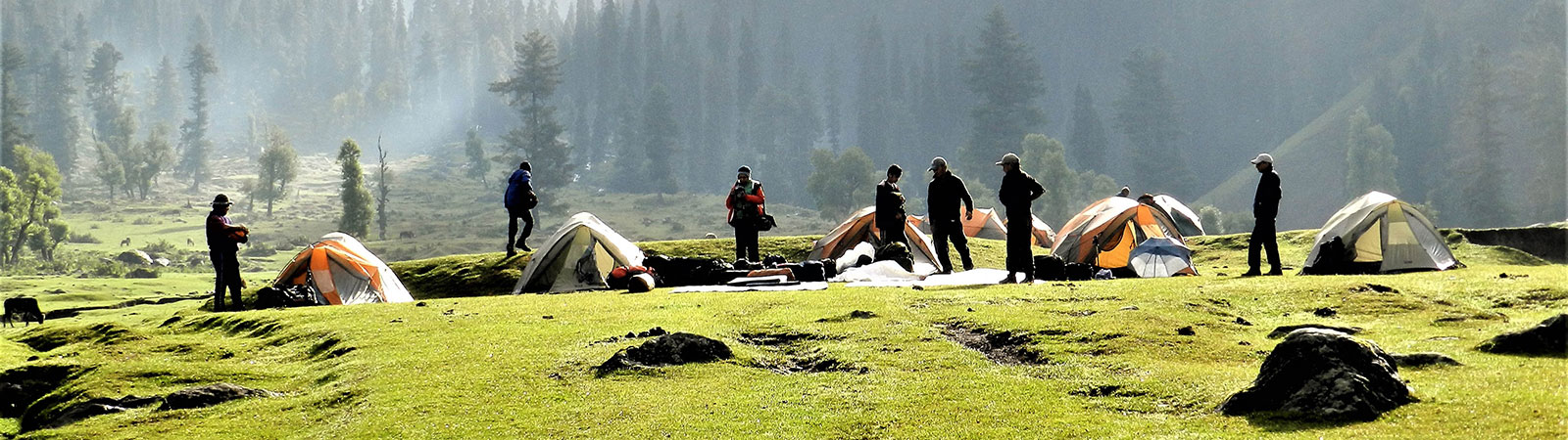
Camp in lower valley
Share on Social
SUMMER OF ’82
1982
‘A thousand, two thousand passes,
Passes in the lands of strangers,
I will cross three thousand passes,
To go to my own country.’
—Bhotia Song
AS FAR AS one can remember people have travelled over mountain valleys, ranges and passes. They travelled for trade, for earning a livelihood or for communication. Today travel continues for defence reasons, government duties or in search of a livelihood. Some of us trek for pleasure, to seek beauty and glean knowledge of those ranges. Motives differ and that perhaps leads to a vast change of attitudes. For us each step is meant to discover beauty; for others it causes inevitable hardship.
The people of Darma, Byans and Chaudas (Kuthi-Kali) valleys have always been travelers. Every winter they still descend to the lower valleys. Formerly they had almost no connection with the plains of India. Their trade, community interaction and life style were all dominated by the people of Tibet, a region which extends towards their northern borders. To the south-southeast lies Nepal. Hence they had close links with both; in fact, they still own land in Nepal and till it. It is the British who penetrated these valleys. They named these people ‘Bhotias’, a term now commonly accepted for the inhabitants of these valleys or for all those who are Hindu in origin but follow Buddhist customs. The Kali valley attracted many visitors and was well-known. One of the pilgrim routes to Kailash-Manasarovar (over the Lipu Lekh pass) leads through its fold. It is believed that in the Vedic era, sage Vyas stayed here; hence its name ‘Byans’. There is a temple dedicated to him at Gunji. The lower valley ‘Chaudas’ is named either after four followers of the sage or it is so called because fourteen villages nestle there. Kali divides India and Nepal, forming a natural border.
The upper Kuthi valley borders Tibet to its east and north, while Darma lies to its west. The Darma valley is bifurcated into Lassar and Darma at the upper reaches. To its west lies ‘Johar’ or the Kala-baland-Munsiary area. All these valleys have many interconnecting passes which are still in use. All the valleys had connecting passes with Tibet leading to Gyanima Mandi or Taklakot and trade flourished on traditional lines. But this has stopped since the borders were closed in 1962. Some trade, illegal of course, still continues via Tinker la in Nepal.
The first thing that impresses a visitor about the Bhotias of these valleys is their appearance. A large population subsists as shepherds. Someone called it ‘goat-culture’. But the other half, particularly the young, are seen in the latest brand of jeans and jackets. The educational level is high. They travel all over the country to earn a livelihood. Most of them take their surnames from the name of their village. The one who is from Dar is Daryal; from Garbyang, Garbyal and so on. So next time when you are in South India or in a big city look around for a Kutiyal or a Sonwal or even a Sipal. One is amazed to learn how far and wide the people of these valleys have travelled.
One of the interesting customs about which we had read was that of ‘rang-bhang’.1 On a particular day, the marriageable boys and girls of a village would come together and the festivities used to go on till most of them had found a suitable partner. Like many other things, this tradition, though it still exists, is now dying. These people have been the subject of a few anthropological and social studies because of their remoteness and unique customs.2 They still present an interesting subject before civilization fully takes over.
These valleys are also lined with many high peaks, e.g., Panch Chulis, Chiring We, Sangthang. Naturally mountaineers were attracted to the region. Among the earliest visitors were geologists Prof. Arnold Heim and August Gansser. They explored the Kuthi and crossed Shin la to Darma in 1936. Cutting across to the west they crossed the Ralam pass.3 The Scottish Himalayan Expedition (1950), led by W. H. Murray, entered from the Ralam pass and attempted Panch Chuli from the Sona glacier.4 In 1950, Kenneth Snelson trekked extensively in the area. The party attempted Panch Chuli, crossed Gangchal Dhura and recorded their travels with a beautiful panorama.5 Among the recent visitors we can find reference to an attempt on Panch Chuli (in 1971) by a group led by Prof. C. K. Mitra.6 The uppermost Lassar, Darma and Kuthi valleys remained unrecorded for all these years.
This was the area that attracted us in the summer of 1982. We trekked up Darma, climbed around Meola glacier, crossed 2 passes, visited 3 valleys and camped near two exquisite lakes. It was a happy and enjoyable summer for us.
13 May. Dharchula was in darkness and wore a deserted look when we arrived there late in the evening. The 300 km bus journey from Kathgodam, Almora, Didihat, Jauljibi was tiring. Amidst the depressing surroundings we saw the smiling face of Sher Singh and two other porters, our old and trusted friends. Within a short while we were settled and even managed to contact the tehsildar (during an interval in the movie-theatre) to obtain his signature on our permits. Next morning we surveyed the scene. Opposite the Kali river lay another Dharchula with a Nepalese flag. A welcome lift by an army truck and we were at our road-head; Tawaghat (1000 m—16 km).
We must have been a curious sight as this area rarely receives visitors. Moreover we were a varied group in age, (‘Age limit 18 to 66 years; membership restricted’) and with a similar wide difference in experience. We prepared for the trek. Above Tawaghat, on the ridge, one notices a huge pillar. This pillar is said to contain inscriptions in Chinese. On this basis the entire Darma valley is claimed by China. Our trek, (initially with 8 porters), started on the 15th. In the first three days we were to reach Duktu, a fairly large village at the entrance of the Panch Chuli valley. The trek was easy, most enjoyable, and the route was sprinkled with empty villages. Mawasas were not moving up yet due to late winter. Nue (1700 m—16 km) was on a jeepable track; Sela (2500 m—17 km) was set amidst a most beautiful forest, while Duktu (3260 m—19 km) was situated with some unbelievable mountain scenery around. We stayed at dak bungalows, enjoyed easy gradients, admired unspoiled forests and crossed many snow-tongues. But the trek will be remembered for the waterfalls. There were plenty, of various shapes and heights. It was an unforgettable sight. Sometimes you’d see a silver trickle on the opposite bank and sometimes you’d pass underneath a huge down-pour. They always conducted their own symphony with beauty.
Duktu is at the centre of the valley with village Son adjoining and Dantu across the Sona nala. Across the Darma river nestle the villages of Baun and Philam. With the backdrop of Panch Chuli range it was a most impressive sight. No wonder our enthusiastic host at Dharchula was writing to the Government to develop Duktu as a ‘Five-Star resort’! Here we re-packed and the party was divided for the next five days. Dhiren, Muslim and myself camped at the Panch Chuli base camp, while Jagdishbhai and Vasantbhai roamed in the villages and visited us for one night. Panch Chuli base camp was 6 km away at 3380 m. The route was easy and followed a good track till the junction of Meola and Sona glaciers. We were warned about a major difficulty on the way—a mad yak. The chowkidar very softly added that if the yak located us, we were sure to reach the base in record time! We did see this terror but we also seemed to hold some terror for the yak; later it chased our porters on a ferry, but it never bothered the Sahibs. Good manners!
The five days at the base were a delight. For the first two, we let loose on snow and ice and practised all possible crafts. It was hard work. One day we climbed to the base of Meola icefall to locate Camp 2 of W. H. Murray and see their route of 1950. Sona icefall was sending thundering avalanches down while Meola seemed to accept things quietly. The last day we decided to climb a small peak of 4330 m on the ridge descending from Panch Chuli V in the south. It had a wonderful panorama. Panch Chuli V (6437 m), IV (6334 m), III (6312 m) and the highest II (6904 m) formed a cirque above the Meola glacier. Panch Chuli I (6355 m) could not be seen. On the horizon above Sona glacier was Ngalaphu (6410 m). Many peaks lined the sky on all sides. A little rest, some food, getting lost on the rocks and we were back to the base. Camp was wound up and we rushed back to Duktu.
The two seniors had a wonderful time there. All the villages were empty. There was only one chowkidar and a fierce dog. They visited the Panch Chuli temple and nearby villages. Vasantbhai, now 66 years old, is still young as ever. He regaled us with stories from his vast mountain experiences and poems from Geetanjali. Jagdishbhai, 53 years old, was back on a Himalayan trek after a 12-year gap. He was observing the surroundings with his usual meticulous care. We kept saying that the poor Himalaya were in trouble this year as the Honorary Secretary of ‘The Himalayan Club’ was on a personal inspection tour!
23 May. We shifted our camp to Sipu (4760 m—16 km). We walked along Darma. On the opposite bank the village of Go was peculiarly situated on a huge black-hole in the mountain side. Anyone would refuse to be invited for lunch there! At Tidang the valleys bifurcate. To the northeast was the main Darma valley while to the northwest was the Lassar Yankti valley. Lassar Yankti was like a dream girl with clear, turquoise-coloured water. Its banks were lined with multicoloured stones of various shapes and shades. Sipu was situated about 150 m above the river-bed. We camped on the school volley-ball ground. A few families had returned here. They were digging out their stock of potatoes stored for the winter. We had read a lot about the Sipals and it was fun to be here. One villager demanded dues not paid by a ‘white-man’s party’ (Scotts’ or Heim’s). After promising to produce the note on the following day, he disappeared. Again good manners prevailed!
Now we made ready to visit Ralam pass (5630 m) leading to Ralam village in the west. The Sipals were scared of this pass, particularly because it had lots of snow now. They advised us to prepare thoroughly. (‘Even if you go for a shikar of a deer make preparations thorough enough to shoot a tiger’). On 25 May we left with our 3 permanent porters. We made our first mistake in map-reading here. We had to turn west on Nipchukang glacier. Jagdishbhai read the map (of 1954) correctly and followed the route marked and climbed up steeply to land in the shrubs on this abandoned track. Dhiren and I, following later, read the map incorrectly and almost missed the valley. We turned west at the river level. Lots of shouting and at last the first party descended on a giant snow-tongue. It was a delight to sleep under a boulder (how sadistic!) and watch both the elders descend with perfect balance adopting textbook techniques. We pushed in further and camped in a juniper clearing at 3910 m (10 km).
Three of us again pushed up to camp at 4450 m (6 km) following a moraine ridge. As the weather was none too good we only pushed the camp up to 4690 m (4 km) on the 27th. We were up at midnight and made tea, ready to leave for the pass. The approach was not too simple and a wind-slab slope was guarding it. The weather broke and we had to call it off. As we had a schedule to keep we could not spend three or four days waiting for the snow to settle down. So we retreated. Shikar on Ralam pass had ended!
29 May. The entire party started again towards the upper Lassar Yankti valley. We reached the main valley and proceeded literally on the river-bed. The map indicated a track upon the right bank: but taking advantage of the snow-bound river, we trekked up the river. A tired party camped at Kharsa (3750 m—10 km) in the evening.
30 May was our most tiring day. Three of us again started for Nassa (4270 m—10 km) in the uppermost Lassar Yankti valley. With heavy loads we crossed Jhutan glacier, descended to Ralphu and Anchri Tal, then across Ghutan and crossed Damolia glacier. All the crossings were very tiring and the final camp was a relief. And as if ordering a rest, heavy snowfall on the ensuing day did not allow us to move from the camp. Through the clearing we could see the great ablation valley leading to nowhere, and bordering Tibet. To the west there were many peaks but we were too close to the moraine walls to be able to see the summits.
1 June. We decided to return. We could start only in the afternoon at 3 p.m. It cleared by evening and we followed an easier lower route this time. By 5 p.m. we were at Anchri Tal (3660 m—4 km). Muslim was in a hurry to reach the camp at Kharsa. Dhiren and I just could not resist the temptation to stay at such a beautiful spot. For Dhiren (18 years) this was the first encounter with the Himalaya. His excitement about everything (‘first time’) was infectious. He had a habit of nicknaming everything. Potatoes were pats, tea was inty and theplas were theps. But the final touch was when Panch Chulis became Panchus and now we camped at Anchu!
But without exaggeration, Anchri had a Wordsworthian air about it. A small lake, very quiet and crystal-clear. The whole valley consisted of no other human beings. A reflection of the rising sun in the cold water. A small bird singing somewhere and our red tent in the background. We sat out around a fire till late at night and watched a glowing moon bestow unbelievable beauty on Anchri. I repeated Nandu Jayal’s words to (his) my companion; ‘(John) D, in all this beauty I guess God must be pretty close!’7
3 June. It was time for Jagdishbhai and Vasantbhai to leave us. Three of us moved to stay at Gangchal camping ground. Gangchal Dhura (5051 m) lies on the divide between the Lassar Yankti and Darma valleys. At this time of the year it was totally snow-bound. We had learnt that locally it is also called ‘Baisakhiram Jot’. A popular I.T.B.P. Officer Baisakhiram, with a few others, was killed while crossing this pass a few years ago. Unlike the usual passes this one does not cross the ridge at a lowest point but at one of the high points. This leads a party to the death-trap in a deep gorge on both sides. This apparently alluring Dhura was dangerous ground.
4 June. By 6 a.m. we left under a bright and clear sky. The route climbed up steeply. Far too steeply to relax or enjoy the view. Soon grass gave way to rocks and we ran into hard snow, Dhiren kicked steps through a wide gully and we rested mid-way. Slowly a beautiful panorama unfolded itself. A quick tea and some food and we deliberately left that alluring lower gorge to climb a steep ridge full of scree. A soft-deep-snow-ground near the top thoroughly exhausted Muslim who was opening the route. At last at 3 p.m. we hit the high point. Traversing the ridge we reached the lowest point. This was Gangchal Dhura. Both sides were lined with the most famous series of mountains one can come across. It was like looking at a crowd of people. And still there were familiar figures among that crowd. Some were old friends with whom we had rubbed noses; Chiring We, Bamba Dhura or the recent Panch Chulis. There were many whom we had seen before: Suli Top, Rajrambha, Lalla We. And there were famous figures: Api, Nampa, Chaudhara. It was a most satisfying place to be in!
But perhaps every white cloud has a black lining! A threatening storm was evidently developing in the south and we had miles to go before a camp. I led the way down, avoiding those obvious traps and regularly sinking in to the hip. A tiring affair. We lost height fast. And when it seemed that the slopes would never end, we were on the bank of Darma river and camping little short of Dawe (4390 m—10 km) in the north. That was the signal for the storm to let loose on the area and we could not move from the tents on the following day.
Dawe is the last outpost on the Indian side. Two passes Nuwe Dhura (5645 m) and Lowe Dhura (5562 m) lead to Tibet (Gyanima Mandi) from here. The place is strategically important and a witness to the past glory of trade between India and Tibet. But the Darma valley, in marked contrast with the Lassar valley, is devoid of any vegetation. Even juniper shrubs are missing. The reason—defence forces. It was evident that many bushes were dragged out with their roots. An ecological disaster!
Whenever Muslim Contractor (23 years) was introduced to someone, you got a variety of reactions. ‘You have a Hindu Contractor also on the trip?’ or ‘So what if he is Muslim?’ He had trekked widely and now he decided to have a bath in the cold waters of Darma. He left a little ahead of us to investigate the crossing of a shaky snow-bridge. Unfortunately while he was about to go across, the bridge broke. He lost his ice-axe and got drenched. Bravely he descended into the chilled waters and searched for the ice-axe. All he managed was to shiver for the next hour. We walked along the true right bank for 4 km before wading the Darma through its cold waters.
We camped at Piungang (4270 m—8 km). Two porters were sent to go to bring up the cache of food we had left there. We had food with us but no fuel. For the next 1½ days we combed the area for little pieces of wood and managed to survive on half-cooked shyakpa and luke-warm tea. We would have paid anything for a litre of kerosene. Sher Singh arrived with that broad smile of his and things appeared better.
8 June. We reached Bidang. A huge camping ground is the place where Tibetan caravans used to camp. A large quantum of trade took place. Now an I.T.B.P. regiment is all that remains. But we had no grounds to complain as they treated us to a sumptuous lunch so welcome since our appetites had been whetted by the hunger of the last two days. We rose to the occasion. Dhiren had to leave us here. He left with a porter and that night he camped at Bauling. The next day he made it a long affair and reached Tawaghat, covering 72 km in two days. Then next day he joined Jagdishbhai at Pithoragadh. The night bus journey to Delhi was another story for them.
Our proposed route now was to cross Shin La (5496 m) in the east and reach Jolingkong lakes. Then follow Byans valley down. Inquiries at Bidang about the exact location of the pass were casually answered. We were told that barats (marriage procession) go over it in chappals. So we started in the late afternoon and camped 300 m above. Then next day we encountered cloudy weather. Not to miss the view we did not proceed to the pass but shifted the camp another 150 m. There were 3 gullies to our east. No apparent route appeared. Everything was snow-bound and that changed the situation.
10 June. Starting early we entered the second gully. It was rising steeply with crusts of ice and rocks. We reached the base of a 600 m high wall with a wide ramp at its base. The route passed on that ramp. It was a virtual death-trap with stone-falls due to the melting of snow. We branched off on a steep rocky wall a little away from this wall. Mixed ground with ice-rock-scree and snow had to be negotiated. A terrible nerve-taxing wet climb! On the top another high rock-wall guarded the route, discharging stones. We traversed loose snow and reached a clearing. A tired party started and ten steps ahead we saw those welcome cairns 15 m below us. We were at Shin la at 3 p.m. after an eight-hour climb. Some pass, we thought, for a barat in chappals! The view to the east was dominated by Sangthang (6480 m), the black rocks of Kunti valley and Tibet. We descended again through the terrible hip-deep snow and later on a moraine ridge. A 6322 m peak adjoining Shin la looked an exact replica of the famous Kailash. It is locally worshipped as ‘Baba Kailash’. In the fading light we climbed up 3 moraine ridges and 100 m to camp at Jolingkong lake (4630 m—10 km).
11 June was the rest day. We surveyed the surroundings. The lake was about 5 km in circumference and still frozen. A small temple and little cairns separated it from the roaring Kunti river. Jolingkong is also worshipped as ‘Chhota Manasarovar’. We had heard about a pair of ‘Rajhans’ that lived here. But we had also heard that no one can shoot them because the bullets went ‘cold’ while shooting across the icy lake. But the very thought of shooting was disturbing. The valley up takes a peculiar S turn to Wilsha. Two passes, Lampiya Dhura (5547 m) and Mangsha Dhura (5486 m) leading to Tibet are a little ahead. A large moraine bed in the Kuthi river was a reminder of a gigantic lake that had once formed. We could not determine when the natural dam had burst.
12 June. This was a day to remember. As we left the lake there was a climb to a prominent ridge in the south. Walking leisurely we observed three figures on that ridge. We continued and coming a little closer were astonished to find the three jawans aiming their Light Machine Guns at us! We waved and that led to a scramble among them to bunkers with L.M.Gs. still pointed at us. We were worried. Never trust a Khaki brain, particularly as they had no live shooting practice since 1962! Hiding behind a huge rock unashamedly, we let Sher Singh go ahead as he looked the most ‘Indian’ among us. We were waved up soon. The Officer talked to us but still a dumb-looking jawan kept pointing a gun at us. At last things were sorted out. The dumb jawan very reluctantly unloaded. He was distinctly unhappy. For already he had visions of medals for capturing three Chinese! They had just arrived and they thought we had crossed the Tibetan pass. Shin la is not open till late in the year. Credentials were established. They withdrew an alarm sent down the lines in the valley. But all along our trek down we encountered curious glances and had a story to tell.
By evening we were at Kuthi village (3760 m—14 km) which has the most exquisite wood-carved houses. As we were seen off by a local officer, he pointed to a small hill at the outskirts, with ruins 5 ft high. This was Pandu Killa where the Pandavas stayed. According to the legend a 9-storeyed building on that hill was their home. With a mischievous chuckle he added, ‘Since we have come it has always appeared a little smaller!’ In the evening we camped at Nihal and on the next day we crossed Gunji.
At Gunji, the Kuthi river merges with Kali which forms the Indo-Nepal border. As the legend goes, it is the Britishers who interchanged the names of the white Kali and the blackish Kuthi rivers. This ensured a vast area of land as British territory since Kali was accepted as a border. They built a temple dedicated to Kali near Lipu Lekh pass to authenticate the name. A good example of British diplomacy! An old man advised us now to follow kachhuve-ki-chaal (‘tortoise walk’) for the route down the valley involved many ups and was rather tiresome. Here we joined the Kailash-Manasarovar pilgrim route from Lipu Lekh pass well described by pilgrims to Mana- sarovar.8 We were to suffer that ‘curse of Kali’. Because of the narrow gorges it forms, the route climbs up thousands of feet a few times and finally descends at Tawaghat. At certain places the track was wide enough to be motorable. In 1960, a contract was made to build the road from Almora to Lipu Lekh pass to facilitate pilgrim traffic. The contractor was persuaded by the Chinese to start the construction from the pass to Almora. This would allow a good deal of strategic advantage to the Chinese to descend to lower valleys. The folly of this plan was discovered. The road has not reached Tawaghat yet.
15 June. In three days we reached Narayan Ashram, 2775 m via Garbyang (9 km), Malipa (16 km), Jipti (11 km), Ashram (16 km). The place appears like a building in fantasy land. The location, the construction and the atmosphere it generates is most conducive to spiritual practice. The ashram was built by Narayan Swami in 1946 to help the pilgrims to Manasarovar. With Api-Nampa in the southeast and Panch Chulis in the northwest it is a place of rare beauty. A day of rest and we descended 1645 m to reach Tawaghat. Back to the heat and to civilization.
We now jostled in buses, ate at dhabas and sped home by trains. All that had gone past was already beckoning us. We had finished our travel. But it will be impossible to forget the Panchus, goat-culture, L.M.G., Kutiyals, passes and of course Anchu!