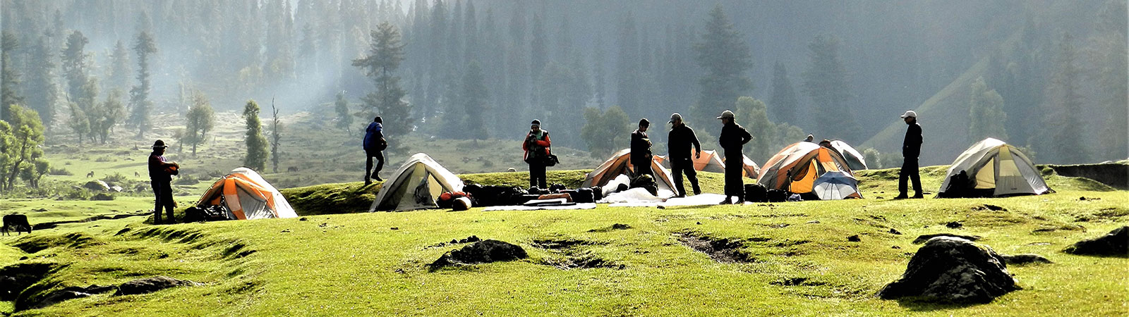
Camp in lower valley
Share on Social
FIRES ON THE MOUNTAIN
Ascents in the Panch Chuli Group
(1992)
A mountaineer never retires. In a sense he never hangs his boots to call it a day. As he grows in years he continues with trekking and loving the hills . ‘This has to be Chris’.
‘Yes’.
‘Is he lecturing Graham so early in the morning?’
I peeped out of my tent and could hear Chris snoring loudly. It was the radio. BBC was broadcasting an interview with Chris Bonington. We were at ABC (4840 m). This must surely be a record of sorts, listening to an interview at this height, with the interviewee snoring in the next tent!
Our expedition had come a long way already. When Bonington and the others arrived in Bombay on 7 May 1992, we were ready with all the last minute preparations. A superfast train took us to Delhi (‘The British Rail can learn a thing or two from this’). A two-day bus ride with half a day’s rest at Ranikhet followed. (‘Solving the case of the missing “tempo” with all our expedition luggage’). Finally everything was in place at Munsiary, the roadhead.
By this time we were learning the diplomatic charms of Bonington. If he paid you a compliment, he wanted something done. His adaptability was amazing. In a jacket, so to speak, he was a great diplomat shaking hands and smiling for hours, enough to disarm a formidable bureaucrat. Once in a bus, or on the mountains, he was totally different.
‘Now you know why he has reached, where he has’, was a compliment someone paid him referring to these amazing transformations.
Starting on 15 May, we walked three days in an amazing virgin forest, halting at Damol and Balati. Base camp (3200 m) was at the snout of the Uttari Balati glacier, one of the lowest BCs in the Himalaya. In fact, the height difference from BC to Panch Chuli II (6904 m) was 3700 m, more than on most high mountains, including Everest.
‘Shit, how are we going to go through this?’. It was exclaimed after looking at the three icefalls of the glacier. The first one was passed by and the Glacier Camp (3900 m) was established. Victor opened a route on the (true) left of the glacier. It was a maze of collapsing crevasses, and stones bombarded the fixed ropes after 7 a.m. We christened it ‘Victor’s Terror’ and very reluctantly moved in.
‘Surely the Pandavas did not go this way’.
‘Why, this is the surest way to heaven’.
‘But we have to reach the peak and cook a meal before that is ensured. These peaks symbolise their cooking fires on the mountain’.
‘They are, figuratively speaking. It is the spirit that counts, isn’t it?’ We all certainly intended to return, and not go the Pandavas’ celestial way.
‘Forget the Fires on the mountain, run run run.’ Someone said reminding us of a childhood rhyme, warning us about the falling stones.
We were discussing the legend of the Panch Chuli peaks. Folklore has it that the five Pandava brothers cooked their last meal on these peaks and proceeded to heaven. These peaks were the hearths from which the sun-rays rose towards heaven, every morning and evening.
There was a loud sound. As we looked up Chris was hanging on a jummar on the fixed rope. The entire floor beneath him had collapsed.
‘Chris do you still think we should follow this route with loaded porters.’
‘If I were you, I would not follow this route’, he replied with British understatement.
‘I am certainly not you. We will try a route on the right hand edge’. I pointed to it and started descending. Chris and Graham continued upwards.
We found two gullies, leading up and passing by the second and third icefall. This was the route followed by all the earlier teams. It was highly exposed. All the difficulties we had faced on the left route on snow and ice, were present here on scree and rocks. We fixed a rope and on the first run I almost lost my rucksack. After crossing it once, Victor got even with me.
‘I heard all about it Harish. If the left route was “Victor’s Terror” this is “Harish’s Horror”.’
He was proved right. Later on in the expedition Vijay slipped in one of these gullies and almost fell down the rocks. Sundersingh literally slid after him and stopped him at the last bump. Vijay broke an ankle and that’s when the helicopter flew in for the first time, to pick him up.
Above it we climbed another ice gully and reached ABC. Chris and Graham were there, having climbed Sahadev East (5750 m).
Sahadev East (5750 m)
(Chris Bonington writes)
Graham Little and I had the upper Balati glacier to ourselves. The others had gone back down to help rejig the route round the second icefall, one of three that blocked the Uttari Balati glacier. Our camp, which was to become our advance base, nestled beneath a little rocky buttress on the northern side of the glacier. On the other side towered a tooth-like peak that had dominated the skyline both on our walk up the Balati valley and even more dramatically during our ascent of the glacier. It seemed a good objective for a first climb. A direct ascent up the ridge facing us looked a bit too challenging—steep rock steps divided by snow-clad ice-slopes—but there appeared to be an easier option up glaciated snow-slopes leading to a spur that in turn led to the summit ridge.
We set out at three o’clock the following morning, picked our way across the glacier and then plodded on for what seemed like ages, our path lit by the small pools of light from our torches, up the slopes leading to the spur. It was good to be moving without the weight of a heavy rucksack. I could even keep up with Graham, taking my turn in front. One of the problems of climbing with people nearly 20 years younger is that all too often they are tiny dots disappearing over the horizon, or tugging insistently out in front on the rope.
Night changed to the grey of the pre-dawn and, as we gained height, the skyline of the Balati glacier took shape, ridges and snow slopes becoming defined, then etched in the golden light of the sun, as it lit the top of the peaks. Opposite and behind us was Rajrambha, a big sprawling peak, whose steep crenellated face fell away sheer to the glacier. At the head of the valley was the unclimbed Nagalaphu, with twin rocky peaks and steep walls.
We reached the bergschrund as the sun crept round to us. It was my turn to lead. The bergschrund was bigger than it had seemed from below. Snow crumbled away. I sank down to my thighs, edged further across, ice-tools thrust into bottomless soft snow, and heaved myself up into a praying position with everything sliding away around me. Panting hard, I was able to stand and kick into the harder snow above. I kicked my way up, twenty metres or so, cleared a stance, buried my axe and brought Graham up.
Pitch followed pitch, about nine inches of softish snow lying on ice at an angle of around 500. Not difficult, but nerve-racking. It was around 9.00 a.m. by the time we reached the crest of the ridge, looking across to what had seemed the summit from below. It now appeared lower than us and we were only just short of top of what we named the East peak. It seemed a long way to the West peak, so we unanimously declared our summit to be the higher one. It was only after returning to advance base, when we examined the map that we had to admit the West peak was a few metres higher. We called the two peaks Sahadev East and West after the second and youngest brother of the Pandavas.
Graham and I next decided to attempt Nagalaphu (6410 m) via a bold traverse. We left advance base on the afternoon of 29 May, walked up the Uttari Balati glacier through a thick mist and stopped below what we judged to be the face we planned to climb that night to reach the crest of the ridge. It was snowing hard by the time we had put the tent up and a violent thunder storm quickly followed, hail drumming on the sides of the tent through most of the night. It stopped at last and we got away at 3.00 a.m., plodding in the dark past serac walls and part by hidden crevasses. It was only at dawn, just after I had stepped into a huge bell-bottomed crevasse, that we could discern the mountains around us in the faint grey light. The dreadful realisation came to me that in the dark we had started up the wrong mountain and we were just short of the upper Balati plateau instead of the big face we had planned to climb.
We were so shaken by our mistake that instead of continuing we retraced our steps and after a half-hearted probe up the glacier, returned to advance base shamefaced, to find the entire team assembled there. We decided we needed a rest before we continue on down to base camp that same day.
Panch Chuli II (6904 m), southwest ridge
(Harish Kapadia writes)
‘Mus, do you think the porters will make it to the next camp today?’ I was shouting from behind, plodding in deep snow. The route appeared to be a very long one.
‘They will bloody well have a long day’, is all that Muslim said as he continued plodding.
C1 (5750 m) was established at the edge of the Balati plateau. We were to take on the southwest ridge, while Chris and Graham were to climb the west ridge. Both the ridges were separated by a little distance. We were to open a main route to the foot of the peak as four Britons were traversing Rajrambha1 (6537 m) from ABC. On 3 June with Chris, Graham, and Monesh, I joined Muslim and Bhupesh who had already recced the Balati plateau. The next day we crossed the maze of crevasses to C2 (6120 m) on the col at the foot of the southwest ridge. Chris and Graham bifurcated off half way through for the west ridge.
‘Pasang and myself will fix some rope ahead to move the camp. We will surely be up in two days time’, Monesh said with enthusiasm as we embraced wishing each other good luck. The next day as Bhupesh and I returned to C2, Muslim, Monesh and Pasang were on the ridge, establishing C3.
7 June was a little cloudy. From C2 we could not see a thing at first.
‘I can see three dots moving up the final ridge’, I shouted at about 10 a.m. Slowly the dots moved up and disappeared from view. We could see two dots moving up the west ridge, too, from our ring-side seat.
Starting from C3 (6400 m) three of our men had reached the foot of the upper rock band in two hours, at 6.45 a.m. This band was climbed with some difficulty in 45 minutes and in an hour they reached the point where the southwest and southern ridges met at 6800 m. But the ‘fun’ had just begun. The cornices hanging on the east were very thin (‘so thin that we could see sunshine through’. Bill Murray had written about this ridge, observing it from the east). They carefully crept up, without any chance of fixing a protection. Finally they were on the top at 10.15 a.m. There was no time to waste. They started to descend immediately. A little below the top Monesh fell through the cornice almost up to his chest. As he pulled out he realised how close heavens was. He left a scarf there to mark the spot. Having lost their way in a white-out they abseiled the upper rock band and with difficulty reached C3. This was the only second ascent by this ridge. Whereas the earlier team had fixed the entire route, now only about 60 m of fixed rope had been used. Carefully, they retreated to C2 where Bhupesh and I were waiting with hot mugs of tea.
After about two hours, two other figures made their way to us for their cups of tea: Bonington and Graham, after their ascent by the west ridge and descent by the southwest ridge had reached our camp.
Panch Chuli II (6904 m), west ridge
(Chris Bonington writes)
When we returned three days later on the afternoon of 2 June, Victor Saunders, Stephen Sustad, Dick Renshaw and Stephen Venables had already set out for a traverse of Rajrambha. Harish Kapadia and the Indian members of the team were completing their build up of supplies on the upper Balati plateau for their attempt on the southwest ridge of Panch Chuli II. Graham and I decided it was high time we also concentrated on the main objective and chose its unclimbed west ridge.
Starting out the next day with the Indian team, we carried heavy loads to the head of the icefall guarding the Balati plateau. The camp was on the shoulder of the ridge between the Uttari Balati and Dakshini Balati glaciers. From there, the following morning (4 June) we reconnoitred a route to the foot of the west ridge and moved up the next day to pitch our little Gemini tent at 6120 m within easy reach of the bottom of the ridge.
At 3.30 a.m. on 6 June we began ferrying all our tentage and gear. It was a moonless but starlit night. A steep little bergschrund, climbed by the light of the head torches, led onto the ridge itself. It was only 450 in angle but was hard ice with only the occasional thin smear of névé, clinging to it. We were climbing one at a time and, feeling the altitude, had slowed down. Dawn came and the sun crept up and over the crest of the southwest ridge. The view was magnificent; the two peaks of Sahadev were far below us, across the valley sprawled Rajrambha, whose long serpentine ridges the other four were climbing, while out to the west towered the steep pyramid of Nanda Devi, surely one of the most beautiful mountains in the world.
The angle steepened and the crest of the ridge was barred by a serac, forcing us onto the west face up steep, poorly consolidated snow. Our progress became even slower and the day was beginning to slide away. We had been on the go for ten hours and reached around 6500 m but there was no sign of a bivvy site. Graham led up a steep ice-gully and pulled out on a little vertical ice-wall leading back onto the crest of the ridge. I panted slowly up behind him and was happy to let him lead the next pitch. He was hunting for somewhere to camp, but to no avail. It was late afternoon and the cloud was swirling around us. The occasional lump of ice or slurry of snow came tumbling down, but he could find nowhere large enough for our tent. The rope came tight between us. I abandoned the belay and started moving up behind him. At last, I heard a tired shout of triumph. He had found a camp site.
I joined him on the crest of the ridge. Just above was a small ledge below a serac wall. We were able to dig out a camp site with minimum of work and pitched our little Gemini at 6610 m. It feels very secure, can stand almost to any weather, but it is small. It would make a reasonable one-man tent but is cramped for two, specially if one of the occupants (Graham) is six feet two inches tall. Fortunately I had a modification made of a commodious sleeve entrance in one end. Graham was able to put either his head or feet into that extra space to stretch out.
It started snowing almost immediately, but what was more serious was that Graham had a savage headache, something that is always worrying at altitude. Inevitably I thought of cerebral oedema, but Graham told me that he had fractured his skull as a child and suffered from time to time with debilitating headaches. There was none of the puffiness associated with oedema around his eyes and they weren’t unduly bloodshot, so I was slightly reassured.
We were slow in getting away the next morning. We were both tired from the previous long day, and anyway there was not too much urgency. We wanted to reach the summit very early in the morning to be sure of being rewarded with a view. We only had 400 m to go to reach the top, and therefore decided to push our camp a short way up and closer to the southwest ridge which we planned to descend once we had completed our climb.
Fortunately Graham’s headache became more bearable once he started moving, and we took alternate leads, progressing slowly over the crevassed upper face in the direction of the southwest ridge. Just after midday we saw three small figures moving down the crest of the ridge. It was the Indian team descending after a successful ascent. We shouted, but got no reply.
By this time the cloud had rolled in once more and we stopped on the lip of a bergschrund and around 6730 m. It was snowing again by the time we pitched the tent and once Graham got into his sleeping bag, his headache returned with renewed fury. I could almost feel the pain he was obviously experiencing. Neither of us slept that night. The snow pressed in on the tent, making it even smaller. Had the weather finally broken? Would Graham be able to go for the summit if it was fine in the morning? Could I go for it on my own? Perfectly feasible, but how could I justify leaving Graham alone? The snow stopped just before the dawn. I started melting some in the gas stove hanging from the roof of the tent, asked Graham what he wanted to do, and to my immense relief he said he’d have a go for the summit.
We left the tent in place, and cut across towards the crest of the southwest ridge. It was easy-angled but hard ice. Just below the summit we came across some red rag (Monesh’s scarf) left by the others the previous day. Graham had rallied once he got going, took his turn in the lead, and suddenly we were almost there. Graham led the last few feet towards the summit of Panch Chuli II. We had our reward for our high camp and early start, for the sky was still clear, the view magnificent, with fresh vistas to the north of mountains in Tibet, of Gurla Mandhata, massive, majestic to the northeast, and further to the north, a distant pyramid, Kailash, most holy of all mountains in both Hindu and Buddhist mythology. Looking to the east we could see Api and the mountains of west Nepal, shapely snow peaks in the distance, while in the immediate foreground, much lower but still dramatic, were the peaks of Panch Chuli IV and V (III was hidden by the lip of a huge cornice), Telkot and Nagling, all of them unclimbed, all steep and challenging.
We spent half an hour on the summit before returning to our camp, where we stuffed the frozen tent and all the gear into our packs and started the long descent of the southwest ridge to rejoin Harish and others who were still encamped on the col at the foot of it. It was wonderful to enjoy their hospitality, crammed three to a two-man tent, to have endless cups of hot tea and to share with each other the stories of our two ascents. It had been an immensely satisfying climb snatched in the teeth of deteriorating weather.
To Pyunshani Valley
(Harish Kapadia continues)
‘There is nothing more to do in the Balati valley. The others have climbed Rajrambha as well’.
‘Venables and co. are coming up to climb Panch Chuli II’.
‘We will talk to them’.
Chris and I were discussing plans as we descended together after ascents of Panch Chuli II. I was yet to see the master diplomat in action. We met others on the glacier below. Congratulations to each other and lots of laughter followed.
‘What are your plans?’, Chris inquired.
‘We will try another ridge on Panch Chuli II’.
‘Harish and I are going to the Pyunshani valley, a little to the south’.
‘Graham is up at ABC, waiting for us’.
‘Good luck then. We will tell you about those unclimbed peaks. No one has been to the Pyunshani before us. It will be a wonderful exploration for us’. Chris started walking down.
The others looked alarmed. Graham was pulled down, camps wound up and the entire party was moving to the Pyunshani valley.
There was no record of any party visiting this valley which drained the Panch Chuli peaks III, IV and V. After some persuasion we found a guide, Dhansingh, who as we discovered later, had been up here years before. He promised us fresh meat from the shepherd in the valley. All went well to begin with. We retreated to Phunga Gair (2920 m) a gem of a place as the name implied. On 15 June we climbed a steep incline through dense forest to cross Bagarthora col (3800 m) and camped at Shyama Gwar (3600 m). Ahead the route traversed up and down numerous ridges. Dhansingh stopped every five minutes. Ultimately it was too much for Britain’s best mountaineers.
‘Harish, there is no meat here, shall we eat Dhansingh?’ They started descending to the river wanting to follow it to the base camp in the upper valley.
Dhansingh nodded his head in disapproval to say that no route was possible from here.
‘We have a rebellion on hand. What shall we do Chris?’ I asked helplessly.
‘If I were you, I would follow Dhansingh’, Chris replied in his characteristic style. He had dealt with many such restless climbers.
After a while as others descended, Chris gave a shout.
‘Follow the river, camp in the open and in rain. Remember we have the tents. See you at the base camp in 2-3 days’.
The four cursing Britons climbed back in line behind Dhansingh!
On 16 June we established our second base camp (3320 m). We had five days. Two plans were made. Muslim, Monesh and I were to climb in a side valley and explore the adjoining Rula and Bainti glaciers. The five Britishers were to try one of the Panch Chulis and meet us back at Munsiary. We were to leave some food and three porters for them and go back early to wind up the expedition at Munsiary. Accordingly both teams left on 17 June.
These were the most delightful days for us. We had already achieved the main objective, Panch Chuli II. Where most teams would have gone back, here we were in a valley never visited before. Totally relaxed we moved two camps to reach the Bainti Col (5100 m) on 20 June. Two peaks rose to the northeast and southwest of the col. We climbed both, Panchali Chuli (5220 m) and Draupadi (5250 m). The view to the east was of the Bainti and Rula glaciers. They looked most fearsome. Many unclimbed peaks like Bainti (6072 m), Nagling (6041 m) and others rose above it. The icefalls could keep experts busy for some time.
‘Surely the Pandavas could not have gone this way’, was the clear verdict as we saw Panch Chuli II rising in the north.
‘Are you sure, you have gone up that ridge’, I asked Monesh and Muslim pointing to the southwest ridge, which looked steep, and exposed with ice shining on it. Both of them looked at it with satisfaction.
We came down in rain, and clouds returned to Munsiary on 23 June leaving the Britishers to follow.
Little did we realise the drama that was being unfolded on Panch Chuli V. The expedition was not over as yet!
History of the Panch Chuli Group of Peaks
The Panch Chuli peaks lie in the eastern Kumaon area. They form the watershed between the Gori and the Darma Ganga valleys. The eastern approaches are through Sona and Meola glaciers. The Uttari and Dakshini Balati glaciers guard the western approaches. The peaks are numbered NW to SE—I (6355 m), II (6904 m), III (6312 m), IV (6334 m) and V (6437 m). It is not known how the highest peak came to be regarded as peak II, (and not peak I), but the nomenclature is too well established to change now.
Legend
As per the legend, these peaks are named after the five Pandava brothers from the Indian epic Mahabharata. These peaks represent their cooking hearths (chulis) as they cooked their last meal before proceeding to their heavenly abode. As one watches the group from the bungalow at Munsiary before sunrise, the rays directly reflect on these tops and throw the light upwards to the sky. The same scene is repeated in the evening, a little after sunset, for the people in the Darma valley. Thus the legend is firmly established in folklore.
Early Expeditions from the East
The mountaineering history began with Hugh Ruttledge. He saw the group at close quarters reaching high up on the Sona glacier. He examined the routes and thought that the north arête may be possible. After 21 years two teams examined the eastern approaches again. W.H. Murray and his Scottish team followed the Ruttledge route. They intended to reach the north col and follow the northeast ridge. They found the terrain too difficult.
North col was ringed below by a bergschrund, from which 300 ft of bare ice swept up to the rocks and ice was everywhere raked by stonefall. We were beaten.
And about the upper ridge they opined that it ‘. . . was so thin that we could see the sunshine through’. Later Murray and Douglas Scott went up the Meola glacier. From its junction with the Sona glacier they climbed ‘till 16,000 ft by way of the central diff and found the only way to Meola’.
Just 20 days after them came Kenneth Snelson and J. de V. Graaff. By early September they reached the upper Sona glacier and ‘found that its head was a cradle of 600 foot cliffs offering no route to the northeast summit ridge’.
They then followed Murray’s route to upper Meola and reached the south col to examine the west side.
The Goriganga side of the col falls precipitously, to the Panch Chuli glacier and the almost vertical face rises another thousand feet above the col making the lower part of the ridge razor edged. Hardly a route!
They thought of the south ridge but wrote: ‘The ridge towards south col has a rather easier gradient but it is very broken, heavily corniced’. They gave up the southeast face also after 400 ft.
With such verdicts, the eastern approaches were left alone. Only a team each in 1970 and 1988 tried them unsuccessfully.
Attempts from the West
The western approaches were tried one year after Murray, in 1951. Heinrich Harrer and Frank Thomas were joined by two Sherpas and a botanist. Though their account in the Himalayan Journal is not very explicit, their photographs in the archives clearly indicate that they pioneered the route through the Uttari Balati glacier, bypassing three icefalls. Harrer with Sherpas reached the Balati plateau and examined the north and west ridges. They tried the west ridge but a Sherpa fell off on hard blue-ice. Harrer gave up. They had spent only 16 days on the mountains but pioneered the route which was followed by all subsequent expeditions from this side.
In 1952, P.N. Nikore followed the Harrer route and his attempt in June almost coincided with an attempt by another team led by D.D. Joshi which included Maj. John Dias. Both the teams reached the Balati plateau. Nikore returned in 1953 and claimed a solo ascent of the peak without any conviction or proof to corroborate his claim. He was disbelieved and the claim ignored.
Wrong Claims
Group Capt. A.K. Chowdhury led a team sponsored by the Indian Mountaineering Foundation to this group in 1964. Following the Uttari Balati glacier they reached the Balati plateau. Their cursory attempt on peak II failed. They then claimed ascents of Peaks III, IV and V in two days, in fact two peaks on the same day.
These peaks stand above the southern valley of Pyunshani and are completely unapproachable from the Balati plateau at all. To climb these peaks, as claimed, the party would have to climb over very difficult terrain covering almost 10 km in one day, above 6300 m and crossing low cols. The party had mistakenly climbed three distinct humps situated near their camps and running east-west from peak II instead of peaks II, IV and V, which broadly run north-south. The mistake was ultimately accepted by the sponsors. At first, the so-called summiteers had either refused to reply or were adamant in their claim. The record were corrected after 28 years, when the mistake was pointed out by the 1992 Indian-British expedition.
First Ascents
The history of the group continued with two large expeditions from the Indo-Tibet Border Police teams. The first team in 1972 was led by Hukam Singh. They powered their way to the Balati plateau via the Harrer route and made the first ascent of peak I. The first of the Panch Chuli had fallen. Repeating their route, Mahendra Singh led another team in 1973. They fixed almost 3000 m of rope. The entire route on the southwest ridge was fixed. On 26th May 1973, 18 people summitted. The highest peak there was climbed.
The mountain was left alone for 18 years. In 1991 two routes were climbed by the eastern approaches. Both teams were from the Indian army. The first team followed the Sona glacier, climbed the northeast slopes to reach above the north col and established a camp on the north ridge. The ridge was followed to the top. Thus the route suggested by Ruttledge in 1929 was completed after 61 years. The second army team followed Murray’s route to the upper Meola glacier. They pitched a high camp following the southeast slopes to the east ridge. The summit team broke the cornice to reach the top. Thus the route suggested by Snelson-Graaff was completed after 41 years.
Last Climbs
The scene finally shifted back to the west. The Indian-British expedition 1992 followed the route along the Uttari Balati glacier to the Balati plateau. On the way the team divided into groups to climb Sahadev East (5750 m), Menaka (6000 m) and Rajrambha (6537 m). On peak II, a team of three climbed the southwest ridge. It was a hard climb on ice, keeping well away from the hanging cornices. Compared to the earlier ascent only 60 m of rope was fixed on the ridge. This was the second ascent of the southwest ridge, now after 19 years.
Another team of two pioneered a new route up the steep and icy west ridge, with bivouacs. They descended the southwest ridge completing the traverse. Thus the route tried by Harrer was completed after 41 years.
The 1992 expedition later made the first ascent of peak V later. Peak III and the direct south ridge on peak II still remain unattempted.
Expeditions to the Panch Chuli Group
(All the expeditions were to Panch Chuli II, 6904 m, the highest peak of the group, except mentioned otherwise).
Expeditions from the Eastern Approaches
- 1929: Hugh Ruttledge reached c. 5730 m Book Ref. 5-6
on the Sona glacier. He thought that in Appendix A
a route to the summit was possible
via the north arête.
- 1950: W.H. Murray and the Scottish H.J. XVI,
Himalayan expedition reached p. 38;
- c. 5790 m via the Sona glacier. They Book Ref 1-2
tried to reach the north col. in Appendix A
- 1950: K.E. Snelson and J. de V. Graaff H.J. XVII,
reached c. 6100 m from the Meola p. 97
glacier. They ruled out the south
ridge, southeast face and northeast
ridge from the Sona glacier.
- 1970: C.K. Mitra led an Indian team from H.M.J. 6,
the National Cadet Corps. They p. 112;
reached c. 5950 m, both on the H.C.N.L. 28,
Meola and Sona glaciers. p. 2
- 1988: Aloke Surin and his team from H.J. 45, p. 196;
Bombay attempted it via the Meola H.C.N.L. 42,
glacier and stopped before south col. p. 29
- 1991: Capt. N.B. Gurung led the Gorkha H.J. 48, p. 48;
regiment (Indian army) team. They H.C.N.L. 45,
climbed via the Sona glacier to the p. 18
northeast ridge to the summit in
August. This was the second ascent
of peak II.
- 1991: Col. Suraj Bhan Dalal led a H.J. 48, p. 54; Kumaon-Naga regiment (Indian H.C.N.L. 45,
army) team in September. They p. 18
climbed via the Meola glacier up
the east face and east ridge to the
summit. This was the third ascent
of the peak.
Expeditions from the Western Approaches
- 1951: Heinrich Harrer and Frank Thomas H.J. XVIII,
pioneered the route via the Uttari p. 171
Balati glacier. They reached
- 6100 m on the Balati plateau, and
attempted the west ridge. They
found the north ridge in bad
condition.
- 1952: P.N. Nikore attempted via the —
Harrer route.
- 1952: D.D. Joshi led an Indian team via Book Ref. 3
the Uttari Balati glacier to reach in Appendix A
the Balati plateau in June.
- 1953: P.N. Nikore claimed a solo ascent, —
via the Uttari Balati glacier route.
Claim not believed and not accepted.
- 1964: Group Capt. A.K. Choudhary led a H.J. XXV,
team from the Indian Mountain- p. 207;
eering Foundation. Reached the H.M.J. 3,
Balati plateau from the Harrer No. 1, p. 53;
route. Tried the southwest ridge of H.C.N.L. 22, peak II. Later claimed mistaken p. 5; H.J. 49;
ascents of peaks III, IV and V in H.C.N.L. 46,
two days. Claim now corrected. p. 19
- 1972: Hukam Singh led the Indo-Tibet I.T.B.P. Report;
Border Police team (I.T.B.P.) via H.C.N.L. 33,
the Uttari Balati glacier. They p. 26
climbed peak I. This was the first
ascent of peak I.
- 1973: Mahendra Singh led another I.T.B.P.
I.T.B.P. team by the same route. 1973 and
They climbed from the Balati Jan. 1974
plateau and via the southwest (Nov.-Dec.);
ridge, to the summit. This was H.C.N.L. 29,
the first ascent of peak II. p. 23
- 1992: Chris Bonington and Harish H.J. 49, p. 57;
Kapadia led the Indian-British h.c.n.l. 46,
expedition via the Balati plateau. p. 17
They climbed peak II via the
southwest ridge and also the west
ridge—a new route. This was the
fourth ascent of peak II.
The expedition also made the first
ascent of peak V, from the Pyunshani
valley.
Summary: 1929-1992: Expeditions to Panch Chuli II
From eastern approaches—5 attempts and 2 climbs. From western approaches—6 attempts and 2 climbs.
Totally 11 attempts, 4 ascents; 15 expeditions in 64 years (not counting the heavenly journey of the Pandavas!).
Ascent and Attempt on Other Peaks
- Panch Chuli V: The first ascent of this peak was made by the Indian-British expedition in 1992. (See details above)
- Panch Chuli IV: The first ascent of this peak was made by a New Zealand expedition on 1st October 1995. The team was led by John Nankervis (see H.J., Vol. 52, p. 247).
- Panch Chuli III: The peak was attempted by an Indian expedition in 1996, led by Divyesh Muni. They attempted a straight line from the Pyunshani valley. However as the first party was heading to reach the col between Peaks II and III an avalanche carried E. Theophilus down from 5500 m to 4700 m. Luckily he survived unhurt but the attempt was given up (see H.J., Vol. 53, p. 247).
Notes & References
- Rajrambha was traversed over peak Menaka by a party of four Britons from this expedition. Their story is recorded in the Himalayan Journal, Vol. 49, and in the book No Place to Fall by Victor Saunders.