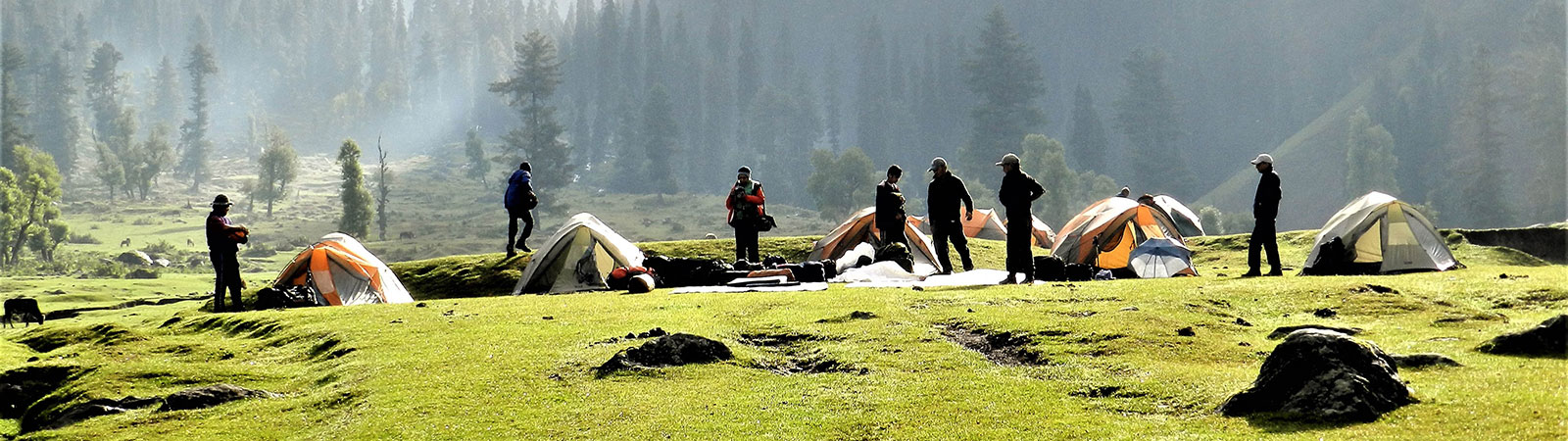
Camp in lower valley
Share on Social
NANDA DEVI : THE ‘BLISS GIVING’ GODDESS OF KUMAUN
Mountains, like men, have their history. They too are born, grow, decay and die. One cannot claim that, like men, they love, but it is true – and how true – that they are loved.
Felice Benuzzi, No Picnic on Mount Kenya
The twin peaks of Nanda Devi (7,816 m) and Nanda Devi East (7,434 m) of Kumaun stand majestically in the centre of a ring of mountains, distinct and beautiful, particularly as the first and the last rays of the sun caress their summits. Hugh Ruttledge, a British explorer, after his attempt to find a route to these peaks in 1932, described the Nanda Devi Sanctuary in a letter to The Times, London: “A seventy- mile barrier ring on which stand twelve measured peaks of over 21,000 ft, which has no depression lower than 17,000 ft except in the west where the Rishi Ganga rising at the foot of Nanda Devi draining the area of some 250 square miles (800 square kilometres) of snow and ice has earned for itself what must be one of the most terrific gorges in the world.” Without the Sanctuary and its wall of high peaks to absorb the main thrust of the icy Tibetan winds, the Gangetic plains, the granary of India, would have been stripped barren.
History
In 1883, in one of the first attempts to reach the inner sanctuary, W W Graham, a British traveller, tried to forge a way through the Rishi Ganga gorge, failing to make much headway. In 1905, Dr T G Longstaff, a British explorer, inspected the eastern approaches to the Nanda Devi, and reached a col – named the Longstaff Col after him – south of the Nanda Devi East, thus being able to look into the inner sanctuary. With the intention of climbing the Nanda Devi, Longstaff returned in 1907, and in a team effort, explored the Ramani glacier to the north of the Rishi Ganga, the Trisul glacier to the south, and scaled Trisul I (7,120m) in record-breaking haste. He then attempted the Rishi Ganga gorge, but like his predecessors, was unsuccessful. Hugh Ruttledge in 1932 was next, and of the several routes examined by him such as the Longstaff Col, Ronti Saddle opposite the Dharashi pass towards the south, and Shipton Col, the most innovative was an approach from the Sunderdhunga Khal in the south, which he declared was possible but difficult.
Spurred on by Longstaff’s efforts, Eric Shipton and H W (Bill) Tilman, set their hearts on finding a viable route to the inner sanctuary. In 1934, in one of the most brilliant explorations in the Himalaya, they forced their way along the Rishi Ganga, the only accessible option, reaching as far as the Uttari Rishi glacier to the north. Towering above the glacier was Nanda Devi’s north face, through which they concluded there was no practicable route. With the onset of the monsoon, the party retreated, returning two months later to explore the south ridge of the Nanda Devi, which they believed offered the best route to the summit. They took Ruttledge’s Sunderdhunga Khal on their way out, and made a dangerous descent to the Sunderdhunga valley. As a testimony to the sanity of mountaineers it has not been attempted to this day.
After two years, Tilman was part of an eight-member expedition to the Nanda Devi, comprising four Americans and three British mountaineers; their knowledge based on their earlier climbs in the Himalaya making them an almost invincible team. The south side, explored earlier in 1934, was chosen for assault and the base camp was established on the Dakshini Nanda Devi glacier at a height of 4,720 m. As higher camps were set up, sickness and difficulties of the route affected the Sherpas and other members, and gradually the party was depleted in strength. Going up slowly, without crampons, Tilman and Odell reached the summit on 29 August 1936. Overcome by relief and the magnificent view of the mountains around them, Tilman says, “I believe we so far forgot ourselves as to shake hands on it.” For the next fourteen years, till Annapurna I was scaled in 1950, the Nanda Devi remained the highest peak to be climbed.
After a route to the sanctuary had been satisfactorily explored and the peak climbed, the next objective for mountaineers was to traverse the two km long ridge between the twin peaks of Nanda Devi. Never attempted before, this knife-sharp ridge at its lowest dipped to 6,700 m and was fraught with gaps and pinnacles. In 1951, two French climbers, Roger Duplat and G Vignes, began this dangerous journey, setting up base camp on 18 June. On 29 June they were sighted a little below the Nanda Devi summit, after which they were never seen again. Diwan Singh Butola, the 95- year-old resident of the Lata village, who accompanied Shipton and Tilman to the Nanda Devi Sanctuary in 1934, was with the French team in 1951. The French killed too many bharals and birds en route to the base camp, and according to him this was a bad omen. The traverse finally succumbed to an organised and well-planned assault by an Indo-Japanese team in 1976.
Nuclear Device on Nanda Devi
During the mid-sixties, the Nanda Devi was in the public eye for all the wrong reasons with several secret expeditions going to the sanctuary to plant a nuclear detection device on the summit. The local people were told that they went looking for gold in the sanctuary. Diwan Singh Butola remembers these few expeditions: “Many Americans came looking for gold in the Sanctuary. They went in with huge boxes.”
After the Chinese conducted their first nuclear test in 1964, a need was felt by the Americans to monitor further activities by the Chinese in this area. In 1965 autumn a joint Indo-American team carried a nuclear powered sensing device to be placed on the summit of Nanda Devi. The summit is in clear line of sight of the Tibetan plateau, specially the area of Lake Lop Nor where China had built nuclear facilities and IBMs can be launched from there. This was before the days of the satellite technology and reactions from such a generator would give idea of nuclear activity and an advance warning of such activities by the Chinese. As this heavy generator was being carried to the summit, winter caught on and it had to be left at a high camp, well anchored onto a platform. When the climbers returned next summer the device was missing ! It may have fallen down the slope but no trace of it is found till date. In a way it is a time bomb as after a few decades it may disintegrate and pollute the water source of the Ganga (it has already used 40 years from its life span). Another such device was placed on summit of Nanda Kot and taken down later.1
The Sanctuary was thrown open to foreigners in 1974, and an Indo-British team climbed Changabang (6,864 m), an impossible-looking peak with steep, smooth rock walls, situated on the northernmost point of the inner sanctuary. The local villagers believed that this peak could never be climbed by a human and they wondered how these Britishers could ‘fix their hands’ on the rocks and go up. Nine days later, a small team from Mumbai scaled Devtoli (6,788 m), the sanctuary’s southernmost point, after manoeuvring a highly crevassed and dangerous icefall measuring five km across. While returning from the summit one of the climbers, Harish Kapadia fell in a crevasse and dislocated a hip joint. In a brave rescue effort the team carried him down till base camp where a helicopter flew him out to a hospital after a 13-day ordeal.
Apart from these noteworthy early ventures, there was a spate of expeditions, climbing the main peak and many surrounding mountains, that put tremendous pressure on the fragile ecology of the sanctuary. The humility and veneration of the first climbers was perhaps missing in these later expeditions, and within eight years much pollution and devastation was caused, leading to the closure of the sanctuary in 1982, depriving a generation of mountaineers from exploring its many peaks, and adversely affecting the livelihood of the local villagers. After discussions on opening the sanctuary and it was partly opened till Dibrugheta, first three day’s march.
Movements for Forestry Rights
This area has a history of protests related to forestry rights. In the past the well- known Chipko Movement originated from the area. The Chipko movement (literally ‘hug the trees’) was started from the village Reni which is situated at the entrance to the Sanctuary, by Ms Gaura Devi in 1976. The village women embraced trees to prevent the forest contractors from cutting it. This became a well-known idea and received much coverage the world over. She was given a medal and some money. Later Sunderlal Bahuguna (Tehri Garhwal) and Chander Prasad Bhatt of Gopeshwar entered the movement and took charge of it. Ms Gaura died in 1996 and today Chipko movement is not active.
A movement in the name of ‘Chhino – Jhapto’ literally meaning, ‘Grab and Take Away’ was started in July-August 1998 by the villagers of Lata. This was a protest against the closer of the Sanctuary since 1982. The idea was to take over the grazing land and forcibly enter the reserved forest for grazing/cultivation and collection of medicinal herbs. According to them when the Sanctuary was closed in 1982, the villagers were promised alternative grazing rights in the forest division of Badrinath section. Unfortunately, even after almost 20 years their plight was not attended to.
During the protest, many villagers gathered at the Lata village and climbed up to Lata kharak, Dharashi and crossed into the core area of the Sanctuary at Dibrugheta. Their plan was to camp in the forest reserve for months in a relay and break rules of the National Park. Later while trekking in to the area we could read the slogans written by them on the rock walls and trees. The Government in response had sent the District Magistrate for negotiations. When these failed, a contingent of Police Armed Constabulary (PAC) was sent but the villagers could not be stopped. However, after about a month, the protest fizzled out and villagers returned back from the prohibited area.
Kumaun
Kumaun can be roughly divided into the Danpur (Pindari), the Johar (Milam) and the Byans (Lipu Lekh) valley areas. At first entire areas to the north of the plains of Uttar Pradesh were known as Kumaun, and the British, to patronise local rajas of Pauri, Chamoli and Tehri, carved Garhwal out of it in 1839. To the west is the Danpur (generous) area, lying in the shadow of the Nanda Devi peaks. It primarily constitutes the Pindari and Sunderdhunga glaciers, with the Nanda Khat, Nanda Kot and Panwali Dwar peaks rising above them. The people here were mainly traders and they extended hospitality to the Tibetan merchants who could not make it to the passes before winter. Across the Pindari glacier, the Traill’s Pass leads to the Milam valley area in the east. Traditionally known as the Johar (so called as they reap harvest in autumn, summer being a busy trading time) valley, home of the Pandit explorers. These study explorers were recruited by the British, specially the Survey of India, to enter Tibet posing as local pilgrims and traders.
Further east is the Byans valley (the valley of Vyas Rishi who wrote the epic Mahabharata), which contains the Jolingkong lake, the Darma and Lassar Yankti valleys and high passes such as Shin La. This area offers a route to Kailash- Manasarovar in Tibet across the high pass of Lipu Lekh, now opened to pilgrims to Kailash and select traders. The people of eastern Kumaun, from the Milam and Darma valleys, regularly traded with Tibet, carrying wool and other products in exchange for salt. These traders, called the Bhotias by the British, were originally Hindus and they settled down for part of the year in Tibet, intermarrying and practising Buddhism. Since the 1962 India-China conflict, very few persons have special permits to trade, and many Bhotias subsist as shepherds. There is an interesting tradition of annual migrations. The entire villages, called mawasas, move down to lower hills with their belongings, schools and crop, to be safe during the severe winters. The process us reversed no sooner the spring arrives.
Kumaun valleys were roamed by the legendary shikari Jim Corbett. He was employed with the Indian railways but whenever the lower valleys of the Kumanun suffered from man-eater tigers he was called upon. Some of the shikars of such tigers, where his expertise and courage were at the fore, brought relief to villagers. Books by Corbett about his shikars are masterpieces and many children grow up on these tales. A roadside monument at Rudraprayag is at the very spot where he shot a man-eater. His home at Kalmatia, at the edge of ‘Jim Corbett National Park’ is converted into a museum, and apart from his tiger hunting trophies it contains a decorated grave of his faithful dog who accompanied him on such dangerous missions.
Uttaranchal, a new state formed in 1999, has a long tradition of people serving in the Indian Army, and the recruitment centres in Ranikhet and Lansdowne is always swamped with aspirants. The Garhwal Rifles and the Kumaun Regiment have won many laurels for bravery in the wars. Many of these soldiers have played for the army band, and it is not unusual to hear the strains of a bugle wafting through the air or hillsides reverberating with bagpipe music.
The important peaks in Kumaun that received ascents were Trisul II and III in 1960, Tirsuli (7,074 m) in 1966 and Chiring We (6,682 m) in 1979. The Panch Chuli mountain group in east Kumaun was attempted in 1992 by an Indo-British team. One of its members, Stephen Venables, known for his epic solo climb of the Everest by the difficult Kangshung Face, was already familiar with the Himalaya, having earlier climbed the Kishtwar-Shivling and attempted Rimo I in East Karakoram. On Panch Chuli group, the mountains from where the legendary Pandavas of Mahabharat reached heaven, Stephen Venables almost decided to join them as he fell down the mountain. On peak V, after the ascent as the party of four Britishers descended in the middle of the night, carefully putting ropes and pitons to protect itself, the last piton (it is always the last !) came off and Venables hurled down towards his doom. With strong presence of mind and ability Dick Renshaw, Steven Sustad and Victor Saunders stopped his fall. Venables broke his a knee and an ankle making him completely incapable of movement at above 6100 m. Chris Bonington, who was with the team, descended alone to alert others about this fall. There was only one way by which he could be rescued – by a helicopter. After several tries, two brave Indian Air Force pilots took great risks and showed a wonderful ability to land their helicopter on one single ski with the rotors inches away from the nearby snow walls. Venables, withering in pain was put into the craft, which took off even as the door was being closed. Because of this brave rescue, Steve Venables lives to tell another tale.
Milam is a major village in the Johar valley. Once prosperous, today the site of this historic village would make one both happy and sad. Once about 500 houses nestled here. Now a few families live in ruined houses a few months of the year. Behind, the ‘Dudhpani’ stream (‘stream of milk-white pure water’) still flows but it brought no prosperity. There were heavy rounded stones in a square which were lifted in sport by youngsters. Now with trade closed, the inhabitants have gone to the plains and only the ruins stand.
In these ruins lay the stories of the past. Gorkha Kyul is a strong building. It was built of heaviest stone by a Rani (queen) who used it as protection against the Gorkha invasion. She erected cairns on surrounding ridges which looked like humans. The Gorkhas were kept away, scared for a while, looking for the Rani as she roamed about in male dress. She washed her face one morning with both hands at Ranikot (where the Gori ganga and Goenkha gad meet) a little outside Milam. As the tradition goes, a man washes with only one hand while ladies with both. She was thus identified and killed, leaving behind many songs of valour.
In 1950 the Scottish Himalayan expedition had met the missionary L.C.J. Moules (a member of the Himalayan Club). He moved up with the mawasa (families) doctoring the caravans. He is still remembered. Though missionaries are present below in the plains, there are no Christians here at all. ‘Christ cured with their medicines and now our Hindu gods also cure with ours’. So all reconverted themselves!
In the area of Kumaun memories of many explorers linger. Many famous names have visited the area from the earliest of times and left behind many ‘ballads’ of exploration. Many small legends in the religious area give an insight into the simple faith of these simple people, being handed down for generations.
The caravans to Tibet sang a couplet in Kumauni in the praise of Madhosing Rawat. He ran a tea shop between the Unta Dhura and Jainti Dhura passes on the famous trade route to Tibet. Carrying wood in this barren terrain from far away Girthi, he served food and tea to the caravans. Trapped between two passes in storms, many were saved by this labour of love. His legend is still embalmed in traditional song which is almost a philosophy of life of these people.
If we stop, we stand rooted like great mountains If we walk, we sail through life.
We remember you at each step and in doing so make you immortal
1 See book Spies in the Himalayas by Capt. M. S. Kohli and Kenneth Conboy (2002). Cap. M S Kohli was the leader of all these missions.