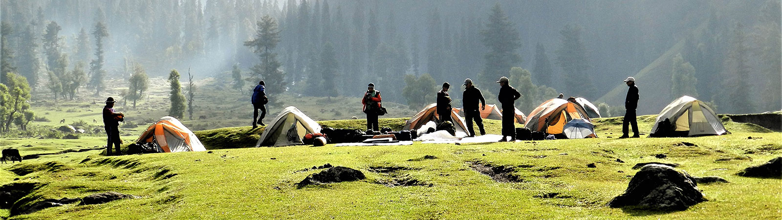
Camp in lower valley
Share on Social
CHIRING WE
(1977)
This time, instinct led me on. Romesh Bhattacharjee, my friend from Delhi, once casually mentioned the Kumaon and Chiring We. Going through past Himalayan Journals I located the peak in a panoramic photograph, looking very tiny. But it aroused our curiosity. So, for an expedition in the summer of 1977, we selected the unexplored Kalabaland glacier in the eastern Kumaon. The names of the numerous peaks around that glacier sounded enchanting. Chiring We (6559 m), Bamba Dhura (6334 m), Burphu Dhura (6144 m), Suli Top (6300 m), Trigal (5983 m) and Suitilla (6373 m), the last being a fine shapely peak. This was a paradise! Most of the peaks were unclimbed and unexplored. Besides, there were many other peaks above 6000 m in the vicinity. The Kalabaland glacier lies a little to the east of the Milam glacier. Milam glacier has the peaks Hardeol (7151 m) and Tirsuli (7074 m) at its head, Tibet to its north and the peaks of the Api and the Nampa group of eastern Nepal to its west. The southern flank comprises Chaudhara (6510 m) and Rajrambha (6537 m).
We were hoping to attempt Chiring We by penetrating the icefall in the centre of the glacier. Only one expedition had been here before and the prospects were exciting. We were a team of seven climbers: Zerksis Boga (deputy leader), Vijay Kothari, Sorab Gandhi, Deepak Mahajan, Dr. Kedar Munshi, Amarnath Bhide and I (leader). All ready, we started off on 14 May for Kathgodam. By a special bus we reached at Munsiary in two days. Here we met our porters and the goats that were coming along with us. We rested in a beautiful bungalow. For a change, this time we had received our inner line permits by apost, at home, thanks to Navnit Parekh, the Local Hon. Secretary of the Himalayan Club at Almora. It was certainly beneficial to have done our paper work well in Bombay. It saved a lot of hassels and time.
We completed all the formalities as quickly as possible and started off for Lilam with 25 porters and 150 goats. The next day we crossed a bridge to climb to Patong and camped ahead at Pilthi, near the bridge. A similarly easy march took us to Sapo Udyar. We had received news that a bridge ahead was not functional. In fact, it was in place. Boga, with the help of the porters took over the hard job of completing its construction while we all practised on the nearby snowfield. Early next morning we cajoled the porters with offers of tea and biscuits into getting the bridge ready. By 10 a.m. the first goat crossed over. This halt delayed us from reaching Ralam (3648 m). The route was rough as we approached Sankalpa glacier. We intended to establish the base camp at the meeting point of the Sankalpa, Yankchar and Kalabaland glaciers. But due to bad snow conditions, the goats could not reach there. By evening we dumped our luggage and ourselves in the middle of the moraine of Sankalpa glacier. For the next three days, we made two ferries each day to the base camp site (4300 m).
At this point Amarnath Bhide, who was feeling the effects of altitude, developed pulmonary oedema. This was unexpected and disappointing as he was the fittest member of the team and had climbed to this height and above several times before. Our rate of ascent was also well spaced out. He was a marathon runner and because of his being very fit, he used to be far ahead of the rest of us everyday. Perhaps that took its toll. It proved that acute mountain sickness can set in without any warning whatsoever.1 He was evacuated to Ralam from where he went back to Bombay leaving us short of one.
We established the advance base camp (4280 m) with a good amount of labour as weather conditions were still rather bad. The camp was near the icefall and all ferries were to start at 3 a.m. and return to camp by 9 a.m. to avoid the soft snow. Boga and I with Sherpas Chewang Gombu and Dawa Tsering started for the icefall at that eerie hour, having had but little rest.
Then Boga and I got on with the business of opening the route ahead for the next few days. It was not too difficult if we decided to stick to the centre. Both sides were swept by avalanches from Burphu Dhura and Chiring We. The icefall was generally quiet but was full of crevasses deep and wide. And we had more disappointments in store. Sorab, who had joined us late because of exams, felt ill and cold. He was unable to help us in any way. Our number was seriously depleted now. Vijay and Deepak could lend good support but could not lead the way and our doctor was a non-climber. Boga and I considered bashing on regardless, alpine style. We guessed that at least two more camps were required to be established before any of the peaks could be attempted. So, regretfully but wisely, we decided to give up the icefall and our main objective. We shifted our aim to Pt 5601 m a shapely peak rising above the ABC. This would avoid the major risks of the icefall.
We left the doctor and Sorab at ABC and climbed up steeply to camp 1 (5180 m). We crossed a huge bergschrund, and climbed the steep slopes beyond. For the next three days Boga, Vijay and I by turn opened routes and fixed ropes. We found that the claw-like jumars did not grip wet ropes, and we had to resort to step-cutting. On 7 and 8 June we were confined to our tents thanks to the weather. On 9 June early in the morning Boga, Vijay, Govind Singh and Gombu started off at 3 a.m. for the peak. Vijay returned from 200 m above but Boga and others continued. They followed a left hand side gully over the rock and snow to reach the top at 9 a.m. We saw them on the summit. Boga observed that the route to the ridge of Suli Top (6300 m) was sharp and would involve some tough climbing.
Having achieved our immediate objective, we decided to withdraw to ABC as there was not much time left. We cleaned up our camp sites and burnt all the rubbish to leave the place as unspoilt as possible and were soon back in Ralam amidst chhang and rakshi.
Birjeganj Dhura
Deepak and I stayed over at Ralam hoping to cross the Ralam pass (5500 m). The weather however turned from bad to worse and left an unusual amount of snow even at Ralam (3660 m). There was no question of crossing a 5500 m pass! So we decided to climb up to Birjeganj Dhura2 (4450 m) west of Ralam. This pass connected the village to the Milam valley. It was a broad path, initially well-built, that got progressively rougher the higher we went, like with any other pass. We climbed gradually, yet with the weather closing-in, found the going tough.
We camped almost atop the pass so that we might get a good look at the surroundings in the morning. How wrong we were. That night was a nightmare. A furious blizzard stormed around us—we sat up all night holding the tent poles. We glissaded down next morning to a camping ground 300 m above Tola. Clouds, fog, mist made the visibility very poor. But suddenly in the evening, the thick veil lifted. That night and the following morning we enjoyed some super views of Nanda Devi (7816 m), the peaks on the northern rim of the Nanda Devi Sanctuary, Rishi Pahar, Hardeol and Tirsuli. What a treat!3
On 16 June we climbed down to Tola and Martoli and joined the main caravan route to Milam. We hiked back via Rilang, Bugdiar and Lilam to Munsiary.
Boga and I sat in a bar in Nainital enjoying ourselves. Members of another expedition, which had failed in the Sunderdhunga valley, joined us and wondered how we could be so cheerful when we had not been successful either. It was Boga’s temperament that made the difference. We had been to the right place at the wrong time. We did not achieve what we had set out to, but we certainly had the satisfaction of exploring the area in some detail. The Kalabaland glacier will offer excellent climbing opportunities for years to come and we were one of the early birds there.
Notes & References
- This was a good warning to all of us. Amar was a long distance runner in the States and had trained hard. But still the altitude did affect him. So basically there is no short-cut to eat-drink-climb slowly maxim for acclimatisation.
- The Pass is called by different names also. ‘Dhura’ in this part is used for both a mountain and a pass.
- For that unusual view of the Nanda Devi peaks it was worth crossing any pass! The twins stick sharply out, like sentinels guarding the heavens. The pictures I took from here featured on the cover of my book (with Soli Mehta) Exploring the Hidden Himalaya.
I presented an enlargement of this picture to H. Adams Carter, who was a member of the Nanda Devi expedition in 1936. Amarnath Bhide carried the huge enlargement to Boston. Ad drove to his house and was so impressed by the photo (and the effort to carry it to the USA) that he insisted on taking Amar out for lunch!