Flowers
Share on Social
A Climbing Holiday at Manali
(1973)
Manali has developed into an important climbing centre in the Kullu valley. It has all that a mountaineer can ask for—nearness to the scores of mountains, easy availability of porters and rations, no requirements of permits for Indians, (and foreigners to most areas) and beauty in abundance with thick forests and flowers. In fact it can now be compared to any climbing centre in the Alps or anywhere else in the world. One is bound to meet mountaineers from all parts of the world on the streets of Manali and in those small cafes, over a glass of beer, one can discuss plans and exchange information. Some of us climbers from Bombay decided to try out these places. We trekked to four different valleys, climbed two peaks, enjoyed excellent weather, saw super views and above all, we are all still friends! What more does one want from a climbing holiday!
After hectic preparations the first team left for Manali on 17 May 1973. After two days of rest and acclimatisation we started for the first trek.
Bhrigu Lake and Climbing of East Peak of Rohtang Pass
(4654 m)
A route from Vashishta village coffee shop leads up to the top of a ridge, called Panduropa. This ridge continues above the Himalayan Mountaineering Institute. Starting late we camped half way to reach the top by next afternoon. It was very cloudy and due to a late onset of winter the ridge was covered with lots of snow. It made progress difficult on an otherwise easy ridge. An exposed traverse toward Rohtang pass leads to Bhrigu lake on the northern edge of the ridge. We camped on snow that night. Walking slowly on the fresh snow we reached Bhrigu lake by late morning. It was totally covered with snow and the only way we could see the lake was in our imagination. We glissaded down to Gulaba on the metalled road. On the 26th we walked lazily to Madhi for lunch and spent a night there.1
Early next day we climbed up quickly to Rohtang pass which was still not frequented by tourists as the road was not open. Vijay and Nawang Tsering started for the peak located to the east of the pass and about 760 m higher than it. After crossing a snow face, they roped up and climbed carefully. The summit was a long ridge with its northern end jutting out. They reached the highest point, and after a quick view in fast deteriorating weather they rushed down to Madhi. It was a hard day for them as they had climbed and descended about 4500 m in 14 hours. A comfortable road journey brought us back to Manali.
Climbing of Peak Shitidhar 5290 m, Solang Nala
On 31 May we started by jeep to village Palchan. A 45 minute walk later we camped amidst very beautiful pines of the Solang valley.2 Manu Dattani and Vijay Kothari brought up the rear party to complete our three-member team. We had five porters and a Sherpa. The porters were paid Rs.15 per day plus food.3 A 4-hour walk on the next day brought us to Dhundi, where the vista was a memorable one. From there to Beas Kund was a gradual climb over snow and rocks. We established our base camp on snow. Evidently we were the first party to visit that year.
Our plan was to cross the Bara Banghal pass (4996 m)4 and then proceed towards Khanpari Dhar to come out at Manali. The track to the pass lies through a gully dominated by a rock-wall on the north and a steep ridge on the south, with rocks on the top. The gully was full of snow but conditions seemed good. Climbing cover the narrow rock ridge on the south the route ultimately had to pass through steep snow-covered gully. The little rocky projection above provided adequate camping ground. We dumped our load there to return the next day. One small powdery avalanche scraped past one of our porters who was shaken and demoralised. In the evening we had a strike on our hands with two of our porters refusing to proceed any further on this route. We tried to persuade them but quickly saw the point that with their low spirits progress would be difficult as the route ahead would pose many more problems. That evening the Ladies Advance Course students of the Himalayan Mountaineering Institute joined us. We requested them to lend us two of their porters which they could not. Anyway that night we had a roaring camp fire, with dancing and singing on the snow to the chattering of our teeth.
One party left next morning to retrieve the loads ferried the day before. They could recover only two of the five boxes left there as the strong winds had blown the others off, well entrenched though they were. The other party went climbing a low ridge of about 5000 m and practised ice-craft. Evening, like all the others, was spent in glissading on the nearby snow-slope and eating a hearty meal.
As our second objective we selected Peak Shitidhar, 5290 m, also called Friendship Peak.5 To approach this peak we had to cross a col on the rocky ridge which separated it from the Beas valley. The route then traversed over snow slopes to the glacier and icefall. Camp 1 was established at foot of the icefall. Previous attempts had zigzagged between the crevasses of this sober-looking icefall, but considering the present snow conditions we decided to follow the southern ridge. This was probably a different route to the summit.
Early morning Manu, Vijay and I started off with Sherpa Nawang Tsering and Palgun Ladakhi, a veteran porter of over two decades’ experience in the Kullu Himalaya. Snow conditions were excellent. We progressed briskly on an exceptionally clear day. We roped up from the col of the south ridge which was very sharp. To our right was a very exposed fall to the valleys of Lahaul and on our left was the icefall. Climbing was enjoyable and our crampons bit in the snow. As we went up the snow started melting and ridge was precarious. After 10 a.m. the progress was nerve-wrecking. We sank knee-deep and then waist-deep in snow and the huge cornices on the ridges began to peel off. At the base of the peak we crossed over to the rocky west ridge at the top of the icefall. The ridge was heavily corniced and exposed. We moved slowly and in long belays. We reached the top at noon in excellent weather. We could see all the peaks of the Lahaul, Tos, Malana and others. Manali town could also be seen. We made offerings and hoisted a scarf.
On our return we followed a route via the icefall as the ridge would have been too dangerous. We kept long distances between us to guard against any fall in the crevasses. Camp 1 was reached at 4 p.m. and after a hot tea we ran down to the green lawns of Bakar Thatch. We spent a fascinating day with a shepherd family there sharing their thick chapattis and drinking goat’s milk. We walked leisurely down to Manali in next two days enjoying the natural beauty around us.
Hampta Pass (4275 m)
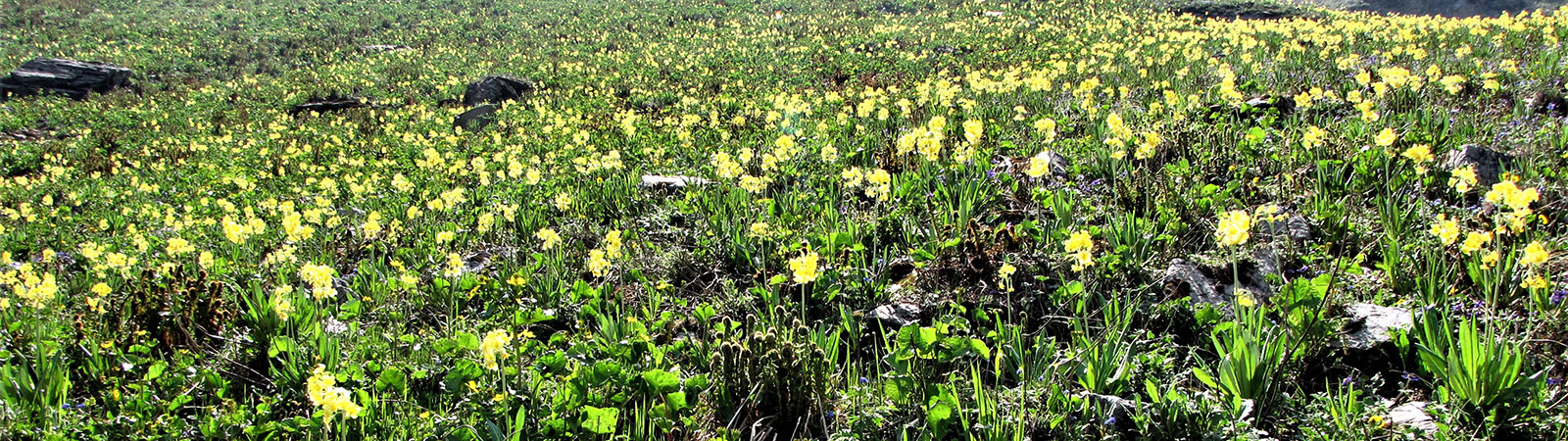
Two days of rest at Manali and I was off on another trek from Manali, this time with Zafar Vasi and Taher, two trekkers from Bombay. After crossing Dugla nala at Praigi village the route took us up a steep ridge to Chedden village. We camped a little ahead, amidst flowers, near a small pond. Nearby was a furious waterfall which constantly produced rainbows from different angles. We further traversed along a nala to Chikka and steadily climbed a well-beaten track to Ratni Thatch. It was a pretty meadow with flowers, numerous streams and an imposing waterfall. I was photographing the flowers around me when suddenly I heard porters shouting. I looked back and saw a brown bear staring at me from close quarters. I ran as fast as I could and the bear also ran, but in the opposite direction. I turned, and had a good shot at him through my lens.
Ratni Thatch to Hampta pass was a long walk mostly over gentle snow-slopes. The weather had turned bad and it began to snow from early afternoon. In very poor visibility and biting winds, we had to stop at many places to check the route ahead and find our bearings. We continued until late evening till we were at the pass without any view. We had to then beat a hasty retreat as a blizzard hit us. Next day the weather showed no improvement so we decided to walk back by same route to Manali.
The Valley of Lahaul
Across the Rohtang pass lies the valley of Lahaul. It runs from east to west with river Chandrabhaga in the centre. The valley is barely 4 km wide at any given place and is almost strikingly devoid of vegetation. Eastwards it meets the Spiti valley6 and on the west it runs into the Pangi valley in J & K. To the south it is bound by an imposing wall of coffee-brown rocks, punctured by small valleys which lead over high passes to Chamba. Now a metalled road leads to Ladakh,7 to the north.
Major Prem Chand,8 an old friend, was on his way home to Lahaul. I went along in and persuaded him to join me on a trek to different parts of that region. We were meeting after nine years after having done the Basic Course at the Himalayan Mountaineering Institute in Darjeeling and we had plenty to talk about besides trekking. The two of us left by bus for Rohtang pass. Walking from Rani nala, little short of Rohtang, we reached Khoksar in about an hour. After lunch a mini bus carried us to Tandi bridge, at the confluence of the rivers Chandra and Bhaga. The valley ahead to the west is called Patan with Hindu population while valley to the north leads to Kyelong and Ladakh with a Buddhist majority.
By evening we had settled at Prem’s house at Rooding in the Patan valley. Houses here are made of plastered stone walls with flat, square roof-tops. Vegetation is very scarce, comprising a few willow trees and grass. Potatoes grow in abundance, are very sweet and exported all over India. Rainfall is scanty. There is a temple dedicated to the demon-goddess Hidimba and in an annual festival people get drunk and garland the statue of the goddess with old shoes, throw garbage at it and curses in the hope that the goddess will get angry and send some rain. Ladies wear Salwar Kameez, beautifully embroidered, and spend their days looking after their houses, fields and live-stock.
I remember my stay in the village with great fondness. Prem’s mother was very old and happy that her son had come on leave. She fed us with fresh meat and potatoes for every meal. We used to get up leisurely as the first rays of the sun warmed the village. A small water-tap had been installed where the rays first reached. Slowly everyone gathered there. Then a whistle was heard. It was the shepherd’s signal to call for the animals, which were sent off for the day’s grazing. Slowly the village woke up, to no apparent activity.
Trekking with a Toothbrush
Our first plan was to trek to the western end of the valley. We went via Thirot to Trilokinath (37 km) where a famous temple of Shiva is located that overlooked the entire valley. This is a well-known temple in the trans-Himalaya, known in Ladakh and far away places. It has a statue of Shiva with a Buddha carved on its head. It has a Hindu priest but it was decorated in the Buddhist style and many different rituals are followed here. Udaipur, another 10 km away, is the last village on this route. Henceforth, the Chandrabhaga is called the river Chenab as it enters the Pangi valley. Miyar nala in the north has many beautiful peaks like Menthosa, Phabrang etc. One ancient temple of the goddess Durga is situated in Udaipur.
We were covering large distances with ease as we had nothing to carry. There was only one good school in the entire Lahaul area when Prem was young. Hence in every village he knew someone or the other who was with him in the school. We needed to carry only our toothbrushes, so to speak. Food and stay was always arranged on arrival anywhere, every time. In fact as we approached a village, Prem would stop and ask me, ‘OK, now decide whom we should honour with our visit’. He would narrate tales about different persons he knew in the particular village and we always picked most interesting friend to stay with.
Next we went up to Kyelong, the district headquarters. It was a small town humming with administrative activities and had a lovely backdrop of mountains. After the winter snowfall Rohtang pass was suddenly blocked, isolating Lahaul. Kyelong is the only civilised place in it. A funny incident was narrated to us which brought out the extent of isolation. The previous year, when the passes were suddenly closed in winter, all the three barbers of Lahaul were out at Manali and were unable to return. For six months people at Kyelong had no haircut and the whole town wore a ‘hippie look’. The barbers did a roaring business when they returned with us. The District Magistrate in such far away places has a special post for a barber among his staff!
On the second day we descended, crossed the river Bhaga and climbed up to Kardhing monastery9 on the opposite bank. It is one of the oldest in the region and has excellent paintings. We climbed up to a pass behind the monastery. I did a recce here and photographed many peaks of the Kulti nala and Darcha valley.10 This region is still unexplored by mountaineers and has many possibilities for climbing. The peaks of Ghepang Goh and Lady of Kyelong were the most impressive.
We trekked back to Rooding for a day of rest and excellent local wine with sweet potatoes. Our return trip to Khoksar began on 30 June. We hitched a ride to Rohtang pass in an army truck. The roads were very bad and it was almost like driving on an avalanche! A little walk on the other side, a comfortable ride in a bus and we were back in Manali.
Notes & References
- This area is now rather crowded with tourists. Anyone now may be disappointed to visit. During summer, hordes of tourists reach here by polluting vehicles. All they want is to touch snow, eat and take pictures. The unspoilt beauty that we enjoyed in 1973 has been lost within two decades.
- The road is now extended till the Solang village and some hotels and rest houses have come up there. But the place, though popular, is still beautiful.
- Today almost ten times more wages will have to be paid, if not more!
- It is also known as Taintu pass.
- This name, ‘Friendship Peak’ was given as an Indo-French expedition had first climbed it. This is the highest point of the Shiti Dhar ridge seen from Manali. Due to its vantage position and its visibility from Manali this ridge and the peak is seen as a backdrop in many Hindi films which were shot in Manali.
- One has to go across the Kunzum la to get here. Now the entire route is motorable.
- This is the well-known Manali-Leh Highway, now popular with travellers and tourists. Most valleys of the Lahaul are now connected by roads.
- He is now retired as Colonel. He was from the 3/11 Gorkha Rifles. We did our Basic Mountaineering training course together in Darjeeling in 1964 and had since kept in touch. He is not to be confused with another Col. Prem Chand (also from Lahaul) who had climbed Kangchenjunga.
- This monastery is rather famous for its scholarship. Two nuns from Switzerland spent many years here and have written warm accounts of it. The famous lama of Chhitkul (Sonam Gyatso of Kinnaur) had studied here and his guru too hailed from this monastery.
- Based on this visit and photographs taken, I was later able to visit both these valleys. Details of the same are recorded in my book High Himalaya Unknown Valleys.