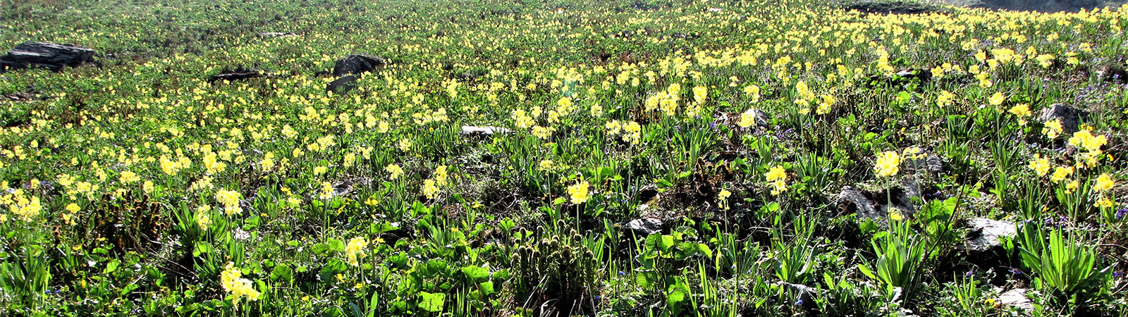
Flowers
Share on Social
BARA BANGAHAL – THE LAND OF PASSES
2004
The Dhauladhar range rises abruptly from the Kangra valley (there are no gentle Shivalik gentle ranges here). This has always been an attractive proposition for those with a short time to visit the Himalaya. It is seen as a long white ridge from the plains of Punjab at the height of summer and hence the name Dhaula (white) Dhar (ridge). Having visited different areas, I was always curious about the land of Bara Bangahal in this range. The map showed a small village surrounded by several high passes, many glaciers and few peaks, which rose from these valleys. Most of these passes were used by gaddies (shepherds) to cross from the Bara Bangahal into Lahaul. From the glaciers emerged the Ravi river which passed the village and through a gorge went to village Holi and finally to Chamba.
In 1981 with my friend Muslim Contractor, I approached the area hoping to follow the Ravi river upwards from the village Holi.[1] It was early winter and as we proceeded to the first village, they looked at us meaningfully and stated, “Well if there is no frost or snow on those dangerous slabs you may be able to get into Bara Bangahal”. Before he could complete the sentence, the other villager looking at the cloudy sky emphatically stated, “You won’t be able to come out anyway before winter is over. The first snow will block the route”. Inhabitants evacuate t the Bara Bangahal village by late autumn leaving only a few caretakers in the village. Following the dictum, never ignore local advice, we decided to climb near Jalsu pass and leave Bara Bangahal alone for a future date.
The time for Bara Bangahal came only in 2004. I always wondered how it would be to get in or get out along the Ravi gorge, for several villagers seemed to be doing it. But my young climbing friend Monesh Devjani, who had crossed that gorge stated, “That’s the most difficult and dangerous thing that I have done in my life”, and he had climbed Panch Chuli little before that. I decided to be wiser and we selected to get in from the well-trodden Thamser Jot, one of the most popular routes to enter the Bara Bangahal valley. Shepherds with thousands of sheep (no exaggeration here) and mules use it and so do most of the population of Bara Bangahal. We (Drs. Girish Lad and his wife Rekha and myself) travelled from Pathankot to Baijnath (via Palampur) on a clear sunny day. Nearby was a large monastery complex, now the headquarters of the Bon religion. We made our initial purchases and by a rough jeep road drove to Billing, which has grown as a major hang-gliding centre and is reputed to be one of the best of its kind in the world.[2] The vast view of Kangra valley unfolded before us. On 12th June, a broad trail led us to Chhanai pass (2800 m) across which lay the wide valley of Chota Bangahal. Nobody could tell us who the Bangahalis are or why these names Chota and Bara Bangahal exist. We heard several stories. Some thought that Bangahal means a high peak and the village lies beyond high peaks, which according to them are one meter higher than any peaks in the Dhauladhar. Rajgundha, which we reached soon was also the seat of one of the Rajas and was part of the Mandi state. Once the Raja of Bara Bangahal attacked and conquered Rajgundha, and established the Chota Bangahal. The Bangahalis were possibly Rajput descendents for all had very sharp features. They brought in workers of different castes to undertake menial occupations. The Raja of Mandi ultimately defeated the Bangahali Raja but the name and the legend remain.
Whatever the origins, one thing everybody agreed that Bara Bangahal was like a kalapani. To serve life sentences Indian prisoners during the British rule had been sent to the Andaman Islands in middle of Bay of Bengal so that they cannot escape.. This was known as the penalty of kalapani (black water). The Bara Bangahal remains out of bounds for six months approachable only when the passes open, so anyone trapped inside has to remain there for the winter. This is similar to the kalapani penalty, for six months at least !
The valley from Rajgundha (2400 m) leads in easy stages to Palchak (2800 m) and Panhartu (3580 m) to the foot of Thamser Jot. It is a gradual walk up a forest route with some steep climbs and you would certainly be walking in the company of a large number of sheep and their owners. Panhartu is a broad amphitheatre, which leads to three different valleys. Turning southwards, you cross Thamser Jot (4704 m). We were there in the middle of June so there was almost a traffic jam on Thamser Jot with sheep, mules and several locals crossing it. On the summit of the pass, I stood admiring the gentle drops on both sides, looking at hundreds of sheep traversing between peaks all along. A Bangahali lady, Nankidevi laughing, approached me and said that this is our life. She, like most of the Bangahalis, was visiting her house in the village of her ancestors. Almost all Bangahalis have houses in lower villages in the Kangra valley. Quite a few of them, after education and employment in the plains never return across these high passes. After a camp we descended to the main bowl of the valley. A village north of the Ravi stood in an elongated line with a lovely rest house amidst pines nestling in the southern most part. It was sparsely populated and everybody went about their work almost unconcerned about us. Time was of essence and two summer months had to be utilised thoroughly. There was electricity and a well run primary school. The valley shifts every six months from the Bara Bangahal (2541 m) to Kangra. We spent two wonderful days mixing freely with villagers.
We leisurely walked around the village and went to the house of Nankidevi, our companion from Thamser Jot. She offered us fresh milk, farm products and talked warmly about her family and life. In a nearby house, several posters displayed a variety of Hindu gods, another poster had film stars andyet another, Indian cricketers. Civilisation was everywhere but in this gentle atmosphere, it never pinches you. The headwaters of the Ravi led to few different glaciers.[3]
Once inside the valley we had to get out, but where from was the question. First we thought of going across the Kalihini pass, a pass where many sheep cross and because of their droppings the entire snow turns black, Kalihini, black snow. It leads over a beautiful route to Manali, but we were told that this pass was not open yet and no caravans or goats had come across. One party of trekkers, which had left before us to cross the Kalihini had not turned in yet. We had just about five days to return to Pathankot and time was of essence to us. By crossing the Ravi gorge to Narayangaon and Holi, in about three days we could be at the roadhead, catching a bus. Various views about that gorge route were offered to us, along with some earlier information from Monesh. (“My district forest officer came by that route, a little plum gentleman, but he managed”. As we had felt little hopeful, he had added, “but he could not sleep for six days after that”!) The local shopkeeper, a very unfit gentleman who comes here every year, almost rolled his eyes “Oh! The Ravi route, oh my God, I was sleepless for months after that. I have done it only once”. But several villagers assured us that it is not as bad as its reputation. School children, ladies and even goats come across this route. It is only that you must hold your nerve and don’t look down to Ravi 600 m below the rock slab. You have to traverse with your heart in your mouth and you will be there. Up to now not a single child or a person has fallen down to their death in the gorge. We were debating all along and finally mustered courage and with few local supporters decided to go across the Ravi gorge, which even the guidebook declared to be very dangerous and difficult.
We relaxed in the lovely forest bungalow, hoping to start our return journey the next day. As both Girish and Rekha were doctors, several villagers visited them for medicines. On the evening of 19th of June, came an elderly lady. When she was given her dose of medicines, as a parting “blessing” to us, she said, “So you are returning tomorrow by the Ravi gorge. Please be careful, it is very dangerous. I will pray for you”. Girish, Rekha and me looked at each other aghast. Here is how a kindly lady blesses you after being looked after… there is something wrong with this route surely. Instantly we rushed to the village, hired two guides and decided to go across 4749 m high Nikora Jot into the Kugti valley through which the map showed an exit. We and quite simply even the villagers were relieved that they would not have to escort us through the gorge.
Nikora pass is not a frequently used route as it is high and leads to Kugti which is also surrounded by mountains. It is steep and high climb with a steep descent on the Kugti side. On 20th June, with two guides we climbed a steep route, first on the grass and later on the rocks, camping at Sagmadhi (3400 m) and the Nikoramadhi (4100 m) at the foot of the pass. Both were traditional camping places but what lay ahead was a high barren ridge. On 22nd we reached the high pass, situated on a small depression between two rock points. Weather was poor and the descent on the other side, took our breath away. Steep snow mixed with steep rock was a deadly ground and for those two hundred meters we remembered the Ravi gorge. But after a camp we descended the Nanun nala, camping at two places. As we descended to the Kugti valley, the lovely peak of Chamba Kailash (5656 m) rose in front of us. In the winter of 1983, four of us had come up the Kugti nala and crossed the high Chombu pass. Across the Chombu pass is the Mani Mahesh ake, an often – visited temple during summer. But the valley of Kugti now looked a lovely green, vastly different from that wintry appearance.[4]
The peak of Mani Mahesh though not high was a challenge to climb. In 1968 an Indo-Japanese ladies expedition made its first ascent followed by a second ascent by a team from the army. [5]
As we were rushing towards the Kugti village, our guide, instead of taking us down the Nanun nala to Dalotu, preferred the traditional high gaddi route traversing high on grass and rocks with several ups and downs. We managed and reach Kugti (2500 m) late in the evening. When I was here in 1983, the road to Kugti was under construction and I had assured my companions that with 20 years of progress this road would be ready so we could expect some transport at the Kugti village. But to my horror, the road was still under construction! We could not get any transport before reaching Hadsar. So we walked again on this so- called road with several ups and downs to Dron (2200 m), a half way stage where we spent a miserable night with several insects swarming over us. Starting at 4.00 A.M. we reached the bridge below Hadsar where to our great relief, a jeep had just arrived with pilgrims. We immediately hired it and drove towards Chamba. His diesel ran out of 2 km before Chamba and we had to change taxis and drive fast to reach Pathankot station in time for our train.
The steep rock face of high Nikora pass, the incomplete road to Kugti and a diesel less taxi– are all part of the adventure of trying to exit from Bara Bangahal. The choice is either that or crossing the Ravi gorge over dangerous slabs and not sleeping for six nights after that. What would you prefer? I hope to find out someday soon.
[1] See ‘A Winter Foray’ in High Himalaya Unknown Valleys, by the author.
[2] An unfortunate incident last year tarnished its image. A hang-glider took off without his harness properly tied. He fell to his death hundreds of feet below .
[3] There are several glaciers at head of the valley, with a pass on each of these glaciers crossing to the Chandrabhaga valley and Pangi. The highest peak of the area was named ‘Wangyal Peak’, about 6000 m, when American team climbed it in the 1970s.
[4] See ‘Around Kailash in Fourteen Days’, in High Himalaya Unknown Valleys, by the author.
[5] Refer the Himalayan Journal, vol. 51, p.211 for details of this ascent and letter about the earlier ascent.