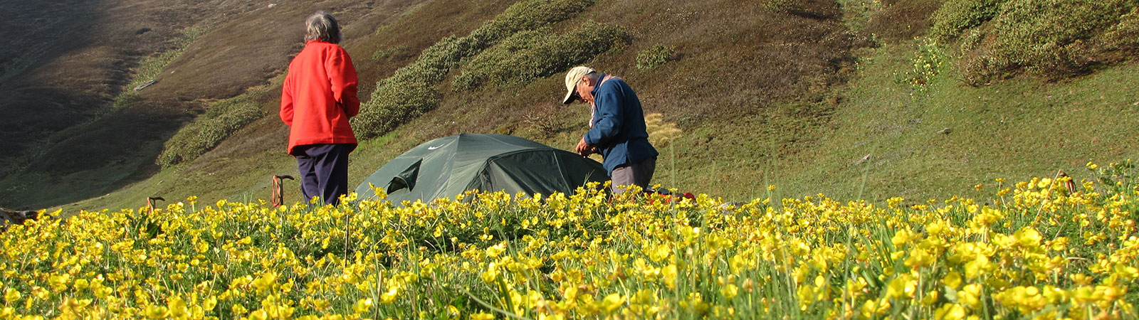
Camp in Kinnaur
Share on Social
KINNAUR – THE LAND OF MUSICIANS
It is useless to try to describe the grandeur of the scene: there are perfections about which the only eloquence is silence.
Marco Pallis, Peaks and Lamas
The river Satluj, originating at Tirthapuri, near the foot of Mount Kailash in Tibet, makes a long journey across the Himalayan chain, entering Kinnaur in Himachal Pradesh at Khab, where the Spiti and the Satluj river valleys meet, forming a terrific 1,500 m gorge. Running through Kinnaur’s centre in a south- westerly direction, the Satluj dominates and divides the region, sometimes flooding and wreaking havoc on the villages that have sprung on either side of its banks. In the year 2000 and 2005, due to a cloudburst in Tibet, floods were unleashed; villages and bridges were destroyed and many perished along the river’s banks.
The Satluj is said to carry gold dust from Tibet and Kinnauris try their luck by churning out sand on its banks near Kharchham, at the confluence of Baspa and Satluj river. To the east of the Satluj, lies the magnificent Baspa valley, famous for its fruit orchards and serene villages, the Charang valley, where the ancient monastery of Rangrik is situated, and the Nissan, Thangi and Sangla valleys leading to high passes to Tibet. The Kinnaur Kailash massif, a high mountain group, is located between the Baspa and Charang valleys. In the west are the valleys of Hangrang, Ropa and Sorang, the last one linking Kinnaur with Spiti through the Manirang pass. Leo Pargial (6,791 m), one of the earliest peaks to be climbed in Kinnaur way back in 1933 by Marco Pallis, is to the east.
Kinnaur Kailash
The Kinnaur Kailash range constitutes two peaks; the 6,473 m high Jorkanden, and the tall pillar of 6,050 m to the north-east, the Kailash. The range, particularly the fearsome Jorkanden, rises above the Satluj valley, dominating the view at Kalpa. H M Glover, from the Imperial Forest Service who travelled extensively in Kinnaur in the early 1920s describes the enchanting spectacle: “From the forest bungalow at Chini (now Kalpa) 9400 ft above sea level and 145 miles from Shimla along the Hindustan Tibet Road, the Kailash is seen to advantage. The hills are so close that in spring the reflected light from the snows is painful to the eyes, while during monsoon, the sound of falling avalanches can be heard all day long.” In a lighter vein a visitor advised that a person should wear dark glasses on a sunny day while lunching at the bungalow in front of the peak — or else they are likely to suffer from snow-blindness ! About 750 m below Kalpa is the newly developed township of Rekong Peo, the headquarters of the Kinnaur district.
Several peaks in the Himalayan and trans-Himalayan ranges are named after Kailash, the legendary mountain-home of Lord Shiva. The holiest of them all is Mount Kailash (6,714 m) towering above the Manasarovar Lake in Tibet. It is considered to be the navel of the earth from where the four great rivers, Indus, Satluj and Brahmaputra (the Tsangpo in Tibet) and Karnali originate. Baba Kailash (6,322 m), in eastern Kumaun, Shri Kailash (6,932 m) in the Gangotri glacier, and the Mani Mahesh Kailash (5,656 m) in the Ravi basin in
Chamba , Himachal Pradesh, are some of the other peaks named after Kailash. However, the most spectacular of them is the Kinnaur Kailash range, which holds the steep and fiercely difficult peak of Jorkanden.
The Jorkanden is a complicated mountain with no clear approach to its summit; no glaciers or valleys are situated obviously at its foot. The peak itself consists of many broken pinnacles and steep walls to which the winter snow clings, exacerbating the problem of avalanches during the summer months. The Jorkanden was explored by P R Oliver in 1931 and later attempted several times without success in the 1960s and the early 1970s. Finally in 1974, in quick succession, it succumbed to the Indo-Tibet Border Police (ITBP) and the Indian Army teams.
Around Kinnaur Kailash
Kinnauris have a long tradition of performing circumambulations round the Jorkanden, the abode of Shiva. The trail begins at Thangi in the Tirung valley, to the north-east of the peak, and leads to Charang village on the edge of Indo-Tibet border, from where the journey gets arduous. The progression is to the south, towards the steep Charang Ghati pass (5,200 m), from where one can see the Rangrik Rang (6553 m), situated in the remote Racho valley. Sir Chris Bonington, a British mountaineer, made the first ascent on this peak in 1994, teaming up with a group of Indian climbers (led by Harish Kapadia) who had discovered it.
Descent from the Charang Ghati pass is steep but the end is heavenly as one reaches Chhitkul, where the Baspa river flows gently amidst the deodars and pines. The circumambulation continues from Chhitkul to Sangla, Kharcham, Kalpa and Thangi. The holiest and oldest of all monasteries, the Rangrik, a large wooden structure located near Charang, though to some the real attraction of this route is Sonam Gyatso Lama, affectionately known as Chhitkul Lama, who is over 100 years old, and is a storehouse of knowledge, having travelled far to Ladakh, Zanskar, Tibet and many other places in the Himalaya.
Kalpa, a small sleepy town which offers a fascinating view of the Kinnaur Kailash range, is situated on the old Hindustan-Tibet road built by the British in the early 19th century to facilitate trade between Shimla and Tibet. Earlier the entire district was known as Chini after a village nearby. After the 1962 Chinese conflict name was hastily changed to present day Kalpa should Chinese lay claim – as ‘Chini’ in Hindi means ‘Chinese’ !
The town has been frequently visited for several decades, and Lord Dalhousie, the Governor General of India from 1847 to 1856, took refuge here from the scorching heat of the plains, studying the first-ever plans of the railways in India. The old Hindustan-Tibet road, as it nears Kalpa, climbs the steep, exposed Rogi cliffs rising from the Satluj river till about 1,500 m. Stories of mules falling off these rocky precipices abound, and Rudyard Kipling describes this area, the Satluj valley near Rogi, in his famous novel Kim, as the “valley of death” which is “no place for man”. Now with the construction of a new motorable road, which makes Kalpa accessible within a day from Shimla, these descriptions may seem exaggerated and fanciful, although the steep rocky cliffs and the turbulent Satluj river do lend credence to these tales.
Many British families visited Kinnaur, particularly the beautiful Baspa valley, the land of ibexes and orchards. Marco Pallis is one of the early explorers who visited Kinnaur in 1933. After having explored the Gangotri area, he crossed into Kinnaur’s Baspa valley through the Lamkhaga pass. Proceeding to north Kinnaur with C B M Warren, a British mountaineer, he was the first to explore the Chango valley and climb the Leo Pargial, one of the high peaks in the area. Several other Kinnaur peaks that have attracted mountaineers are Sesar Rang (6,095 m), Hansbeshan (5,240 m), Gang Chua (6,288 m) and Rangrik Rang (6,553 m), the highest mountain in the Racho group. These peaks lie in the valleys to the east of Satluj.
In the north-west corner of Kinnaur stands Manirang (Jewel of a Moutain), (6,593 m), a huge tower of crumbling rock isolated from other peaks, rising majestically on the tri-junction of Kinnaur, Kullu and Spiti. It was first climbed in 1952 by Dr and Mrs J de V Graff, explorers from South Africa who had travelled in Kullu and Kinnaur, and again in 1988 and 1994 by an Indian Army team and a small team of Paul Nunn, a British mountaineer who died on Haramosh II (6217 m), in Karakoram four years later, and Divyesh Muni, a leading Indian mountaineer.
Legends
To the east of Kinnaur lies the vast open Tibetan plateau, and the first rays of the sun finding no obstruction touch the sharp pinnacles such as Jorkanden and Hansbeshan (in the Nachar valley) at dawn. This phenomenon has been beautifully ascribed to a legend. When there was complete darkness in the world, Ahan Rishi meditated in the Kinnaur valleys to bring the sun to the earth. The sage’s increasing powers threatened the gods, and they sent a beautiful damsel named Usha, the goddess of dawn, to break his meditation. The demon part of the sage, Banasur, was attracted to her and he married the damsel. Later realising his folly, Ahan Rishi separated his inner-self and meditated forcefully with his better part and when he regained enough powers, he cut off the head of Banasur. Usha, now his wife, gathered his blood. With his new powers, Ahan Rishi summoned the sun and with the first rays of light, Usha disappeared streaking the sky with the blood of her husband. This celestial sight is witnessed on all Kinnaur peaks and is enacted every morning when with the arrival of sun, the dawn disappears in a red sky. Many people in the region are sun worshippers. Several temples are dedicated to Ahan Rishi; the one near Nachar being a masterpiece of wooden architecture, with a large wooden door at the entrance, its intricate carvings depicting the various Hindu deities. The best of Kinnauri architecture is reflected in old forts, one for almost every valley. The famous fort at Kamru, is built on a hill and is a tall structure with several floors. It is visible from a distance and it enables it occupants to keep an eye on the area around.
It is believed that the Kinnauris belong to an ancient civilisation from ‘Kinner desh’, which finds a mention in the epic Mahabharata and other Hindu scriptures. They were musicians of gods and played celestial tunes in courts. Their interests in art and sublime nature testify to this legend. Fair complexioned and colourfully dressed, they speak varied dialects, so much so that Hindi is used to discuss inter-village matters. One of the most important festivals for Kinnauris is Phulej in September, the festival of flowers heralding spring, and the celebrations continue for three days.
Csomo de Koros, a Hungarian scholar, who had travelled the longest in the Greater Himalaya, after Marco Polo, stayed at many monasteries. Stone tablets in his presences can be seen at Phuktal in Zanskar, Ringdom at Kargil and at Subathu, Shimla Hills. He passed away in Darjeeling in April 1842 a grave stands there in his memory. In 1827-1830 he lived in Kinnaur the Kanam monastery near Kalpa watching Racho group of peaks (he called them Shurang), and these mountains spoke to him in their language.1 He translated Tibetan language to Hungarian, first translation of it into any European language and left his work at the large kangyur (library) at Kanam. To him, just as to any visitor today, the mountains of Kinnaur will speak in their language and play music, if you will care to listen.
1 Refer The Great Tibetologist Alexander Csoma de Koros by Hirendra Nath Mukherjee.