Bandarpunch from Nag Tibba
Share on Social
TEMPTATIONS OF KEDAR
(1992)
Don’t you get tired of fumes and pilgrims?’ my friends asked me whenever I planned a trip to the pilgrim centres of Garhwal; namely Badrinath, Gangotri, Jamnotri and Kedarnath. I had been to the former three but not the last one. So there we were, on our way, jostling with the pilgrims, along the Mandakini towards Kedarnath.
These pilgrim areas have been visited by the faithful for hundreds of years. Much has been written about them, in vernacular literature also. As a young person every Indian aspires to know about and is attracted towards them. But as a trekker I was fascinated by the variety of opportunities these valleys offered. These temples are situated high up in different valleys. Using them as a base, a lot can be done in the surrounding ridges, peaks and valleys.
Firstly ‘fumes’, there were none. A comfortable taxi ride of six hours dropped us at Gupta Kashi, our first destination. From the lovely bungalow, we saw the gathering clouds and took a look at the fine temple nearby. We were in the Mandakini valley. A little below us, the Madhyamaheshwar Ganga joined the Mandakini. Both subsequently flow into the Ganges.
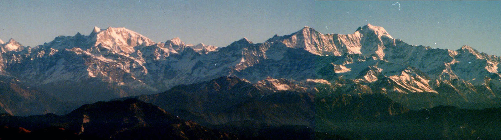
Madhyamaheshwar
Eric Shipton and Bill Tilman. These names will always remain linked with Madhyamaheshwar. Though pilgrims visited this temple, northeast of Gupta Kashi, it was brought to the notice of the Western world by the exploits of these two in 1934.
Starting from the Satopanth glacier near Badrinath, they planned to descend to this valley in 4-5 days, with their Sherpas. After forcing their way through a sheer ice-wall they faced a very thick forest. As they hacked their way through and crossed and re-crossed many streams, they ran short of food. They struggled to live on bamboo-shoots, but had to compete with bears for the same. The situation was almost hopeless. Finally, one afternoon they climbed up a ridge to have their first glimpse of a village. The Sherpas were joyous. But Tilman greeted the site with a typical dry comment, for which he was well-known: ‘We shall be down in time for tea’, to which Shipton merely stuttered ‘Thank heaven for that!’
In fact, Shipton and Tilman were trying to explore a legend. It was said that, many hundred years ago, a priest at the Badrinath temple crossed over a pass in one day to the Kedarnath temple to perform puja, serving both temples on the same day. It was believed that there could be a pass joining the temples, known to the priests. Shipton and Tilman decided to investigate this by crossing from the nearest low point with near-disastrous results. Their trip exemplifies the difference between knowledge and legends or fact and fiction.1
After reading about this trip, my imagination was excited. I wanted to visit this valley. Two trekkers from Bengal were lost here in 1986, trying to reverse the Shipton-Tilman route and were presumed dead. Hence we did not plan any heroics but wanted to merely investigate the upper reaches. We were summarily defeated in the purpose by the untimely rain and fog. Not that one minded that, for the temple and its surroundings were beautiful anyway.
As the legend goes, Shiva was chased by the Pandavas of the Mahabharata fame. To run away from them, he assumed the form of a bull. When the Pandavas discovered this, they held the bull by the tail. Shiva buried himself at Kedarnath with only his shoulder visible. This ‘shoulder’ is worshipped today at the Kedarnath temple. Other parts of the bull emerged at four other places, including at Madhya (centre) Maheshwar (a name of Shiva). Geographically two rivers flow here. From the north, the Markand Ganga, and from the south Madhya-maheshwar Ganga, on both two sides of the hill on which the temple stands. Hence the explanation for the name could simply be: ‘Shiva temple on the hill in centre of two rivers’. ‘What is the significance of Madhyamaheshwar temple?’ my companion Jehangir, a yoga teacher from Bombay, asked of the only priest at the temple. After narrating two different stories, the priest wanted Jehangir to tell him how to reduce his belly! Each to his own profession. Thinking of the route we had come up by, it was a wonder that the priest was fat.
Starting from Gupta Kashi (1480 m), we had descended to Kalimath (6 km). From this ancient temple, dedicated to the Goddess Kali, it was up-hill all the way. We trekked over a broad path to Raonalek (8 km), and stopped at Ransi (1989 m—6 km) for the night. Next day, through some lovely pine forests, the route led to Gaundar (1400 m; 6 km). Here, to the north, was the nala and the valley through which Shipton’s party had descended in 1934. Ahead was a steep climb of 1900 m in one continuous slope. Via that 10 km climb, we crossed Khandar (2020 m; 3 km) and Nanu (2330 m; 2 km) to reach Madhyamaheshwar (3290 m; 5 km). All along the route we could get food, and tea shops were aplenty.
We stayed in comfortable quarters near the temple. But as we climbed upto Budha Madhyamaheshwar (3500 m; 2 km) clouds gathered and we were denied the supposedly close and excellent view of the Chaukhamba group. From here a Gaddi track leads to Kashni tal, a lake at 4730 m. Many other trekking routes are possible from here. A little above the lake some of the various gullies could lead a qualified party across the watershed to the Panpatia Bank and the Badrinath valley. This route was heard of by the locals and, perhaps, Shipton’s party was one valley north (Satopanth Bank) of a possible crossing.
Towards the east, Maindagalla tal and Pandosera (5120 m) are visited by shepherds. Crossing a small watershed ridge one can descend to Rudranath which is another temple of Shiva and has an exit to the south.
For two days we observed the temple rituals. Two assistants looked after the washing and all the preparations for the simple worship. Our friend, the priest then made an appearance for the aarti and did the final preambulations, the activity certainly not enough to keep him physically fit! Jehangir showed him some yoga asanas. When we left, we were firmly convinced that the priest may rise spiritually but would not reduce an inch at the belly!
Kedarnath
Back at Gupta Kashi we travelled by taxi to Gauri Kund, the starting point for the Kedarnath temple. Filth, crowds and noise accompanied us for 14 km upto the temple. With so many dhabas, pilgrims and sadhus on the way, a trekker can be put off. At every 100 m or so a sadhu sat wishing you Jai Kedar (hail Kedar). But this was the ploy to draw your attention to give alms to him. As the day progressed, the sharpness of the tone ‘Jai Kedar’ could indicate how much his earnings had been for the day.
At Kedarnath (3600 m), looking away from the temple and the crowds, a majestic range rises within about four km, running from east to west. There are great south faces of Bhartekhunta (6578 m), Kedarnath (6940 m), Rock Tower (6150 m), Sumeru Parbat (6350 m) and Mandani Parbat (6193 m) ending in the great Chaukhamba massif (6954 m). These south faces could provide some great climbing to challengers. The Italians are active here. The only two peaks climbed here are: Kedarnath in 1988 (G. Mandellin, H.J., Vol. 45, p. 45, p. 186) and Rock Tower in 1990 (Stefano Righetti, H.J., Vol. 48, p. 182). Both climbs were achieved during second expedition, after their first attempts had failed in previous years. Within a day of availability of supplies, some serious climbing can be under-taken with the Kedarnath temples as a starting point.
On 31 August I climbed upto Vasuki tal (4300 m) on the west. It was a beautiful tarn but its importance to the mountaineer lies in the opportunities it offers nearby. Numerous peaks between 5400 m and 6000 m and cross country routes to the Dudhganga and Chorabari glaciers are tempting. Not much has been done here and, except for army trekking parties, the climbers have not explored it. A lot can be done here in a short time; if you can tolerate the pilgrims, as my learned friend would put it.
Bhilangana Valley
About 10 km before Gauri Kund a route bifurcates from Son-prayag to Triyugi Narayan. A beautiful temple nestles here. A well-trodden trekking route adjoining Bhilangana valley joins up.
Almost a decade ago in October 1982, Geeta and I had come here. The Bhilangana valley, draining the river of the same name, is a beautiful and relatively unspoilt valley between the Gangotri and Kedarnath shrines. The entrance to the valley is from Gamsali and Ghuttu, reached by bus, 194 km from Dehradun.
In two stages of 10 km each the track reaches Gangi (via Reeh). This friendly village had a spectacular view, but something was strange about the people here. Due to the lack of exposure and inter-marriages, many in the community did not seem normal. Ahead, the track proceeds via Kalyani to Bhelbagi and finally to Bhumka, the last camping ground before the Khatling glacier.
One of the early visitors here was Dr. J.B. Auden. During his exploratory visit to the Gangotri area he had finally crossed a pass between Gangotri III (6577 m) and Jogin I (6465 m) peaks from Rudugaira Bamak. He descended to the Bhilangana valley. This col is now called ‘Auden’s Col’ and the route was repeated twice in 1983, from both directions (H.J., Vol. 40, p. 168).
On the northwest of the Bhilangana valley lies a group of peaks: Kairi (5435 m), Draupadi-ka-Danda (5724 m) and even an approach to Jaonli (6632 m) is possible. On the northeast, via the Dudhganga Bamak one can join the route at Vasuki tal and descend to Kedarnath.
We retreated to Gangi. The old pilgrim route traversed valleys: from Gangotri to Budha Kedar, down to Gangi, across Bhilangana valley to climb the eastern ridge, locally called Panwali Kanta. We followed this track. Leaving Gangi early in the morning, we crossed the river on a pucca bridge. A continuous and steep climb saw us on the ridge, at Talli, camping without any water-source nearby. We were on the Panwali Kanta. The route proceeds north on this flattish ridge awarding some of the finest views of peaks—Jaonli, Thalay Sagar and others. After a hard day we reached a small depression called Khimkhola khal and turned east to descend to Mugu Chatti and Triyugi Narayan near the Kedarnath route.
This is just a small selection of the variety of opportunities available for trekkers and climbers in the valleys near Kedarnath. With food and shelter available a trekker can enjoy some fine mountain scenery—if you can tolerate the ‘fumes and pilgrims’. And if you can say ‘Jai Kedar’.
Notes & References
- See Nanda Devi by Eric Shipton, part 4, ‘The Second Crossing of the Watershed (Badrinath-Kedarnath).’