Bandarpunch from Nag Tibba
Share on Social
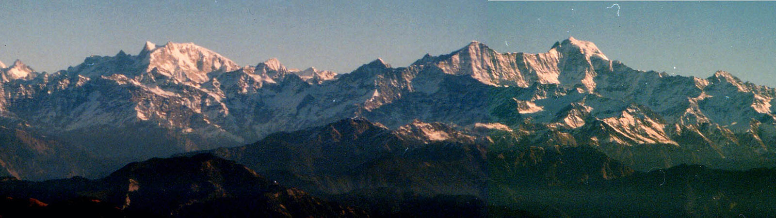
Rupkund, Jatropani and Gona Lake
(1966)
The Frontier Mail started from Bombay Central on 19 May 1966, with Zafar, Jitu and me in it. We were on our third trip to the Himalaya, off on the much-awaited month-long trek to Rupkund (the lake of mystery), Gona lake (the blocked one) and Jatropani (the peak of the singing waterfall). We wondered how it would be: dry and barren as west Nepal? As beautiful as Har-ki-Doon valley? As snowy as Pindari glacier? Whatever it might be we were determined to enjoy ourselves.1
On the 20th we were in Mathura, to change trains for Kathgodam. There was a solar-eclipse that day and the Jamuna river was crowded with people bathing. Shops were closed. We were rather bored throughout the day in that town. We boarded our train late at night only to find our berths occupied by someone else. The only alternative for us was to pull the chain. A drastic step, but the berths were ours.
On the 21st we reached Kathgodam, the last railway station on our route. Immediately we booked our tickets to Ranikhet (84 km). We met our porters, Pansingh and Pansingh, who had been with us on our earlier trips as well. This solved our problem of finding new porters. We paid them Rs. 6 per day per porter besides food.
23 May: Early in the morning we were off for Garur by bus. From there we were to proceed to Gwaldam (106 km), the last bus terminus on the route. By 11-30 we were in Garur. And the next bus to Gwaldam was not before 16.30. We had no alternative but to wait. In spite of a heavy rush, we managed to get tickets, and reached Gwaldam at 6 p.m. After much consideration we decided to stay in one tent rather than in a small room in the forest rest house there.
The First March
24 May: All set for the 20-day trek to Rupkund and other places. We had decided to start as early as possible, which turned out to be 6.30 a.m. Our destination for the day was Bagargad (1890 m; 19 km). After 4 km of a gradual descent, we came to the river. Then a straight road (5 km) took us to Deval (1220 m; 8 km). We were exhausted, for it was the first day and we were carrying nearly 20 kg each.
In fact we had been making that mistake every year, the blunder of aiming a high target of walking on the first day, setting a difficult target, then finding it difficult to achieve it. We dragged ourselves over the last 3 km and then were forced to camp by the side of a stream.
The Fire
In the adjoining small valley some distance away, we could see black smoke curling upwards. The porters told us that it was a jungle fire and the matter ended there. Or so we thought. The whole afternoon we ate, took baths and rested. At 5.30 p.m. we decided to go to bed. We had settled down rather comfortably when we suddenly noticed that the fire had creeped into our valley. We were helpless against this act of the God and were forced to hurry up and pack and move to the next valley. The tents were rapidly dismantled and we moved in pyjamas, like refugees, to the adjoining valley. Again we dumped ourselves near a stream. The whole operation took one and a half hour. It was 8 p.m. by the time we finally established a camp a kilometre from the original site.
The Great March
Next morning the valley was full of grey smoke. We were ready to leave by 6.30 a.m., our intention being to reach somewhere near Lohajung pass (2400 m; 13 km). After continuous ups and downs we managed to cut across 8 km, in nearly three hours, to Bagargad. From here we could see the Lohajung pass about 4 km away. After a 2 km steep climb which took nearly two hours, we reached Mandali village (bazar, post office). It was but 11 a.m. and we were very weary indeed. We decided to take lunch there. We used the remainder of our energy and will-power to trudge to Lohajung pass. It was 1.45 p.m. when we reached there. There was no water to be seen and the villagers said the only stream in the vicinity was about 2 km down. We were now moving like machines without any feelings whatsoever. When we eventually reached the stream we were further disappointed to find that there was neither a camping site nor a place for the porters to spend the night. So once again we, the robots, began to march together. 4 km further downstream there was a camping site as well as a shelter for the porters. But our woes were not yet over. It started pouring. At last the God decided that we’d passed the test. It stopped raining and we entered our tents at nearly 8 p.m. after a long, long day. Our 23 km trek had left us fatigued. We could not start early the next day, not before 9 a.m. at least.2
Another Bad Day
As planned, we rose late and started our 7 km march for the day. We had not recovered from the previous day’s fatigue and the progress was slow. On the way we met a school teacher from the Wan village. He was kind enough to carry a part of each one’s luggage. We got a lot of information from him. As compared to other fellow-travellers he was literate and enjoyed a high reputation in the village. At 11.30 a.m. we managed to reach the Wan village. From the village the Forest Rest House was 1 km away, near a temple. Going there involved a climb of nearly 150 m. The teacher asked the chowkidar to open the bungalow for us.
It was beautifully located at 2590 m. In front of the bungalow rose Jatropani, one of our objectives. Kukina khal was to our right. Everywhere there was peace and greenery. The pine trees in front of the bungalow sort of protected it from the wind. The run-down, fed-up feeling that we had been experiencing all the while vanished. The beauty was extraordinary, excep-tional and breath-taking!
The next day, the teacher and some other people advised us to go to Jatropani first and then to proceed to Rupkund. They said that would take less time. We accepted their suggestion and changed our plans accordingly. We decided to go to Jatropani the next day and return on the same day to Wan. That involved a trek of about 26 km. We also decided that we would rest in Wan for one more day after our return from Jatropani, because the route from Wan to Rupkund was supposedly difficult. That evening we invited the school teacher over the dinner. He regaled us with tales and information about the region.
The Ascent of Jatropani3
Jitu was not feeling well so Zafar and I set course by ourselves at 6 a.m. with our guide Raichand. After spending two hours in an undulating terrain we reached the left wing of Kukina khal. We had covered almost 4 km and could see Trisul and Nanda Ghunti. From there began a very steep climb right up to the top of the summit. The climb was so steep that it was not possible for an average climber to cover more than 1 km in an hour. The higher we went, the clearer we saw Trisul and Nanda Ghunti. After a desperate struggle and some mountain sickness, we were able to reach the top at noon. Trisul and Nanda Ghunti which were clear in the morning were now hidden behind clouds. We were told of a waterfall nearby which made a humming sound. We saw the cataract, not different from any other, but it gave one 4400 m peak its name.
A few clicks of the camera and we started the descent to Wan. We were completely dehydrated and increasingly giddy. At last the ordeal ended and we reached the Forest Rest House at 5.30 p.m. It had been another tortuous day. The outing of 11½ hours took its toll. The teacher once again came to meet us, this time with Hukamsingh who was going to be our guide to Rupkund.
The next day was again a day of rest. In the evening in order to lighten our luggage we packed some of our things in a kit bag and sent it to Sutol directly with a porter.
30 May: With Hukamsingh as guide we started off for Rupkund. We’d recovered from the trip to Jatropani and Hukamsingh turned out to be fun, so the going was good. In the initial stage there was a mild climb for nearly 5 km. Our destination for the day was Bedni Bugiyal, the stretching, fascinating pasturelands. After this began the steep climb. After almost 5 km it brought us to the top of the ridge at a height of about 3350 m. We were now above the tree line. We could see Jatropani and Trisul in two different directions. On our left were the Badrinath peaks. The three colours before our eyes were the blue of the sky, the snowy white of the peaks and the green of the pasturelands. At 11.30 a.m. we reached Bedni bugiyal (3660 m; 10 km).4 We pitched our tents near a dharamshala which was the only shelter for the porters. The day had been pleasant but as the sun went down so did the temperature. The cold became unbearable by midnight and we were forced out of our tents into the dharamshala where the porters were sleeping. It was the coldest night anyone of us had ever experienced.
31st May: The morning was rather pleasant, but our disturbed sleep prevented an early start. We were off by 7.30 a.m., on our way to Belpa Sulera (4270 m), 13 km away. The climb was gradual for the first 8 km. Where we halted, Hukamsingh had some time in the recent past hidden some dry wood. He fetched it and we were able to cook our lunch there. We had crossed the treeline on the previous day and, but for Hukamsingh’s foresight, we wouldn’t have had fuel-wood. After a hot lunch we were ready for the steep climb to Kelwa Binayak. It was as steep as that of Jatropani. By 2.30 p.m. we were at Belpa Sulera where we camped for the night. In front of us we could see the ridge where Rupkund was located, barely 5 km up. Having learnt a lesson the previous night, we went inside our tent wearing as many woollen and cotton clothes as possible.
The Day and The Hour: Rupkund
For three months we had waited for this day. We had dreamt of it and planned for it. We started on our last lap at 6 a.m. Hukamsingh came with us. The porters were sent ahead with the luggage to Ramni, where we were to reach on our return. We’d decided to proceed to Sutol and not go back to Wan after reaching Rupkund. Cutting our way through the snow-patches and resting in between, we managed to reach the lake by 10.15 a.m. We had covered a distance of 5 km in four hours. It was foggy and we could not see anything in the valley. The lake was all hard ice, and the bones,5 according to the guide were nearly 4 metres below the surface. At 11 a.m. we started the descent. We wanted to move as fast as possible to avoid any trouble, for the glaciers had already started breaking. The climb down was not too bad. By 1 p.m. we were with the porters at the place where we had agreed to meet. Pansingh had already prepared lunch for us. We were all in a good mood: to eat, rest and talk. Our goal was further down, and soon after the lunch we set off towards Sutol. Our plan was to rest in a cave for the night, about 3 km from there. By 4 p.m. we were safe inside the cave near a river. Up on the mountains we could see the heavy dark clouds gathering.
2nd June: Our destination was Sutol, a distance of 22 km of unfrequented terrain including a steep descent along the Pupanga river and a thick forest. The journey was not pleasant and we walked towards Sutol without following any particular track. We were hurrying in order to reach the plains as early as possible. By 11 a.m. we had covered almost 16 km. We took a two-hour break for lunch in a cool shady place. In spite of the rest the speed was perhaps the lowest ever recorded by us. We were in Sutol by 3.30 p.m. but we decided not to go into the village, so we camped near the confluence of the rivers a little before the village. Soon we met the porters with the luggage which we had sent directly from Wan. We were in a human settlement after nearly four days.
3rd June: We started for Ramni, a distance of 21 km involving constant, tiring ups and downs and without any shade at all. The first 8 km were covered with enthusiasm but as the sun became strong we slowed down. We decided to lunch at 11.30 a.m. and after that the speed was slower still. It was extremely hot and so we called it a day at 5 p.m. near Alegaon, 12 km from Sutol. That night we had the heaviest downpour of the trek. God listened to our prayers, though, for it was a short one.
The next day after starting rather late and going through the thick, green forests, we managed to reach Ramni by 11 a.m. The Forest Rest House was unguarded, in ruins and about a kilometre above the village. We decided to camp in its compound. The view was the most panoramic of the trek. The village was a big one, so we could get potatoes and, with some difficulty, rice. We badly needed both for our days of leisure at Gona tal.
Gona Tal6
5th June: We left at 7 a.m. for Gona tal (13 km; 1710 m) where we intended to spend a few days. By this time we had decided that we would not be going to Kuari pass. For the first 3 km we climbed up to a ridge. At the top, we could not see any track leading to Gona. We were surprised to note the complete absence of human beings. We studied the maps which we had been carrying from Bombay and were able to get the directions. The path we followed went through thick forest and kept going downwards. After a few kilometres we were informed by the local farmers that we were going an old, long and tiring way. After covering nearly 12 km we were back again in the hot valley near the Gona village from where the tal was just 3 km on. It had been a horrid, hot, sweltering journey, at the end of which we found that the Forest Rest House was occupied by an engineer from Chamoli. But by evening he left and we were on our own, beside the green, clear water of Gona tal.
The following day passed by quickly; we spent it mostly in boating and swimming. However the chowkidar informed us in the evening that we would have to leave the Forest Rest House in order to make room for some officers whom he was expec-ting. We had no alternative but to put up in the boat house.
Three days of paradise was not enough but we had to leave mainly because our food stock was over and we had to eat the local food which we did not relish. At 3.40 a.m. on the 8th, we left Gona tal for Birehi, 16 km away. We could see the forests burning in the distance in the darkness of the night. By 7.30 a.m. we were in Birehi. We had completed the 170 km trek in 16 days, and discovered at the end of it that the pilgrim season was at its peak and buses weren’t easy to board. We were psychologically drained. There was no question of walking even a kilometre more. And Pipalkoti was 8 km away. It sounded like an eternity. Providence was on our side, for the Engineer whom we had met at Gona tal was going to Pipalkoti in his jeep and he was kind enough to give us a lift. At Pipalkoti, things were no better, for pilgrims usually go straight from there to Joshimath. After a great deal of effort and persuasion we managed to get place on a Joshimath-bound bus.
More hectic struggles were in store as we tried to get seats on a bus to Rishikesh. We finally enjoyed a short stay in Mussoorie. On 20th morning we were in the Frontier Mail, carrying us, tired but happy, towards Bombay, home sweet home!
Notes & References
- Since I was in Bombay University, Zafar and I went on annual Himalayan treks, like the ones mentioned here. These were organised in small scale and we had studied a lot as not much was known those days. We undertook almost 8 treks like these and everytime our companions changed. We jokingly called this as moto: ‘Come once with us and be satisfied’!
- Inexperienced as we were then, water management was very poor. All these were symptoms of dehydration and we did not drink enough water nor carried any juice powders. I never suffered so badly in any of the later trips.
- In Garhwal there are several small hills like Jatropani which have bugiyals (meadows) and thick forests around them. This one was called Jatro (humming), Pani (water) or simply the ‘humming waters’. Many of these hills are within easy linking distance from such bungalows.
- The view from Bedni Bugiyal is stunning, possibly one of the best in Garhwal. A wide range of peaks can be seen and it is a treat to camp here, amidst the green, velvety grass.
- Rupkund is known as a mystery lake. Many human bodies and bones were discovered here. There are various theories about how they came to be there. Some say that they were remains of General Zorawar Singh’s army, something which is hard to believe as the area is far from Tibet. The other theory is that a pilgrim party was caught in an avalanche. These points are discussed in The Nanda Devi Affair by Bill Aitken.
A pilgrimage, called the ‘Nanda Jat Yatra’ still takes place here once in about 12 years. Perhaps one such yatra was caught in bad weather over an avalanche. It is a matter of curiosity for scholars and authors.
- Gona tal was a natural lake, created by a landslide. After few years the natural dam burst causing floods and havoc. The last such flood was in 1971, a few years after we had visited the lake. It had caused lots of destruction and killed many people. We had enjoyed three wonderful days there. Now only an empty bowl exists, where the lake once existed.