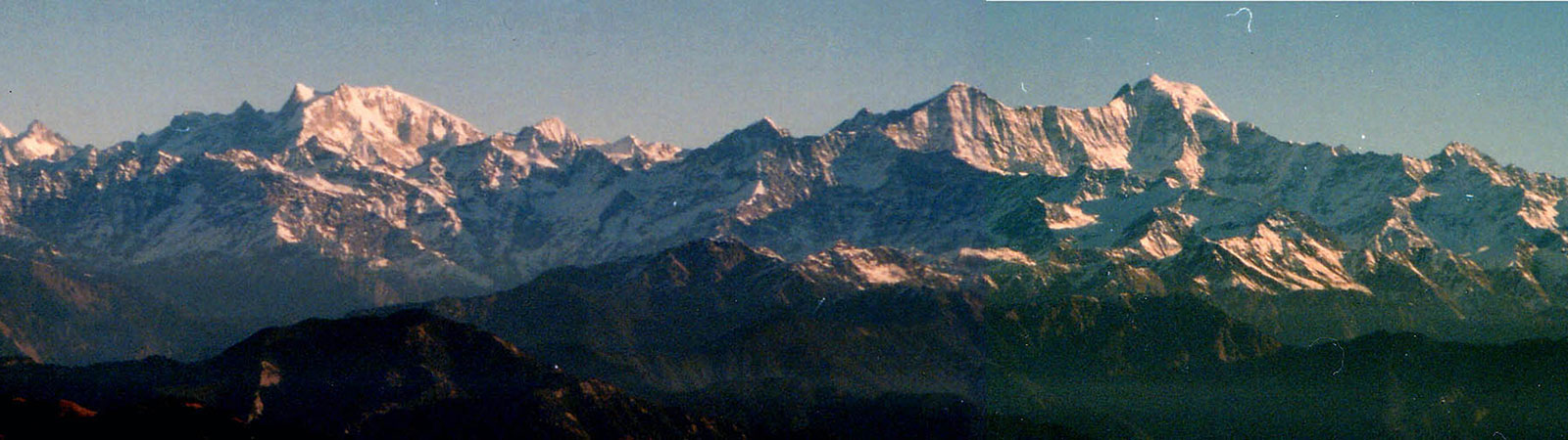
Bandarpunch from Nag Tibba
Share on Social
LOST IN THE LEGENDS
(1997)
In 1934 two prolific explorers from England reached the Garhwal Himalaya. In fact it was a beginning of an exploration which made them famous. They were Eric Shipton and Bill Tilman, who were trying to force an entry into the hitherto unknown Nanda Devi Sanctuary. In summer that year they discovered a route through the formidable Rishi gorge and deposited some of their food and equipment there. When monsoon arrived, they returned to Badrinath. Their intention was to spend some time elsewhere and then, as the monsoon withdrew, to return to the Sanctuary to complete their unfinished work.
Once in Badrinath they heard of the Hindu legend about the journey of a temple priest in the Kedarnath valley who crossed a high pass to worship at the Badrinath temple on the same day! If true, considering the terrain, this would be a major mountaineering feat. Shipton and Bill Tilman, supported by gallant Sherpas, decided to check the validity of this legend, with near-disastrous results.
They crossed a difficult col at the head of the Satopanth Bank, to check out the above Hindu legend. They descended the Gundarpongi gad but were caught amongst the ice-walls on the upper reaches and were trapped in the bear-infested thick forests in the lower sections. Being delayed for many days, they ran short of food. The party had to survive on bamboo shoots in the forest—fighting with bears. After a saga of survival and hair-raising moments, they exited at the Gaundar village.
We thought that they perhaps misjudged the route talked about in the legend. They crossed the col at the head of the Satopanth Bank. But as per local information and modern maps, there is a high col at the head of the Panpatia Bank in the south. Perhaps this col could be crossed. This col leads down to Maindagalla tal on the ridge leading to Madhya-maheshwar temple directly and above the nala-valley which trapped the Shipton-Tilman party. The legend, perhaps was built around this Panpatia col which has direct access from the temple.
A party of two trekkers from West Bengal tried to repeat the 1934 route in 1984, trying to come up the valley from Madhya-maheshwar to Badrinath, perhaps via Panpatia col. They were never seen again, presumed dead in the valley.
We, the five-member team, reached Badrinath and met our local friend, a priest. The Panda (priest) was strong. With a shaven head and a tilak on the forehead he sounded like an epitome of knowledge. I inquired from him about the old legend that the priest in the Kedarnath temple worshipped at the Badrinath temple, crossing high passes, on the same day.
‘It maybe true, in the days when the earth was flat, that the priest went from Kedarnath to Badrinath’.
He went straight into the Himalaya before the days of the tectonic thrust, which supposed to have created the range.
‘Now Nilkanth has risen inbetween, blocking the route.’
He added, ‘This place is named as Badri, after a fruit that can grow only in a flat country. At present there are no badris growing here. So once all this area must have been flat land.’
‘But as per the map it looks like an impossible terrain to traverse. In a modern scientific world it will not be possible to believe that it was possible to cross the range at all, let alone on the same day,’ I protested.
‘The story is true, you require faith to believe it. There was a route then and there will be a route now if you look for it.’ And as an afterthought he added, ‘It is for the faithful’.1
Bells were ringing and it was time to go to the Badrinath temple. I had bought a ‘special offering’ ticket of Rs. 51 for a separate entry. It was still a horrible experience—with dirt, pushing and crowds. I could not believe that the young Rawal performing the puja knew all about the ‘journey’ and would lead me to salvation. I came out less faithful than before. We were ready though, to start in search of the legend of the priest, almost following the Kipling’s advice, ‘there is something lost behind the ranges, go and find it’.
We decided to follow the Panpatia valley to check out the legend. Talking to villagers we found that almost everyone had heard of this legend. But they referred to ‘Kedarnath’ as an area and not specifically to the main temple, which is situated far away. After three days of acclimatisation, enjoying a view of Nilkanth, the team was ready to enter the Panpatia valley on 31 May 1997.
By 4 June the base of the icefall (4440 m) was reached in four easy stages (Khirao village 2840 m, along the river 3360 m, snout 3860 m to foot of the icefall). Our intention was to reach the high col (5250 m) to the southwest of the upper Panpatia plateau. Crossing this would have lead to the Madhyamaheshwar temple, via Maindagalla tal and to Gupta Kashi (Kedarnath).
The icefall was tried via three different routes, each ending in huge crevasse fields which would have required more equipment to cross. Finally a steep slope to the north, after fixing some ropes, gave us access to the higher plateau. However it was observed that to reach the Panpatia Col it would be necessary to traverse almost seven km through highly crevassed ground. Reluctantly the idea was given up. We returned by the same route to Badrinath on 13 June 1997. There is a pass, from Khirao to Kalpeshwar, lower down in the valley. This is the only route which we thought was possible to cross over to the ‘Kedarnath area’.
We travelled to Joshimath for rest and to re-stock our rations. We visited Auli, a new ski resort developed above Joshimath. My enquiry as to why it is called ‘Auli’ had a humorous explanation. Once two lovers visited Auli and in the mist the lady was lost, never to be found again. The gentleman kept shouting ‘Auli Auli’ which in the local language means ‘come come’. The tea-stall owner, who narrated the story to us, added with a grin, ‘now we are shouting ‘Auli Auli’ (come come) to the tourists.’
During their second exploration in 1934, Shipton and Tilman had followed the Bhagirath Kharak Bank but were unable to locate the route to cross Meade’s Chaukhamba Col which was their intention. A side valley leads to this col which is dangerous to approach via the main valley. They failed to locate this side valley and came to know of it only after their trip was over whilst talking to C.F. Meade. Shipton and Tilman crossed a pass to the north of this valley to enter the Arwa valley and crossed Kalindi Khal to reach the snout of the Gangotri glacier at Gaumukh. They returned to Badrinath by the same route creating another legend of exploration. We hoped to follow this route in the second half of our trip.
We entered the Bhagirath Kharak valley on 14 June. Going past the popular Vasudhara falls, we stayed at Alkapuri (3560 m), Khadu Kharak (4150 m) to settle at lower Deo Dekhni (4400 m), which was a little short of the usual advance base camp of the Chaukhamba expeditions. It was a bleak place, cold, windy and in a moraine. We were looking for a camp-site when our cook ‘John’ called out to say that he had found a perfect place for a kitchen. It was up to us to locate a place to sleep! He was oblivious to our standing on a bleak ridge and shivering in the cold wind. He, as a cook, had his priorities right. He had settled the issue and our base camp was established there.
Two separate recces discovered a route to the upper Deo Dekhni plateau (5200 m). Rajesh, Monesh and three Sherpas attempted to reach the Chaukhamba Col (6050 m), which was last reached from this side by C.F. Meade in 1912.2 From a camp on the Bhagirath Kharak glacier Meade had reached the col in seven hours in July. However the team found the middle ground full of slushy snow. The resulting waterfalls made the climb very difficult and after a valiant attempt (till 4850 m) they found the going quite impossible so they returned to join the main party. They had made a brilliant attempt and reaching where they had was also an achievement under the conditions.3
The main party in the meantime had established a high camp (5200 m) on the upper Deo Dekhni plateau. Bhagat Peak (5650 m) was climbed on 19 June 1997 by Ang Nyima Sherpa (John) and myself. With ‘John’ I started for the peak at 7 a.m. No sooner had we climbed a little, then John unroped and I thought he went for the obvious nature’s call. I was wrong. He was looking for water, to be collected on our way back so that he could cook better meals! Again he had his priorities right. We climbed the ridge slowly, enjoying the ‘view of Gods’ (Deo Dekhni) from the peak and on our way back John did collect water for the kitchen.
After I left for the BC to rest the next day Kaivan and Mingma reached two peaks on the plateau with heights of 5360 m and 5400 m. Both were enjoyable climbs and they returned in about six hours.
Shipton and Tilman in 1934, like us, had failed to reach the Chaukhamba Col and had climbed to the Deo Dekhni plateau and crossed Shrak la (5700 m) (‘Pass of rocks’) to the north of this plateau. We reached this pass on 19 June (after 63 years). Next day loads were ferried there, and were carried (partly) to the other side.
The entire team crossed the pass on 22 June. Towards the north it had two gullies. The eastern gully led steeply down to the valley floor with some avalanches pouring down through it. The western gully was broad and led down easily to the floor on the Arwa side without much difficulty. By the time the entire party reached the pass, ropes were already fixed and loads lowered into the eastern valley. We had missed the best advice of Shipton that ‘mountaineering is reconnaissance, reconnais-sance and reconnaissance.’ Almost the entire gully had to be fixed with ropes and as avalanches hissed by narrowly missing us we eyed the easier broad valley which was the correct route. It was late evening when in heavy snowfall we camped on the glacier (5400 m), fortunate that everyone was in one piece.
We descended to the end of this side valley and in two days were camping on one of the branches of the Arwa valley (5280 m). Again following the route of 1934 we entered a side valley and reached the next high col, which we named ‘Serga Col’ (5840 m) (‘Pass of crevasses’) on 25 June 1997. Ahead we could see ‘Birnie’s Col’ temptingly close and far away was Kalindi Khal. The ground between us and the col was full of bergschrunds and crevasses. It may have trapped our large party of 14 persons. Very reluctantly we had to abandon the idea of crossing ahead. This was not the year and nor time for crossing such passes. Arwa had its charms. Explored by Frank Smythe it has not received many visitors. ‘Arwa Tower’ (6352 m) and ‘Arwa Spires’ (6193 m) in the southern valleys, will test best rock climbers.
We camped again on the same branch of the Arwa and descended to what is marked on the map as ‘Arwa tal’ (4720 m). There is no lake (tal) at this place now. In three days the team returned via Ghastoli to Mana-Badrinath-Joshimath by 29 June 1997.
I met the Panda at the conclusion of our trip.
‘I hope you found the route to cross the ranges, I was praying for your safety,’ he informed me.
I was about to tell him that there was no route as mentioned in the legends. It may have been possible in the earlier days but not now, and the legendary route led to Kedarnath ‘area’ and not to the main temple. He was only half correct. Then I realised that you do not tell a learned priest that he knows only half truths.
So I replied, ‘with difficulty it will be possible to discover a route the priest went by’. As Aubrey Menen had written, ‘We generally find the truth, but never destroy the simple faith of simple people’.4 And that may be the truth. Some explorer some day might discover the route by which it will be possible to cross the connecting ranges. Shipton and Tilman almost did it.5
We were tired and looking forward to going home. Imagine, after doing what we did, and more, Shipton and Tilman in 1934 had returned to the Nanda Devi Sanctuary to complete their exploration!
Notes & References
- There are several stories in the Himalaya which are ‘for the faithful’. The wall behind the ancient Yarma gompa in the Nubra valley, Ladakh, is said to be shining with gold in the evenings, as per the local belief. When Prof. Dainelli of the Italian expedition 1929, tried to inquire scientifically he was told to look at it with faith. See ‘My Expedition in the Eastern Karakoram, 1930’, by Dainelli, G., H.J., Vol. IV, p. 46.
- The col was reached by Simon Yearsley’s team in 1995 from the Gantori glacier. They camped on the col during their attempt on Chaukhamba I.
- Several times have I found this phenomena in my recent travels. What earlier parties, like C.F. Meade here did, and their timings do not seem to be possible now-a-days. Today no one can reach the ‘Chaukhamba Col’ in seven hours from the Bhagirath Kharak glacier. I wonder whether early explorers were fitter, tougher or whether the terrain has changed. Or possibly because they had no return tickets booked so had more time, which made them do things without stress.
- Space Within the Heart by Aubrey Menen.
- The ridge was crossed successfully in the summer 1998.