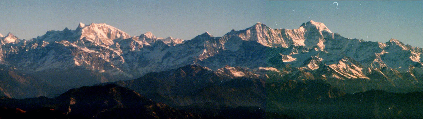
Bandarpunch from Nag Tibba
Share on Social
IN FAMOUS FOOTSTEPS
A Trek in Central Garhwal and Kumaun
1988
If we stop, we stand rooted like great mountains
If we walk, we sail through life.
We remember you at each step
and in doing so make you immortal.
THUS GOES A COUPLET. The caravans to Tibet sang it in the praise of Madhosing Rawat. He ran a tea shop between the Unta Dhura and Jainti Dhura passes on the famous Tibet trade route. Carrying wood in this barren terrain from far away Girthi, he served food and tea to the caravans. Trapped between two passes in storms, many were saved by this labour of love. His legend is still embalmed in traditional song.
In the area of Central Garhwal and Kumaon memories of other explorers also linger. Many famous names have visited the area from the earliest of times and left behind many ‘ballads’ of exploration by way of articles and books. We decided to follow in some of their footsteps and re-live their adventures. And in doing so we hope to revive their memories along with many legends of these areas. Many small legends in the religious area give an insight into the simple faith of these simple people. These too are immortal, being handed down for generations.
While the earlier travellers had a long trek to reach Malari, we reached there by a motorable road comfortably via Joshimath. But nothing else had changed much, a sleepy village, mostly drunk by early evening, with small eating dhabas. At the outskirts was a giant walnut tree supposed to contain chandan (sandalwood) and it gave that flavour to the walnuts. The motorable road goes ahead till ‘8 point’—8 km ahead, where it crosses Girthi. But at first we planned to follow the Dhauli ganga (Amrit ganga valley).
Amrit Ganga Valley
It was on 11 June 1988 that our little caravan left Malari for Gamsali (3300 m) a famous stop on the way to Kamet (13 km). Here the Amrit ganga, draining the 40 km long Bank Kund valley in the NW meets Dhauli. We went up the Amrit ganga valley to its head as it turned and twisted in various directions. At the head of this valley lies the Gupt Khal (5760 m), crossing over Alaknanda valley into Mana village. The presence of this famous pass had been suspected by A.L. Mumm in 1907, who named it the Secret Pass as it cannot be seen till the last slopes.1 The successful Kamet expedition sought it in vain in 1931.2 It was first crossed in 1937 by the surveyors R.C.A. Edge and R. Gardiner. Later in the same year Frank Smythe and P. Oliver used this pass on their way to the first ascent of Mana peak. This pass has been now reached a few times from the Alaknanda side to attempt Mana peak. Very few parties have crossed it from the Bank Kund valley. It is also known as ‘Zaskar Pass’ as it lies on the dividing line between the Great Himalayan and Zaskar ranges.
Going up the Bank Kund valley we reached Dumsain, a flat open maidan with a clear pond. Lord Badrinath, it is said, was eating here when he saw a dead bull, pointed out to him by a big bird ‘Bampa’. He felt very upset and burst into tears. His aansu (tears) rolled down into the pond turning into stones. Round pebbles are still to be found here. However, Badrinath went away to settle in the Alaknanda valley and Bampa settled near Gamsali (village Bampa).
‘For my part I would not readily exchange the exotic gardens of a Moghul Emperor for a sight of these little plants that lift their starry heads close to the eternal snows’.3 Thus wrote Frank Smythe of a ground between Thur and Eri Udiar where we established ourselves on the 12th. It was an idyllic camping site. A natural rock garden with flowers, turf, a small waterfall and a rivulet flowing in the centre. In fact now we were to follow his travels. Smythe had climbed up in the NW to the Devban plateau and climbed Pk 6435 m (later named Bidhan Parbat) and Devban (6853 m). Then going up the valley he reached Gupt Khal. He traversed over a c. 6600 m (21,500 ft) peak to climb Mana, finally reaching Badrinath across the pass.
We decided to divide ourselves to follow three different directions. Allwyn and I left for Gupt Khal. 1 km ahead was Eri Udiar (cold cave)—a bleak place. Going across the glacier to the right bank they reached Bank Kund lake (4380 m) 6 km. It was a most beautiful site with turquoise blue water and soft green grass. A variety of chirping birds and a backdrop of an icefall made it a perfect setting. The next day after a 3 km climb on the moraine ridge, the rubble of the glacier had to be crossed again to the left and after a long day a camp was made below Garh (4870 m), 10 km, and on the next day we stopped on the glacier (5440 m), 6 km. On 17th we were ready to leave at 2 a.m. but a short hail-storm delayed departure till 7 a.m. The glacier was now flat. Behind rose the huge slopes of Nilgiri Parbat (6474 m), another ‘first ascent’ by Smythe in 1937. As they turned, Gupt Khal revealed its secret for the first time. It was a prominent depression. As we came nearer we could see some figures on the pass. An exchange of shouts finally established that it was an Indian army team on a recce of Mana peak. Helped by their fixed rope on the final 200 m, the pass was reached at 11 a.m. (5760 m), 5 km. It was great fun exchanging notes at that high altitude and an invitation to lunch at their camp on the Alaknanda side had to be reluctantly turned down. The terrain seems to have changed a lot since Smythe’s time. The 21,500 ft peak to the north of the pass was a steep rocky pyramid. It cannot be used now, like Smythe did, to reach the upper plateau on Mana peak (7272 m).* Mandir Parbat (6559 m) in the south had a steep dome of a temple with ice-flutings. Not an easy proposition. The view across to the west was closed hiding Nilkantha and Chau-khamba. The party returned to base on the 19th after one camp.
During this period Milind and Sher Singh had gone up to Bhyundar Khal (5090 m) opposite our camp. Keeping to the centre of the southern moraine coming from Rataban, they turned west. By 11.50 a.m. they were looking across the last crevasse on the pass, 7 km. In the early days, this was the entrance to the valley. C.G. Bruce, A.L. Mumm and T.G. Longstaff crossed this pass from Bank Kund to Bhyundar valley in 1907.4 According to Longstaff this pass was probably crossed by Richard Straechy in 1848 and by Edmund Smythe in 1862. In 1931 after climbing Kamet, the entire team crossed over from here followed by Capt. Birnie later in the year. Smythe came over in 1937, naming the Bhyundar valley the ‘Valley of Flowers’. In 1947 T.H. Braham5 and in 1954 Gurdial Singh6 crossed it. Now it is being crossed quite often. It is as much an easy passage as it is historic.
The other historic triangulated peak is of Kagbhusand (5830 m) guarding the entrance of Devban plateau. It has graceful shoulders supporting a delicately soaring peak. The top has a shape of Garud (eagle) whose other name is Kagbhusand. This peak is seen from a little above Gamsali, from Gupt Khal and even from the Girthi gorge. Thus it was an ideal triangulated point for the surveyors. A garud was listening secretly to Vedanta being recited by a sage at Kagbhusand tal (near Bhyundar valley). He was caught and cursed to be frozen as rock and all the crows were cursed to die, leaving their wings there. On 7 July 1931 on their way back from the first ascent of Kamet, Shipton and Holdsworth attempted it to within 100 m of the top, with difficult ice and rock work. Not to be outdone, Shipton paired with Nima Sherpa next day and managed to reach the top. Shipton called it ‘severe’ but he had climbed 1600 m each day to accomplish it.7 Only one more ascent is achieved on this in 1970 (by the Indo-Tibet Border Police).
Arun and Muslim established two camps on the SE side. The route climbed up a steep grassy slope to a depression below an icefall. From the left of it the upper Bank Kund plateau was reached. However, the peak rose very steeply here. No way could they figure out how Shipton had dashed up in a day. Perhaps the terrain has changed beyond recognition. Finally a day of bad weather helped them to make up their minds to give up and come down. They did not find the dead crows either! With this we wound up our camp and retreated to Malari on the 22nd. Now three members were left for the major part of the trip. Allwyn and Milind visited the Valley of Flowers from the west linking it up with the Bhyundar Khal. Dr. V.N. Desai trekked on the lesser known pilgrim trails to Bansi Narayan (4135 m), Rudranath (3610 m) and Tungnath (3680 m). This 100 km trek went through thick forests. Shipton in 1936 had descended from Satopanth glacier and had an anxious time in thick woods infested with bears, in the nearby Madhyamaheshwar valley.8 It was more remarkable for the fact that Dr. Desai was 70 years and with a lone porter who was 60!
Girthi Ganga Valley
Girthi Ganga originates from two glaciers, both flowing north at first, west of Unta Dhura. Girthi east valley is broad, drains the glacier at the foot of Nanda Gond and its waters are black. Girthi west valley drains the glaciers at the foot of Kholi (6114 m) and Chalab (6160 m). From a narrow and highly crevassed glacier milky white waters gush out. Then it flows westwards forcing a way through the gorge to meet Kio gad at Girthi Dobala and merge with the Dhauli at Malari. This gorge was said to be first traversed by Dr. Kurt Boeckh in 1893. The next record of its traverse is by the Scottish Himalayan expedition in July 1950.9 During their long journey they crossed this gorge climbing Uja Tirche (6203 m) at its entrance. We decided to follow their footsteps and explore the Girthi west valley which had had no visitors. The eastern valley is relatively broad and shepherds visit it.
On 23 June, we left the windy and bleak ‘8 point’. Following Girthi on its left bank, the route climbed up steeply and traversed across a bad scree patch. Finally it turned to enter the Siruanch valley. Suddenly we were amidst lovely pine, birch and rhododendron forests. From two deserted houses the route traversed a camp on a lovely alp. We had an occasional view of Uja Tirche and the Tirsuli wall. The route now crossed the nala to go up 660 m to Damphu Dhar (4200 m) and down to Gangdeopani. Traversing to the right we landed at Johar Kharak. Opposite was Girthi Dobala with Kio gad draining the Summa and Lapthal valleys, near the Tibet border. This was the edge of the Zaskar range. To the north of Girthi was the dry trans-Himalayan area. As we entered the Girthi gorge 600 m above the river-bed, Rambha Kot (5395 m) rose steeply opposite us. This intricate looking barren peak stands between Girthi and Kio gad. It is believed that the fairy Rambha pleases the gods here and towards dawn sometimes you even hear bells. It would be an ill-omen to disturb the gods at that time.
The route slowly solved itself with a descent of 700 m. There was no water anywhere and finally we were relieved to be camping at Dumpani (3500 m) 14 km.
The brightest idea that Scott gave to the expedition was, to my mind, the eastward traverse from Malari in the Dhauli to Milam on the Gori by way of the Girthi river. If only we could make it we should thus link the two great trade routes of Central Asia, and if only it were not too difficult the route might ultimately prove of value to travellers. From the broader view point, this passage would be of greater importance than the ascents of any mountain, and for that reason we had been puzzled by the lack of records.
—The Scottish Himalayan Expedition
by W.H. Murray, p. 187
On our return, in September 1988, we were fortunate to meet Douglas Scott (not to be mistaken for the younger Doug Scott) at Bombay, the originator of the idea. He vividly described the route with an unfailing memory at the age of 77. They had crossed eight ravines with many drops and climbs. Nothing had changed, in fact at some places it had become worse. First we ran into Are Gadera—a steep ravine full of snow. Afterwards we crossed Sangla Palyo which was a bowl of scree. Ahead came the beautiful Senyarupani alp. But it was getting late when we reached Dudhgarhi—the place of Dhanmaya. Some Tibetan god had crossed over and buried some treasure here which inflames the trees. Opposite we could see almost a ‘river’ of lime-stone totally frozen. We were tired and so we decided to stay here. If we are lucky, we thought, we may strike the Tibetan treasure too. In 1968 and 1984 a team from Delhi had crossed this gorge. With difficulty they could find a guide Gaur Sing. That too because he was going to Topidunga to look for his lost son Har Sing. Now this lost son came with us as a porter and told us that he had decided to stay at Milam with goats for two years causing anxiety to his family. Malari village boundary ends near Girthi. Some old houses stand as a testimony to their attempts at colonizing the area. All the grazing beyond this belongs to Milam. They come over the pass and spend summer months here. Across the Rambha Kot ridge was Girthi Dhura pass (5079) which led to Raoli on the Sumna-Lapthal route. A leisurely walk of 4 km brought us to Girthi (3620 m) and soon we were set up to camp in a birch forest.
Attempt on Chalab
The Girthi west valley runs south for 4 km to the foot of Kholi. It bifurcates in a highly broken icefall in the SW to Chalab and climbs steeply in the SE to peak 6210 m. We set up camp (4300 m) at the bifurcation and turned SW. The icefall was a maze and after a day of recce we had to look for an alternative. A steep grassy patch led up- wards. We had to climb this ‘Bharal Bypass’, like its namesake, on all fours. An exposed traverse tested nerves even on fixed rope. I dropped an ice-axe and Muslim dropped his rucksack, the unfortunate end of both reminding us of our fate in case of a slip.
The valley opened up a little and followed a moraine ridge. C2 was made at 4920 m. But the route ahead was disappointing. There was no way to reach the col to the north of Chalab (6160 m) which was the only route possible to the summit. Arun and I tried a circuitous route but it did not go. Muslim and Arun finally tried to go up ‘Girthi Top’ (c. 6120 m), north of Chalab. After a gruelling 10 hour climb we stopped at 5960 m. We had to call it off. We had enjoyed and climbed as much as was feasible for a small party.
Across Unta Dhura
Topidunga has a peculiar location and name. Situated in a bowl it resembles an inverted hat (Topi) of rocks. It derives the name from a giant rock in shape of a hat, a rare sight for people coming from Tibet. This is an important junction. The route to the south leads to Unta Dhura (5360 m) (into Milam), to the southeast to Jainti Dhura (5592 m) and to the east to Kungribingri la (5548 m) into Tibet. In the north lies Khingri Dhura (5244 m) leading to Lapthal. Thus it has a strategic and isolated position.
Girthi to Topidunga (4200 m) was a day’s walk (12 km) via Gangharia where Girthi east joined. We were to follow the trail over Unta Dhura. Until the 1962 war with China, this pass bore heavy trade traffic. Caravans would come from Tibet across Kungribingri la, Jainti Dhura and Unta Dhura in one day. Then they would go down to Dung (4000 m), 14 km, to Samgong and Milam.
Unta Dhura has had many visitors. Amongst the available records are crossings by Lt. Hugh Rose10 in 1931, Longstaff and party in 1907, W.H. Murray in 1950 and A.D. Moddie and Gurdial Singh in 195911—to mention just a few. On 8 July in brilliant sunshine we were at the ruins of Madhosing Rawat’s tea stall, below the pass. The strong winds and bleak surroundings were alleviated only by the grey lake of Gangpani. One can understand why Madhosing is revered even today. A cup of tea here between the two passes would certainly be worth a ballad. The view was also encompassing and one could see Himalaya as a barrier. As we left the pass, down to Pari Tal (lake of fairies) we could but admire the human effort required to cross this barrier. What motivation would lead caravans of loaded goods across this terrain? The route descended steeply to Dung (4000 m), 14 km, and via Samgong to Milam (3424 m), the meeting place of caravans.
The site of this historic village made us both happy and sad. Once about 500 houses nestled here. Now a few families live in ruined houses a few months of the year. Behind, the ‘Dudhpani’ stream (‘stream of milk-white pure water’) still flowed but it brought no prosperity. There were heavy rounded stones in a square which were lifted in sport by youngsters. Now with trade closed, the inhabitants have gone to the plains and only the ruins stand.
In these ruins lay the stories of the past. Gorkha Kyul is a strong building. It was built of heaviest stone by a Rani (queen) who used it as protection against the Gorkha invasion. She erected cairns on surrounding ridges which looked like humans. The Gorkhas were kept away, scared for a while, looking for the Rani as she roamed about in male dress. She washed her face one morning with both hands at Ranikot (where the Gori ganga and Goenkha gad meet) a little outside Milam. As the tradition goes, a man washes with only one hand while ladies with both. She was thus identified and killed, leaving behind many songs of valour.
In 1950 the Scots had met the missionary L.C.J. Moules (a member of the Himalayan Club). He moved up with the mawasa (families) doctoring the caravans. He is still remembered. Though missionaries are present below in the plains, there are no Christians here at all. ‘Christ cured with their medicines and now our Hindu gods also cure with ours’. So all reconverted themselves, as one villager put it!
9 July was a Saturday. By evening we saw a large group of villagers marching towards Milam. They were all coming to watch the popular Hindu religious serial ‘Ramayan’ on the T.V. Next day the jawans from the border post also arrived to this solitary idiot box. Many had walked almost 30 kms to view this. About a decade ago almost 500 goats were sacrificed here at the temple on arrival, one by each family. All this was changed by the swami of Martoli. But still that evening people gathered to look at ‘ghera’, a circular rainbow around the sun. It brings bad weather.
Danu Dhura
Bad weather it did bring, but after 4 days. We trekked to Martoli on 10 July and camped at the beautiful Nanda Devi mandir. Martoli led to Lwa gad in the west. Dr. Longstaff and two guides passed here to reach the famous col on the Nanda Devi saddle, now named after him. The famous Traill’s Pass had visitors from Martoli to Pindari valley. The pass was reached in 1830 by G.W. Traill, the first Deputy Commissioner of Kumaon, who in the words of A.L. Mumm ‘exercised a benevolent and active despotism from 1817 to 1835’. Among other famous parties here were: the Schlagintweits (1850), Ruttledge (1926), Japanese Nanda Kot team (1936), Osmaston and the surveyors (1938), Arnold Heim (1937) and S.S. Khera (1941).12
J.C. Donaldson wrote in June 1945 about the ‘Possible alternative to Traill’s Pass’.13 In August 1926 after their crossing H. Ruttledge and R.C. Wilson left four Martoli villagers including the famous guide Dewansing Lata. They went over a different route to Shalang gad (SW of Martoli), reaching Martoli in one day. We planned to go up Shalang gad and to locate this alternative to Traill’s Pass.
Inquiries with villagers revealed that surprisingly they had heard of this alternate pass from Shalang but not from Lwa. All remembered that Dewansing took Ruttledge sahib across and was rewarded with land and guns. Some old persons had crossed this pass. But without exception, no one remembered the real Traill’s Pass.
We went up the beautiful Shalang valley on 12 July. As we camped at Talla Shalang (4200 m) the monsoon caught up with us. It was raining in these parts after 4 years and with a vengeance. We halted here for 3 days with shepherds as company. Young Kalyansing peeped inside the kitchen on the first day and slept the whole day there. Our anxious inquiries about the weather always had a reply from him: Rook bhi sakta hai (it may stop also). With this also added he always kept up our hopes and despair. So much for the local advice. For 4 days he gave us lectures on ‘goat culture’ and traditions of shepherding in the valley. On the 16th Chiring We (6559 m) opened to view in the east, and with mounting hopes we pushed up to Bhadeli Gwar (4600 m) at the foot of the climb. This was the sacred place of ‘Lord Danu’. The god hailed from Danpur, across the pass in Pindar valley. People from Badhiakot (near the Ruphund-Pindari trail) come here to worship. It is not without significance that gods travel across valleys and high passes. There had to be a traditional pass here over which people of Danpur crossed and had installed their god.
Philistines may say that we were becoming superstitious like Kalyansing. But true enough, two separate recces by Arun and me revealed an excellent safe route. Moreover there were some giant cairns all along, marking the route. This was ‘Danu Dhura’ (5560 m). The exact location of the pass was on the saddle between Nandakhani (6029 m) and Laspa Dhura (5913 m) on the western edge of Shalang gad. Above, it led to the snow-plateau below Nandabhanar (6236 m). At the SW end a depression led to Sal Changuj glacier and down to Kupi Dhura and Phurkia.
Early on the 17th, the three of us left, climbing 600 m on scree behind Bhadeli Gwar to a giant cairn. A safe traverse on snow led to the bottom of the final climb of 200 m to the pass. It was on scree and led to the flat ridge top. But for us that was the end of the road. By 2 p.m. we were caught in snowfall and had to camp where we were at 5200 m. Next day it deteriorated further and we had no option but to play safe. An unknown high pass on the other side could have trapped us.
However, we were satisfied about the existence of the pass from this side. Later we could check with photos and accounts of expeditions to Nandabhanar that the pass we saw would lead to the upper plateau.14 It would descend to the Sal Changuj glacier to Kupi Dhura and Phurkia on the Pindari trail. An inviting proposition—to test the strength of ‘Danu Dhura’.
As we came down to the shepherd’s camp, Kalyansing was singing with rain pouring outside. Something looked amiss with him looking red, in new clothes and a cap. He had taken a bath after 4 months—on one of the wettest days! We went down to Martoli (16 km) and on the Tibet trade route to Bugdiar (19 km) and Lilam (20 km). Gori ganga was in full flood, but the track, the work of generations, was solid as ever. As roads were blocked ahead of Munsiary, we trekked along Gori ganga to Madkot. This was a fortress of the devils Mad and Ketab. They cheated the gods while making a bridge across the Gori ganga but were rehabilitated. Now only last year that bridge was completed and an alternate motorable road connects Munsiary. The 66 km road to Jauljibi on the Nepal border across the Kali river is unspoiled forest and a treat to walk through. It remains to be seen whether this new road and a proposed dam turns the valley into an abode of the devil once again.
As we ended our trek we felt satisfied. Having followed many historical trails, it was a journey into history. And history had not changed much here over the years. As Kalyansing was singing:
‘Only two things are missing up here: a ladder to climb up to the sky and a lid to cover the ocean’.