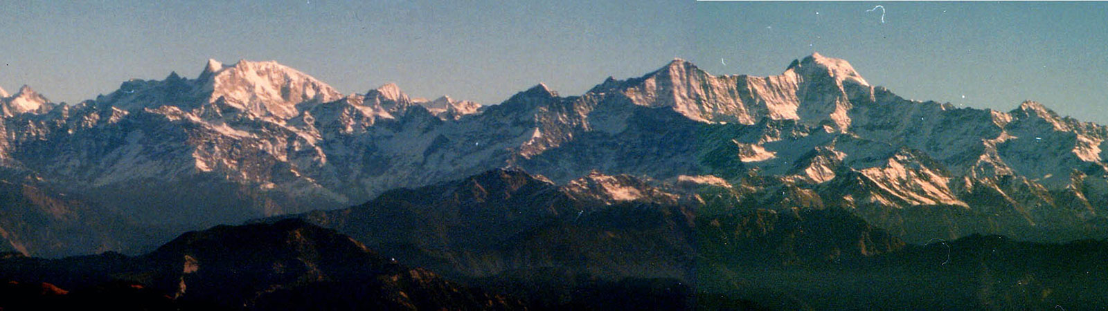
Bandarpunch from Nag Tibba
Share on Social
Trek to Har-ki-Doon and Ruinsara Lake
(1964)
Zafar, Bharat and I were toying with the idea of going on a trek to Har-ki-Doon area. We could easily get rucksacks at the military disposals at Delhi.1 On 4 April 1964 we were off to the hills.
We bought the tickets in Dehra Dun for the only bus to Chakrata (96 km). It cost us Rs. 5 each. The first half of journey was through the plains. Then came the curves. During our journey we crossed several ranges. At Saheli and Kalsi we were warned by the locals that according to a recent order no tourists were to pass through Chakrata. We thought it quite probable that we might have to return. We reached Chakrata, a military establishment (2200 m) at 3.45 p.m. Local persons were allowed to stay in the lower part of the bazaar. We had to wait for 45 minutes before we were told either to go further or return. We were not to stay in Chakrata even for a night. We quickly left for Marrow’s Neck (2285 m) 3.5 km away which was situated at the junction between the two nearby ranges. We had problems obtaining permits from the forest officials and hiring two porters. Once the former were in our hands, we hired two young lads, Khemsingh (14) and Narbahadur (12) for Rs. 5 per head per day including food.
It was 1 p.m. before we started. We took a steep short cut to get on to the main track. The climb was monotonous, the surroundings barren and there was no sign of habitation between Marrow’s Neck and Deoban. It was much later that we passed through a pine deodar forest, after crossing which we reached the long awaited Forest Rest House2 at 5 pm.
Deoban (2775 m) commanded a majestic view. On the 10th we left for Mandali, 20 km away. It was downhill all the way and much of it was through a dense forest. We followed the ‘jeepable’ road after passing the Kautani tea-stall. The bright sunlight hurt the eyes, and the barren mountains made it worse. Before Bhujkoti we encountered a steep climb. A road was being constructed.3 At the top of the mountain there were four paths. We took the one on the left going down, which led to Mandali, and reached the Forest Rest House (2560 m) at 6 p.m.
After a day’s of rest we left for Kathian (2120 m) via a shorter route. For the first 6 km it was descending. After crossing the second bridge began the climb. It did not tire us much for we were walking slowly and steadily. Unexpected, it began to drizzle. Within minutes, there was rain. From the place where we’d taken shelter, the next Forest Rest House was only 2 km away. We reached the Kathian tea-stall at 1.30 p.m., then went to explore the forest above the Forest Rest House. Both at Mandali and at Kathian, we were troubled by mice. They nibbled at the soap, ate the cashew nuts, atta (whole wheat flour) and also made a gaping hole in the kitbag!
Due to rain we were not able to stir out of the Kathian Forest Rest House before 9 a.m. En route to Darmigad we encountered a huge landslide. After crossing the bridge some 2 km beyond Darmigad it was a pleasant walk along the river Tons, right until the Bawar range. The Forest Rest House at Thadiar had a superb location and was built over a wooden plinth. At Thadiar we bought some groceries and things.
We left for Sandra (1150 m; 15 km) on the 14th. The road was a level one, punctuated by several landslides on the way. We were still going along the Tons. We occasionally came across shepherds and local men. Before reaching the Sandra Forest Rest House we crossed a village called Hulloni, where some celebrations were going on giving us a glimpse into rural life in the Himalaya.
On the 15th we headed towards Netwar, 12 km away. The area was rocky, and the only village we crossed was called Devi. We passed by Netwar village about 3 km before the Forest Rest House. Netwar was situated at the confluence of Rupin and Supin rivers. They merged to form the Tons. After the bridge there was a steep climb of 2 km. This was the last village with a post office.
The following morning was cloudy and we hesitated from starting early. When we did move, the rain forced us to take shelter under a rock. That halt was a brief one, because at 11.30 a.m. down came hail. We managed to reach Sankri, a village 2 km away. There it rained continuously for five hours. We were stranded and had to stay at a thekedar’s house. The clouds parted in the evening and we saw a very spectacular rare sunset.4
Next day we reached Taluka in the Govind Sanctuary at noon after a 10 km walk. The Taluka Forest Rest House was at 1980 m. On the 18th we left for Osla (2560 m; 16 km). The first 4 km were downhill, then began the climb. From Datmir we got a lovely view of Kedar Kantha (3660 m). After the climb we had to descend to the valley again to reach Gangad, 4 km short of Osla. We reached the Forest Rest House in Osla at 1 p.m.
The 19th was a interesting day for us. We had employed a local, named Jarbi as a guide for Rs 3. We agreed on Rs. 4 excluding food if we took him along on a hike. We had met Jarbi at Calcutti Dhar through the efforts of his brother. We took with us the keys of the Har-ki-Doon Forest Rest House as the chowkidar stayed in Osla most of the time. The first bridge we crossed led to Osla village. We passed that by. We turned at the second bridge. After climbing the Calcutti Dhar entered the Har-ki-Doon valley and discovered to our delight a waterfall, 20 m high. Through the heart of the valley flowed the Tons river. To reach the Forest Rest House (3415 m) we had to climb a kilometre or so through snow. The Forest Rest House, one of the highest known to us, was poorly constructed but excellently situated. Kedar Kantha was to our extreme right, then came the Kinnaur peaks, the Swargarohini range, the Jamdar glacier and the Mullond peaks. Beyond the Mullond ridge was the Borasu pass.
On the 20th we went to a different valley by crossing the ridge under the Mullond peak. It led to the Borasu pass, and was completely snow-bound. It snowed on that day as well. The two nights we stayed there were cold. Heavy woollens were required. During our stay at Har-ki-Doon, for say 50 hours, we were lucky enough to spot 14 wolves, 1 chital, and 1 brown bear and we also saw many monals. On the 21st, after having left Har-ki-Doon at 2.30 p.m. we reached Osla at 6 p.m.
On the 22nd we left for ‘Rosada’, the local name for Ruinsara lake (3810 m). The track went along the Ruinsara river after the confluence with the Har-ki-Doon nala. The track led through a jungle up to the lake, for about 7 km. The valley was rather wide and in its centre flowed the Ruinsara river. The small cave, that housed us for the night, was full of snow which we had to clear. There was enough space for the three of us to sleep.
On our return journey, which began on the 23rd, we went straight to the Calcutti Dhar, crossed the Har-ki-Doon river and then went to Osla. On the 24th we returned to Taluka. On the 25th and 26th we were at Netwar. On the 27th we left for Jarmola (1150 m; 20 km). Up to a village called Mauri it was the same route that led to Sandra. Then it turned. We reached Jarmola at 4 p.m. It was a pleasant place and the bungalow was well furnished. On the 28th we left for Naogaon (1370 m; 24 km). We had to climb a mountain ridge to reach the border of the Yamuna and Tons forest divisions. Then came Rama Sarai, a big village with a Forest Rest House, just a kilometre away. From Rama Sarai, the distance to Purola was 8 km. From Purola we reached Naogaon at 5 p.m. The Forest Rest House there, right on the banks of Yamuna was both comfortable and picturesque.
29th was the last day of our trek. We left Naogaon for Barkot (1370 m; 12 km) at 11.30 a.m. That evening we paid the porters a lumpsum amount of Rs. 250. The total cost of the trek had come to Rs. 325.
Notes & References
- In those days it was difficult to get good trekking equipment. Even to get a good rucksack was something of an achievement. But there were large stores in Delhi, Dehra Dun or in Pathankot where second-hand old equipments were available. These were generally from the Second World War disposals. They were terrible by modern standards but useful nevertheless.
- We were trekking all along the usual route of forest officers. These rest houses were built for the visiting officers to rest. Generally they were always built away from the village and with spectacular views. These rest houses are still maintained and are worth staying in.
- All these areas are now connected by motorable road and buses ply on them. They still retain their beauty, and are worth visiting.
- The road at present is upto Sankri, from where the popular Har-ki-Doon trek begins. It takes three days to reach the Doon.