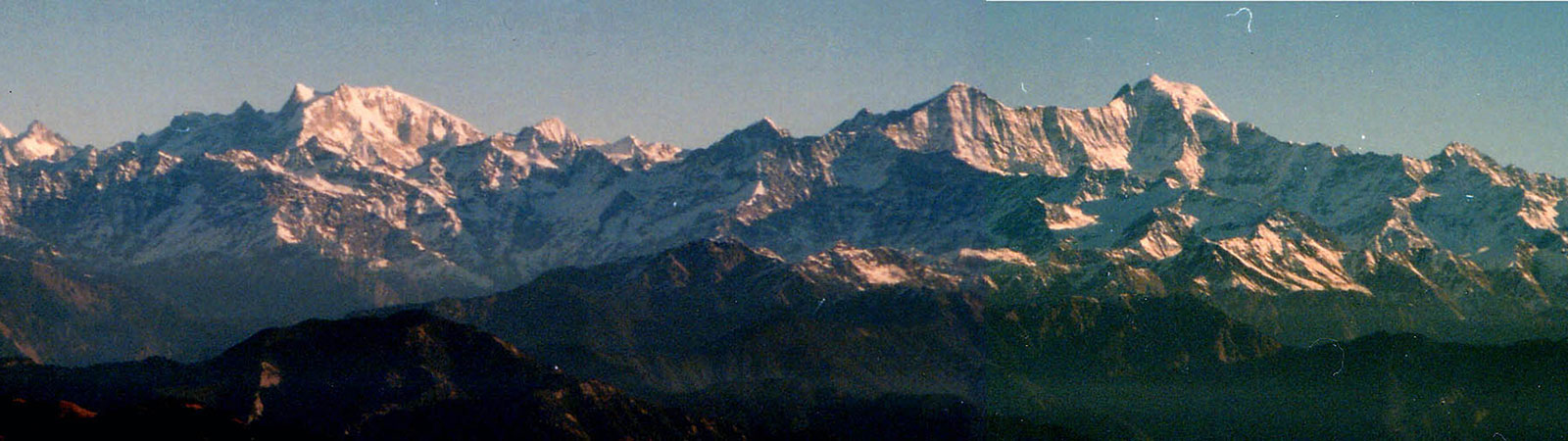
Bandarpunch from Nag Tibba
Share on Social
CENTRAL GARHWAL AND KUMAUN
A Brief Mountaineering Survey
1988
THE AREA OF Central Garhwal encompasses the Alaknanda-Saras-wati valley near Badrinath and the Dhauli valley. To its south lies the Nanda Devi Sanctuary (Rishi valley) and to its west is the Gangotri valley.
Badrinath Area Exploration
There are numerous glaciers and peaks on both sides of the Alaknanda otherwise known as Saraswati, north of the Badrinath temple. This is devbhoomi the sacred valley of the gods for Hindus. Adi Shankaracharya (A.D. 800), the Hindu guru who led the revival of Hinduism, established four temples at the four corners of India. The northern temple is at Badrinath. (Badri—wild berries which grew here in plenty, nath—lord). He was said to have travelled across the Mana pass and the statue at the temple bears resemblance to Budha (Bodhisatva) and Vishnu symbols. Even today the head priest is from Kerala, the southern-most tip of India. This is the earliest record of travel in the region.
Religion was at the core of travel here. The Jesuit fathers have left a long record of crossing the Mana pass into Tibet. Father Antonio de Andrade and Brother Manuel Marques crossed this pass to Guge in Tsaparang province in Tibet in 1624. A little to the south of the Mana pass is the lake of Deo Tal from where the Saraswati rises. ‘Father Andrade mentioned the little lake of Deo Tal, with the result that geographers mistook it for the great Manasarovar, which they sub-sequently declared to be the source of the Ganges. From this mistake there grew the tradition that the Ganges tunnelled under the Tibetan watershed. When this myth was exploded doubt was thrown on the whole of Father Andrade’s story.’1
Kamet and Abi Gamin
Kamet (Kangrie—‘lower snows’ in Tibetan) attracted the first mountaineers. In 1848 Richard Strachy determined its height, followed by the Schlagintweits. In 1855 they went over the Mana pass and attempted it from the north reaching 22,259 ft on Abi Gamin. In 1874-77 the Survey of India under E.C. Ryall and I.S. Pocock set up a plane-table at 22,040 ft on the slopes of East Ibi Gamin. The Schagintweits had named this range Western, Central and Eastern Ibi Gamin —these are now identified on modern maps as Mukut Parbat, Kamet and Abi Gamin respectively. From 1907 to 1920 various explorers attempted it (as tabulated at the end). A. Morris Slingsby attempted it from the west, reaching a steep pass (‘Slingsby’s Saddle’) on E. Ibi Gamin. In 1912 C.F. Meade on his third trip in this area reached the high col between Abi Gamin and Kamet (‘Meade’s Col’). Finally in 1931 Frank Smythe led an energetic team of Shipton, Holdsworth, Greene, Birnie and 2 Sherpas who made the first ascent of Kamet ending a chapter of exploration. The second ascent was in 1954 by an Indian team led by Nandu Jayal, and by now it has been climbed fairly often. The only new route achieved is by its west ridge in 1986 by an Indo-French expedition (Col B.S. Sandhu).2
Abi Gamin was climbed in 1950 by R. Dittert, K. Berril, A. Tissieres and G. Chevally, who approached from the north over the Mana pass. Since then it has been regularly climbed from Meade’s Col.
Climbers–Explorers
A few major expeditions did most of the explorations in these parts till the early fifties. The first to come was Frank Smythe in 1937. This was a most energetic trip, with one companion. He spent time in Bhyundar valley and gave it its famous title ‘Valley of Flowers’. Nilgiri Parbat, 6474 m (‘Blue mountain’) was climbed quickly. Rataban, 6166 m (‘Red arrow’) was attempted. Crossing over Bhyundar khal to the Amrit ganga valley, he went up the Devban plateau, in search of a route to Mana Peak 6435 m (‘Bidhan Parbat’) and Devban, 6853 m were climbed. Going up the valley he climbed up from Gupt Khal 5760 m, over Pk c. 6600 m (21,500 ft) and made the first ascent of Mana. Smythe with his flair for writing well recorded the region for posterity.3
In 1939 Andre Roch made a number of ascents.4 The team came over from Gangotri after some high climbs. Roche entered Kosa glacier to climb Ghori Parbat (‘Horse Peak’). Next, was the first ascent of Rataban. They climbed many other peaks. Chaukhamba 7138 m was also a fine attempt by this team. Approaching it from its north face and east ridge, they lost two Sherpas in an avalanche. However in 1952 (French, Russenberger) the summit of this peak of ‘Four pillars which support the world’ was reached. In 1987 a 38 member strong team of the I.T.B.P. climbed Chaukhamba with two dogs. Five summiters skied down to base, covering 11 kms in 12 minutes, while the other summiter and the dogs took 3 days to descend. Such is the craze for novelty (Hannibal, of course, started it all with his elephants). In 1947, the Swiss (A. Roche) were back here again climbing Balbala, 6416 m, from Jagrao glacier. Dittert, Roche, Suttar, Graven and the leader Lohner reached the summit with Tensing Norgay and Ang Norbu.5 In the same year T.H. Braham crossed from Kalindi Khal to Bhyundar Khal, climbing peaks and recording the area.6
In 1950, four Scots under W.H. Murray crossed the Girthi gorge, a tributary of Dhauli. They trekked to Malari, Siruanch valley and to Unta Dhura for crossing into Kumaon. Apart from the peaks on the northern rim of Nanda Devi Sanctuary, they climbed Uja Tirche (6202 m) and attempted Lampak (6325 m). Their record of travel covered the area exhaustively.7 All along this period, the area received many small parties, who crossed passes, visited the various valleys and crossed over into Tibet and back. In August 1928 Major G.W.P. Money reported travels to Chor Hoti pass and the death of 6 Bhotias in 1927 in a freak storm. A similar incident was reported in 1987 when 12 jawans were killed near there. In both cases the bodies were strewn over a large area and it was wondered how wind could achieve this. Gurdial Singh travelled here in 1951, 1954 and 1959 climbing Rataban, crossed to and from Manasarovar, climbing many smaller peaks on the way.8
Two ‘Avalanche Peaks’ lie north of Badrinath, equally famous evidently because they generated avalanches on the first climbers. T.H. Tilly and John Jackson were involved in an avalanche on the peak in the Bangneu glacier, 6196 m. Jackson received superfluous bruises while Tilly twisted his knee and had to be carried back to base. Two climbers David Bryson and Jackson returned to climb the peak on 18 June 1952. Young students climbed it in 1984 but without any mishap. The second, higher and the northerly, Avalanche Peak is 6443 m, south of Kalindi Khal. It was climbed by Eric Shipton and Frank Smythe on 22 July 1931 with two Sherpas. They were caught in two avalanches while returning. Smythe fractured a rib and both the celebrities were lucky to have escaped.9
With this, the phase of explorative climbing was over and it was left to determined climbing parties to take on the challenging peaks. A few major climbs in the area were that of: Mukut Parbat, 7242 m, (1951) New Zealand party,10 Hathi Parbat, 6727 m, (1963) I.T.B.P. team, Ganesh Parbat, 6532 m, (1965) Indian Police.11 Repeat ascents of many peaks were also achieved.
Plenty of new climbs and exploration remain in the area, chief among these would be Purbi Dunagiri, 6489 m, Chalab 6160 m, Kholi, 6114 m, Tirsuli West, 7035 m, Mana NW, 7092 m, and Lampak 6325 m.
Nilkanth
No history of Central Garhwal would be complete without a detailed mention of this majestic peak. It is a name of Shiva, presiding over Badrinath and worshipped by millions of pilgrims. It is a tough and challenging proposition for mountaineers.
In 1961 an Indian team led by Captain N. Kumar approached from the Satopanth glacier. After 10 days and five camps a ‘first ascent’ was claimed on 13 June. While the team members were being feasted, Jagdish Nanavati (Hon. Secretary of The Himalayan Club since 1972) put a question mark to all the brouhaha. His was a classic study: Nilkanth—Still Unclimbed? (A Study of the Indian Nilkanth expedition 1961), published in February 1962.12 Based on his study of the terrain and the party’s report he meticulously brought to light their failings. His was the pioneering study in this genre and the details are worth recalling. The Nilkanth 1961 expedition had no perspective of the peak and maintained that it was a ‘gentle’ trudge. From the fifth hump on the summit ridge they thought the summit to be a mere 200 ft away in height while it was actually 1470 ft. All the heights were inflated and as a result the summit party started with one flimsy tent for 7 persons and were trapped for almost 6 days by bad weather. Finally the team claimed an ‘ascent’ in foul weather without any pro-per record. But what happened later was still worse.
When challenged with substantial evidence of facts and figures, the bureaucracy moved to defend it by a one man committee of Surveyor Major N.B. Nayar. His findings were so pathetic that on exposure by Nanavati the powers that be were compelled to appoint a three-man committee headed by Col B.S. Jaswal. Every time the team changed its version, the heights of camps and timings were also changed. Finally the committee made up its own timings for them supported by fresh aerial photographs (which merely confirmed Nanavati’s contention). On 25 December 1963 it declared the peak as ‘climbed’ in the newspapers. The report was naive to the point of disbelief. From Nanavati’s exhaustive discussion with the summiter O.P. Sharma it was evident that he had no idea of the physical features of the mountain and none of the objections raised by Nanavati were ever answered by him or by the committee. Suspicions of a cover-up were more or less confirmed when the committee specifically suggested another expedition to Nilkanth in 1964 so that the terrain and timings could be verified. It was never implemented.
The Alpine Journal13 took note of it (T.S. Blakeney—AJ notes) clearly recording: ‘The Committee have given an opinion in favour of the ascent having been made, but their support of claim is hedged round with certain qualifications that strike one awkwardly’ (p. 145).
Unfortunately the Himalayan Journal14 passively accepted the Jaswal committee report and recorded it. The then President of the Himalayan Club was also a member of the Sponsoring Committee of the Indian Mountaineering Foundation. Truth was sacrificed, perhaps at the altar of diplomacy.
However with his study Nanavati had removed the question mark from his title and it was Nilkanth—Still Unclimbed. Finally in 1974, an Indo-Tibet Border Police team climbed it by the same route. The details of their climb were never made public, presumably to avoid any comparison and embarrassment with the earlier fracas. Thus Nilkanth has as much enigmatic history as majestic beauty.
Kumaon
The British divided Kumaon creating Garhwal. This was of course resented by the Kumaonis. Now there is a demand for ‘Uttarakhand’ (northern land) joining both areas. People here are avid travellers and did a roaring trade with Tibet. Three major divisions of Kumaon had interaction with each other and Tibet.
Byans Valley
The easternmost part of Kumaon comprises the Kali river, running from Lipu Lekh to form the boundary between India and Nepal, Kuthi, Darma and Lassar merge into Kali at various points. Vyas rishi, a sage who wrote the Mahabharat is believed to have lived here, giving the area its name. There is a temple dedicated to him above Gunji. The pilgrim route to Manasarovar passed along the Kali and is again frequented by many today—the route having been reopened to pilgrim traffic.
Near Lipu Lekh on the route to Tibet, from a small temple of Kali, starts this ‘black river’. At Gunji, the Kuthi river merges with Kali which forms the Indo-Nepal border. As the legend goes, it was the Britishers who interchanged the names of white Kali (meaning ‘black’) and blackish Kuthi rivers. This ensured a vast area of land as British territory as Kali was always accepted as the border. They built the above temple to authenticate the name—a good example of British practical diplomacy.
Another intrigue followed in the area in 1960. A contract was given to build a motorable road from Almora to Lipu Lekh pass to facilitate pilgrim traffic. The contractor was persuaded by the Chinese
to start the construction in reverse—from the pass to Almora. This would allow a good deal of strategic advantage to the Chinese to descend to the lower valleys. The folly of this was discovered and the road blown up. It has reached just beyond Tawaghat yet!
Kuthi emerges from Jolingkong lake 4630 m which is as beautiful as any. Passes of Mangsha Dhura and Lampiya Dhura are close at hand. Sangthang, 6480 m, is the only peak of note here and was climbed in 1968 (Indian, P. Dasgupta).
Shin la (5495 m) has a nasty reputation and it leads to the smaller upper Darma valley. It is the route to Nuwe and Lowe Dhura passes to Tibet. Further west Gangchal Dhura 5051 m leads to the upper Lassar valley. It was here, that the Scots arrived in 1950, through the Ralam pass (further west). But the Darma valley is most recorded by A. Heim and A. Gansser. Their travels here in 1937 opened the area to outsiders.15 They crossed into Tibet unauthorised and were ordered to return and ‘escorted’ back to Almora by the Commissioner. One of them reported back over the high Traill’s Pass!
At Sosa village, the festival of Kandali to celebrate the killing of the remnants of Zorawar Singh’s army is observed every 12 years. The ladies go out in procession to destroy the shrubs of Kandali (Sporelanthus Wallachii) growing every 12 years under which these soldiers were hidden. Zorawar Singh coming from Ladakh, had reached Taklakot, where he was killed in a battle in 1841. His demoralised army returned along the Kali, looting the villages on the way. The ladies resisted them and this is enacted till today.
Panch Chuli
‘Five chulis’ (cooking hearths) where the Pandavas cooked their last meal on the way to heaven. They are majestic and form a famous barrier between the Darma and Gori valleys. From this side they were attempted by parties over the Sona and Meola glaciers. They are numbered north to south (peak II at 6904 m is the highest) and are difficult. H. Ruttledge recceed it in 1929. Graaff and Snelson (1950), the Scots (1950) made an attempt from this side. H. Harrer (1952) tried from the west. Finally it was left to two massive expeditions by the Indo-Tibet Border Police to open the route (1972) from the west (Gori valley) and make the first ascent in 1973. On the same divide a number of fine peaks merit attention, like Ngaling, 6041 m.
Gori Valley
Kalabaland glacier is the first valley from the east in this section. Chiring We, 6559 m, (‘Mountain of Long Life’) was the finest peak to be climbed in 1979 across a huge icefall.16 Peaks in the upper cirque were also climbed. On the eastern rim Suli Top, 6300 m, was climbed in 1986 after two failures.17 Further south Suitilla, 6373 m (‘Needle Sharp’) is the ‘Changabang of Kumaon’. Two fine peaks, Chaudhara, 6510 m (‘Four ridges’) was climbed in 197318 and Rajrambha, 6537 m (‘The King’s Fairy’) was climbed in 1971. All later attempts on it have failed.
The main Gori valley from Munsiary to Milam is known as Johar. All residents of the upper villages were traders with Tibet. Hence in the summer months they travelled and during the off-season reaped a harvest of ‘jowar’ (maize). This harvesting gave them and the area the name of ‘jowari bhotia’ (now Johar). A solid stone track leads over the Unta Dhura pass to Tibet. With the closing of trade, the area has lost all its importance and wealth.
At the head of the valley stands Hardeol (7151 m) and Tirsuli (7074 m) which has attracted many climbers. The Poles tried Tirsuli in 1939 in vain. Two of them died at C3. In 1964 Capt Kohli’s team suffered damage in an avalanche. It was the determined efforts by a Bengal team led by C.K. Mitra in 1966, that finally led to its ascent.19 Hardeol (‘God’s Temple’) beat back attempts from the north in 1975 by the ITBP. Four ladies of the Indo-New Zealand team were killed in the icefall to its south. Finally the I.T.B.P. Sherpas climbed over the Tirsuli ridge at c. 6400 m, over the peak 6508 m to the summit at 7151 m and returned. It was a magnificent achievement completing the Hardeol-Tirsuli saga.20
On the eastern rim, peaks like Nanda Pal 6306 m, Nital Thaur, 6236 m, Nanda Gond, 6315 m and Kalganga Dhura, 6215 m stand. Each is difficult and beautiful and only Nanda Pal has been climbed (in 1973). On the west stand the peaks of Nanda Devi Sanctuary and the goddess herself. From here Longstaff reached the col (5910 m) on the Sanctuary walls, while a few parties have crossed the ‘Traill’s Pass.’
Nanda Kot
This ‘Fort of Nanda’ (6861 m) is an imposing peak dividing the Gori and Pindari valleys. It was recceed by Dr. Longstaff in 1905 and in 1936 the Japanese made the first ascent.21 An Indian team in 1959 climbed it again. In 1986 the Indo-Japanese team made another ascent to celebrate fifty years of its first ascent.
The peak has its share of intrigue too. It is known that Indo-American teams climbed it twice to install and remove a nuclear detection device on its summit in the late 1960s. This was to monitor Chinese activity in Tibet (after the failure to place it on Nanda Devi). Obviously no published records of this are available, except in some newspapers when the story leaked in 1978.
Danpur
The westernmost part of Kumaon receives the name from the generosity of its people who give free food to travellers (Dan—gift, pur—place). Danpurians are the best porters and the most faithful. The area consists of two major valleys: Pindari and Sunderdhunga valleys.
Pindari glacier has Traill’s Pass at its head and the peaks of Nanda Khat, 6611 m, to its north and Nanda Kot to its south. It has witnessed deaths (Japanese, Indians) in the icefall and the final climb of Nanda Khat (‘bed of Nanda’) was in 1972. To the south of Pindari is the Kafni glacier and at its head nestle smaller peaks like Nanda-bhannar (6236 m) and Nandakhani (6029 m).
Panwali Dwar, 6663 m, (‘Gateway of Winds’) is a beautiful peak, connected with the Sanctuary walls and dividing Pindari and Sunder-dhunga. Like many other peaks, the Japanese repeatedly assaulted it until they finally climbed it in 1980 to complete all the major peaks in the area.
Sunderdhunga (‘Beautiful Stones’) is a lovely valley into which Shipton and Tilman descended from Sunderdhunga Khal, 5520 m, in 1934. This was the exit route which they strongly warned against using and has not been repeated.
Wilfrid Noyce was here in 1944 to climb Tharkot, 6099 m (previously called Simsaga) a small beautiful peak.22 Maiktoli, (6803 m) climbed by Eric Shipton in 1934 has a formidable south face, an imposing 1800 m wall, which was climbed by the Japanese from here in 1977.
Bidalgwar glacier adjoining this saw the Yugoslavs in 1960 ascend Trisul II (6690 m) and III (c. 6100 m), climbing most of the route at night to avoid avalanches.23 Finally the imposing west wall of Trisul I (7120 m) was climbed in 1987 exactly 80 years after its first ascent by Longstaff and his team from the Trisul glacier in the north. The Yugoslavs traversed from Trisul I-II-III and para-jumped to the valley to bring Kumaon into modernity. Ales Kunaver was a member of the first Yugoslav team which had climbed in 1960. In 1987 Ms. Vlasta Kunaver climbed Trisul I and was one of the para jumpers. Like father like daughter!
This completes the brief sketch of the major climbs in the land of the gods. Perhaps just as it began with the Christian fathers, the southernmost part of Kumaon ends with E. Stanley Jones and his ‘Christian Ashram’ at Sat Tal. This is a Methodist Church, the style and name was that of a Hindu organisation. Earl Denman who attempted Everest alone and secretly with Tensing Norgay in 1947 stayed here for many years. He died here in the late 70s. This perhaps signifies the attraction of Kumaon and Garhwal for mountaineers.