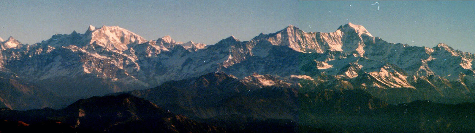
Bandarpunch from Nag Tibba
Share on Social
AN AUTUMN WALK TO KEDAR KANTHA
2012
My trek ended before it began, well almost. My companion Ashwin Popat hit his knee against a railing at Taluka rest house and had to return home. Thus I was left alone for the trek, with my faithful porters and mules. This was a first for me – walking alone in the Himalaya. It was a different experience, spending many hours by oneself in tent and on the walk.
We started from Taluka (via Dehradun-Sankhri) and a well-made forest trail climbed steeply all along for next two days. But there was nothing to complain about as the forest was exquisite. Throughout I had two contrasting personalities for company. Jeet Singh, our guide, was ahead and had never taken a vow of silence. He poured out information about the trek, the villages and his personal woes. If there was nothing to say he would sing to himself. Walking behind me was Harsinh, who never uttered a word during the day, unless spoken to.
On maps of almost all scales and for many decades, you will find Kedar Kantha peak marked. Since several years, I had wondered why so? With its height of 3812 m (12,506 ft) it is quite low by Himalayan standards. Moreover it is named after Shiva, ‘Kedar’, while his abode, the pilgrim centre of Kedarnath, was a few valleys across. We were in the Yamuna watershed and pilgrim centre of Yamnotri was near to us. Then why was this little ridge important enough to be on every map and why it was named after Kedar ?
The answers were found in local folklore. They were mystifying to me but the people living in these regions believe them. The simplest explanation was geographical. Shiva descended from heaven on Swargarohini peak (‘ladder to heaven’), seen clearly from here. He assumed the form of a bull, and intended to settle on top of Kedar Kantha ridge. But he heard the groan of a cow calling her calf from Sirka village, across the Tons river. He decided that the place was not secluded enough and hence he went to what is today known as the Kedarnath temple.
The other legend gets a little complicated. Shiva descended from heaven to earth on the peak Swargarohini. Unknown to him one rung of the ladder he descended broke. Many aeons later, the Pandavas of the mythological text Mahabharat, were believed to have climbed up to heaven from Swargarohini, via the same ladder. Bhim, the strongest of Pandava brothers, fell because of that broken rung. In anger, he went looking for Shiva. Afraid of Bhim’s wrath, Shiva turned himself into a bull and ran away. Bhim chased the bull, but it buried itself in the earth. Bhim dug him out and that was right on top of the Kedar Kantha peak. He dismembered the bull in five parts and flung different parts in different directions. A temple was erected at each of the places where the parts had fallen. Five temples of Shiva exist at these places and it is a holy pilgrimage to visit each of them. (the Panch Kedar).
Soon we were on the upper bugial of Pustara (3440 m). Several routes bifurcated from here: to Saru tal (lake), to Yamnotri temple and one to Kedar Kantha. Each place was at least two days away. Saru tal is known for profusion of brahma kamal [1], a rare high altitude flower but seen during rainy moths of July and August. As we started to traverse towards Kedar Kantha on a ridge, the beauty of the entire region opened up. Above the meadows (bugiyals) were peaks of the western Garhwal. To north and northeast were peaks of Har ki Doon and Swargarohini. To north was high Kinnaur range led by an old companion, Rangrik Rang, (6593 m) which we had climbed in 1994.[2] To the west rose Hansbeshan (‘where sun touches first’) on a ridge. Though only 5240 m, it rose sharply into the sky. It was my old friend too, having been to the peak in the winter of 1996. Now with play of autumn light every aspect of these mountains looked beautiful.[3]
The traverse to Kedar Kantha was long. But on the first night camping on a mall bugiyal I was treated to a rainbows, changing autumn colours and distant thunders. On the second day we started climbing above to a ridge. Soon, and to my surprise, we were on top of Kedar Kantha with our mules and crossed over to descend on the other side. This is not a peak but a long ridge. There were some old stones of a broken temple. But the summit offered a priceless view.
From the top, seven river valleys were seen – each a major river systems of western Garhwal and eastern Himachal, from the Yamuna to Satluj watersheds.
First to my east was the Ruinsara valley with a lake of same name and well known peaks of Bandarpunch and Kalanag.[4] It drains into the Ruinsara gad which soon joins the Tons at Osla. Flowing from Har ki Doon and from north of Swargarohini massif, the Tons contains waters of Jamdar gad, Hatta gad and Maninda gad.
The next valley was the Obra gad, bordered by peaks of Dhodu, Ranglana, Jairai rocks with Devkayri ground in centre. At Bhancha, Obra meets the Supin river which starts from the watershed of Kinnaur. At Netwar the Rupin river, flowing below the villages of Dodra and Kwar merges with the Supin. And finally the Pabar river joins the flow at Tiuni. All these rivers – Tons, Ruinsara, Obra, Supin, Rupin and Pabar flow into the Yamuna in the plains.
Far in the distance ridge of Chanshil Ghati was at the head of the Pabar valley. Hansbeshan (5240 m) ridge with peaks of similar heights are on the divide with the Satluj valley. This was certainly the playground of the future when climbers are tired of just going high and wish to enjoy another ‘high’.
To south-southwest were the lower hills of Mussoorie from where the Survey of Himalayan mountains (and of India) had started. Possibly Kedar Kantha is an important location as a major observation point in the survey of these areas and beyond.
After a night at Baiya bugyal, at foot of Kedar Kantha, we descended steeply to Judwa tal, a small tarn in midst of forest, with its beauty and peace. When I thought I had seen all I wanted and heard all that was to hear about Kedar Kantha, came the final edict from an old shepherd who added a philosophical twist to the tale.
In Garhwal the traditional method for extracting oil from seeds was to grind them in a stone mill known as a ‘kohlu’. The ‘kohlu’ comprised two round stone slabs placed one on top of the other. The upper stone had a hole into which the seeds were fed. The upper stone was rotated continuously by bullocks which were tied to it by a rope. To prevent the bull from getting dizzy, they were blindfolded.
The pilgrimage to Kedar Kantha is compared to the working of the ‘kohlu’. You go round and round in life blindfolded, tied to your desires. When you are here going around Kedar liberates you and enables you to see the great beauty around you. The sight you behold opens your eyes and you are freed from the burden of your desires – you cut the rope and you are free.
Summary: A trek to Kadar Kantha (3812 m) in western Garhwal, in October 2012.
[1] Brahma Kamal (Sausurrea obvalata) and Fain Kamal (Sausurrea graminifolia)
[2] ‘Language of Mountains’, p. 133. Kapadia, Harish. Meeting the Mountains, Indus Publishing, New Delhi, 2009 (2nd edition)
[3] A very long time ago, when even sun did not shine in the sky, the sage Ahan rishi meditated in the Himalaya. He acquired mystical powers and could create or destroy almost anything. The god Indra in heaven felt apprehensive about Ahan’s powers and felt threatened. So he commissioned the most beautiful apsara (celestial fairy) Usha, (Dawn) to descend to earth and break Ahan’s concentration. The moment she came down there was morning light and beauty all around after a million years of night. But Ahan, still undisturbed, created the sun and no sooner did its powerful light reach the earth, Usha had to disappear. This celestial play of light has been going on for ever since: Dawn (Usha) descends to the earth after a dark night and vanishes with rising sun.
‘A Dawn in Winter’, p. 140. Kapadia, Harish. Meeting the Mountains, Indus Publishing, New Delhi, 2009 (2nd edition)
[4] ‘Youth in Gibson’s Garhwal’, p. 94. Kapadia, Harish. High Himalaya Unknown Valleys. Indus Publishing, New Delhi, 2001 (4th edition).