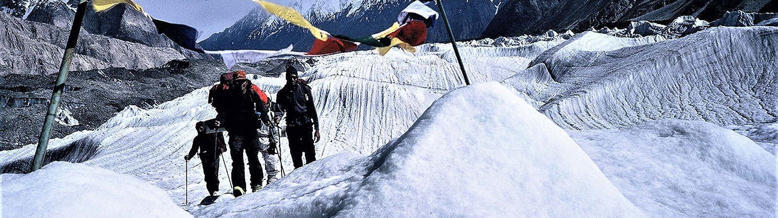
Crossing a Glacier
Share on Social
ON THE ‘DEATH TRAIL’
A Journey Across the Shyok and Nubra Valleys
2002
It was 17 May 2002, we were at the Shyok village, starting on a long Karakoram journey covering the two large valleys of the Shyok and the Nubra rivers, in Ladakh, East Karakoram. It was an ambitious plan, traversing this forbidding terrain, first along the Shyok crossing it more than 24 times, visiting Karakoram Pass, crossing Col Italia, exploring the Teram Shehr Plateau and finally descending via the Siachen glacier. In between all this, we planned to climb the 7030 m virgin peak Padmanabh. Ambitious enough. We were five Japanese and six Indian mountaineers accompanied by an army officer as liaison officer.
We were in the nick of time, for water levels in the Shyok were rising and within a week the route would be closed. This trail from the Shyok village to Karakoram Pass is the ‘Winter Trail’, used only in the winter when the Shyok was crossable. The trail was along the Shyok river, literally meaning the ‘river of death’ (shi-death, yok-river, in Ladakhi), as the river had killed many travellers by floods. No wonder trail also was nicknamed after the river.
Way back in 19th century, the British tried to built a formal trail here by blasting rocks on the left bank so that crossings could be minimised. One could see the blast charges on the rocks and at many places the trail was running on the opposite bank to ours. But as plans to build a trail were later abandoned, the Ladakhi caravans now go by the traditional route crossing and re-crossing the Shyok river more than 5 to 6 times per day, as they had done for generations. Sometimes, in the earlier part of the journey, the water would reach waist level or above and horses would cross with some difficulties and plodding by their owners. The owners would always jump on a horse loaded with luggage and would safely see themselves across. The hardy mountaineers of our party would hold hands and mastering the technique, go across the Shyok. It was fun, as somebody said, but rather cold and very tiring when we finished with it.
This route had come into prominence during the India-China war in 1962. The area immediately to the east of it along the watershed was taken over by the Chinese troops and today the watershed remains a de facto border. That was the reason this route had remained out of bounds for Indians and foreigners alike, and we were one of the few parties to go across it.
Along the Shyok
The first day of the trek was a disaster. The first few crossings were difficult and our group was divided and stranded. A tired and haggard party arrived into the camp only next early morning for breakfast. Half a day of rest was declared and then we made a short journey to Burma (3760 m). The first crossing was that of the Chang Chenmo river. The Chang Chenmo (Ororotse) gorge flows in from the east and it is one of the deep valleys leading from the Shyok valley to the Aksai Chin plateau. There was a prominent track traversing the Chang Chenmo and crossing Lanak la (5486 m) to reach Kun Lun plains and Western Tibet plateau. This was an old trade route used by traders from the Tibet.
Staying at Burma (3760 m) for the night and now getting accustomed to cold crossings we set off very early the next day. Our aim was to reach Chumed and Char Bagh. We were assured that after Chumed, crossings would be easier and the water level would be low. True to this assurance, after the third day, at Char Bagh (3920 m), the water level was low. But the final crossing at Char Bagh was a terror in itself. One of the porters remarked, ‘What sins have I committed in my past life to be crossing the Shyok so many times?! Never again!’, and that was the thought reflected by almost everyone! But the trail had its rewards too, as we were to discover soon.
A day ahead of Char Bagh we camped at foot of the Yurgolak fort (4050 m), which was located on a ridge about 100 m above. Though the fort walls were in a dilapidated state whatever remained was still solid and one could see the rooms and the courtyards. From the fort, looking across the Shyok valley, was the North Shukpa Kunchang nala, locally known as Nortot. By traversing this glacier and crossing an easy pass, a trail crossed to Sumur in the Nubra valley. This was the old route used by the traders from Karakoram Pass to the Nubra valley when Saser la was closed. The reason for building this fort was not exactly known, but according to one legend it was built to protect against the invasion of Gen. Chengiz Khan of Mongolia, known in Ladakh ‘Tsogpo Galden Chhang’. Another fort was built at Sumur by the Ladakhi king to offer complete security.
Next day on our way to Thangnyer (4130 m) (Thang-‘plain’, nyer-‘in middle of’, ‘a camp in middle of plains’) we were to pass some historical places. The first was Mandalthang on the western shores, gateway to North Shukpa Kunchang glacier (also known as Norot glacier). Traversing this glacier, a team had climbed Saser Kangri peaks, as was done during its first ascent in 1973. After their ascent, rising waters of the Shyok, which proved impossible to cross down stream, trapped the team. Hence they had to go northwards undertaking several dangerous crossings to return via Saser la. Fording the Shyok river is a major problem for attempting any of the peaks in this area.
To our east rose Kugrung group of peaks (6568 m, 6556 m and 6541 m were the highest of this group). These peaks were prominent and formidable. To the east it drained into the Kugrung river which flowed to the Chang Chenmo at Tsongtsalu Hot Springs (north of Phobrang). Peaks such as these suggest the wealth of mountain peaks and opportunities available when it will become possible to approach these areas.
The Galwan River
Soon we were standing at the mouth of the Galwan nala, which has a long history — a historic beginning and disastrous end. This is the nala named after Rasool Galwan, one of the great native explorers. Gulam Rasool Galwan was among the pony-men taken on by Lord Dunmore to Pamirs in 1890. He served a host of other explorers and travellers; Younghusband, Longstaff, Phelps, Church, Wellby and Littledale – particularly on the route along the Shyok. In 1914 he was appointed as the caravan leader (a very prestigious post) of the big Italian scientific expedition of Filippo de Filippi, which explored the Rimo glacier systems and spent several months in the area.1
His claim to fame came from an earlier expedition with the British Joint Commissioner in With the Sahibs, he explored a large unknown river valley little to the north of the Chang Chenmo and this valley now bears his name, ‘the Galwan valley’. This is a rare instance of a major geographical feature being given the name of a native explorer who put it on a western map. Apart from the Pundit explorers the native explorers have received far less recognition in the survey of the higher ranges. The native travellers certainly knew most of the routes before these were incorporated in maps.
Looking to this valley with sharp eyes or through binoculars one could see remains of an army post, built about 40 years before. Three valleys joined the Galwan nala at this point. Those who have read books on the 1962 Indo-China war, would find this familiar. It was in this valley in pursuance of the ‘forward policy’ followed by the Indian government, that the
Indian army had built up a post at an almost indefensible spot.2 This post was surrounded by the Chinese troops since it was established in July 1962. It was one of the first casualties of the 1962 war, which was triggered on 20 October, when the post was overwhelmed, many were killed, injured and captured. The Galwan valley was one of the routes of attack by the Chinese troops.
The Shyok valley from now on was wide and to avoid some river crossings we went across a small pass ‘Kalkatra la’ (4400 m). Route to Kataklik (4240 m) was a gentle and simple walk and the camp was at a beautiful spot on the eastern bank. The nala led eastwards to a peak of 6917 m, ‘Kataklik Kangri’. The peaks and groups that we were now to observe were completely unknown, never been attempted or explored. Next day after a short walk we camped at Sultan Chushku (4330 m) (Sultan-king, chusku-stream, ‘stream of kings’) where the Shyok took a sharp turn to the west. On the opposite bank in the west was the Sultan Chusku group, with more than four peaks rising above 6700 m. The Sultan Chusku nala and the Murgo nala met at this camping ground and we were only 5 kilometres away from the Chinese de facto border. This was the reason why the area was well protected and restricted.
From here we left the Shyok river and followed the Murgo nala from Sultan Chusku stream. We crossed the Jeong nala flowing from the Aksai Chin plains in the east. The Murgo nala had to be crossed, not less than at least 20 times before we could reach the open plains leading to the Murgo camp (4650 m). The line of control between the Indian and the Chinese forces is not more than 15 km from here and hence there is a permanent army camp here, the first one we came across on this trail.
To stay for the night we went off to Chhongtash 6 km to the west in an army truck. Chhongtash is a vast plain with a big stone in centre and that is what the name implies. (Chhong-big, tash-stone). A board at the helipad indicated the altitude sensibly, ‘You are 15,800 ft nearer to God’! Now that we had joined the summer trade route, from Karakoram Pass to Sasoma (across Saser la) the trail being used was well built. At least 3 of us had travelled on this trail before. On 26 May we passed Murgo, Kalon Chumik, to reach Burtsa (4600 m). Next day passing Kazi langar (4950 m) we climbed to Depsang la (5415 m) where our walk and horse rides ended. Indian army personnel were waiting for us with welcoming handshakes, tea and trucks. Depsang la is a vast plain and stretches almost 20 by 20 km, controlled in the east by the Chinese. This historic plain had seen hundreds of caravans pass by and in 1962, had seen attacks by Chinese aggressors.3
The Karakoram Pass
We spent the night at Daulat Beg Oldi (5180 m) the famous ground known simply as DBO. Next day on the way up to Karakoram Pass we halted at Polu shelters, where two mud huts signified the place where many Yarkandi traders had taken shelter during bad weather. At this Polu, one of the explorers, Dr. P. H. C. Visser, left a small tablet stating ‘Visser 1935’ which is enshrined here . Next to it we erected another tablet in memory of our friend Kaivan Mistry, an explorer and mountaineering friend, who died in the Shyok river on 27 August 2000 on the Indo-French expedition. It was an innocuous accident where four of us fell into the Shyok, while we three survived, he unfortunately, with his heavy rucksack fell on his back, and it appears his head hit a rock and he died instantly.
Soon we reached Karakoram Pass, a historic day for us, 28 May 2002, the first foreign expedition stood on this international border with China. The Karakoram pass had almost no view because both sides are blocked by small but long mountain ranges. There was a bone structure lined with prayer flags and of course, the flag of India. 4
For some of us this was the second visit to the Karakoram Pass while our friends were the first Japanese reaching this pass after 93 years.
Crossing Col Italia
Finally on 30 May our caravan of 55 mules deposited us at base camp 1 (4850 m), seven km west of Gapshan and at foot of the Central Rimo glacier. We sorted food and gear and started ferries on the Central Rimo glacier to establish our further camps. It was going to be hard work from now on. More than 2000 kg of luggage was to be borne on the shoulders of members and available porters.
We passed near the snout of the North Rimo glacier, which is one of the quietest international boundaries in the Karakorams. From here one can cross the Shaksgam pass, (to the Shaksgam valley) which was seen in the distance. Many caravans had passed through here too. Turning west and going towards head of the Central Rimo glacier, the route was snow covered but luckily devoid of too many crevasses. We established our Camp IV (5750 m) about 3 km before Col Italia.5
This pass, at the head of Central Rimo glacier, crosses to Teram Shehr glacier, which descends to the Siachen glacier, thus linking the Shyok and the Nubra valleys. Around a kilometre to the north of Col Italia, were many ridges and depressions, which overlooked the Shaksgam valley (which was part of the Kashmir state, now under Chinese control) and mountains of Shaksgam were clearly seen. Towards the south rose the Rimo peaks, which we were familiar with, our past expeditions having climbed or attempted at least three of them.
In 1930 Prof Giotto Dainelli, who had been the geographer on the 1913-14 expedition of Filippo de Filippi to the Rimo glaciers, had entered the Siachen glacier in June, before the Nubra rose sufficiently to stop him. He spent two months on the glacier, establishing his base at the junction of the Teram Shehr glacier. Later the passage through the Nubra valley was blocked due to floods and he decided to return over a 6000 m pass to the Rimo glacier system, which he knew well, to join the main Karakoram route. He named this ‘Col Italia’, dedicated to Italian explorers.6
This was the only recorded crossing of the pass (5920 m) and in 2000, after 70 years, I had stood here with Huzefa Electricwala and Kaivan Mistry,. Now, our entire team stayed here and it was 72 years since the first crossing that our party descended towards the west. Col Italia is almost a 7 by 7 km vast plateau where someone could get lost (as our porters did in bad weather while ferrying luggage). We descended to the foot of a giant peak of 7030 m which we had named Padmanabh and established our base camp 2 (5650 m) at its foot. 7
The Karakoram Pass or KKP, as it is known in Indian Army slang, is perhaps the best known historic pass. Though situated on the eastern most point of the range, the entire range of mountains from the borders of Afghanistan till Aksai Chin is known as the Karakoram Range. It is named after ‘black gravel’ found here.
KKP is the pass on the famous Central Asia Trade Route, which linked India (Kashmir-Leh) in South Asia with Central Asia (Yarkand-Kashgar). No records are available about who pioneered the route across KKP. KKP had been crossed since 1794. After the 1962 Indo-China war visitors to KKP were banned. It was only in 1997 that two civilian parties visited the pass and we were the third to reach the pass in 2000. KKP, windswept, isolated and featureless stands as a monument to the historic events and caravans that crossed it.
From the base camp 2 we had two projects in hand. One was the ascent of Padmanabh. A team of climbers led by Hiroshi Sakai, the climbing leader, prepared for the ascent.8 Ryuji Hayashibara and myself were to explore the Teram Shehr Plateau.
Exploration of Teram Shehr Plateau
We owe the first views of this great plateau to Stephen Venables. While attempting Rimo I in 1985, he observed it. His pictures of this plateau, more than around 10 sq. km, with the peaks of the Siachen glacier and K2 in background looked inviting.9 This plateau is one of the unique features of the Siachen, East Karakoram or possibly anywhere in the world. It is amazing that such a huge high plateau exists at 6200 m, surrounded by several peaks, many of them rising up to 6500 m (but only 300 m above the plateau!). From the gaps and cols between these peaks one could look down to the Siachen Glacier. I had noted this plateau in 1985 for a future trip, it remained unvisited until today and finally after 17 years I was renewing my affair with it.
On 21 June, Lingen (Ryuji Hayashibara) 3 porters and myself formed an independent party and left for 5 days of exploration of the Teram Shehr Plateau. It was not technically difficult, but we were conscious that we were going over huge and deep crevasses. We covered ground slowly about 4-8 kms per day, established two camps to reach the head of the plateau. We reached a high col between Mahashrung (6940) and Sheshnag (6855 m) peaks to look to the Siachen glacier and across to the Karakoram peaks. We walked around the plateau to different cols and observed peaks familiar through photographs, with Rimo I (7385 m) dominating the view in the The best views were towards the north where the wall of the Apsarasas peaks (I (7245 m), II (7239 m), III (7236 m), IV (7140 m were seen to a great advantage. Only Apsarasas I has been climbed. To the northwest peaks of the Teram Kangri group (I (7495 m), II (7407 m), III (7382 m) were visible. It was an historical moment for us to stand on this high plateau and look around this vast vista of peaks.
We returned back to base camp 2 satisfied. We could see climbers on the peak Padmanabh. The teams has established a high camp and fixed the route with ropes. On 25 June Hiroshi Sakai and Yasushi Tanahashi climbed Padmanabh (7030 m). It was a difficult climb, according to them, as they found some sections on this climb more difficult than the ascent of Nanga Parbat, which both had achieved. There was jubilation, happiness and plenty of camaraderie as we shared Indian and Japanese food and celebrated.
The Siachen Glacier
On the 27th we wound up our camp and proceeded to descend to the Siachen glacier. Crevasses at the edge of the Teram Shehr glacier were deep, open and scary but once we reached the lower moraine, it was a long and tiring walk. Finally we reached a vast open meadow and surprised to see flowers and droppings of ibex. We camped near a huge lake, which the army had named ‘Forward Logistic Base’ (FLB), and were warmly welcomed by the army. This was the area where Bullock-Workman and Prof. Dainelli teams had camped.
It offered wonderful views of the vast, long Siachen glacier running from south to north and across rose the peaks dominated by K12 (7428 m) Saltoro Kangri I and II, (7742 m) and (7705 m) and others. We spent a rest day witnessing with amazement and pride how the army defended the glacier throughout the year.
Satisfied but tired we were now reaching the end of our journey. Over the next three days we stayed with the army and walked down well-used army trail on the Siachen glacier.
We reached the base camp of the Siachen glacier on 1 July. It was end of the journey for us as we bowed at the temple. In this journey we had travelled a formidable terrain for 460 km, crossed 5 passes and climbed a peak of 7030 m, our first ascent of Padmanabh. What more did one want, than see this as the blessings of God.
SUMMARY
The Indo-Japanese East Karakoram Expedition traversed the Shyok valley from Shyok village to Karakoram Pass along the winter trade route and descended via the Siachen snout along the Nubra valley.
Teams:
(Indian) Harish Kapadia (leader), Motup Chewang, Huzefa Electricwala, Lt. Commander S. Dam and Rushad Nanavatty.
(Japanese) Hiroshi Sakai (deputy leader), Yasushi Tanahashi, Dr. Hirofumi Oe, Tadashi Fukuwada and Ryuji Hayashibara. Capt. Madhab Boro (LO)
Period: 8th May to 9th July 2002.
Organised by: Japanese Alpine Club, Tokyo, Japan and The Mountaineers Bombay, India.
1 Rasool Galwan was an ‘Arghon’. For full details refer to the Himalayan Journal (H. J.) Vol. 58, p. 99- 100, ‘In the Land of Argans’, by Harish Kapadia.
2 In 1960 Government of India, as part of policy, ordered the army to establish posts as near to the border as possible to physically occupy land. This was irrespective of its strategic value or possibilities of defending it. This policy led to disasters.
3 For photos and details of Depsang la area refer to H.J. Vol. 57, p. 111, ‘The High Altitude Golf Courses!’, by Harish Kapadia.
4 Karakoram Pass (5569 m)
5 Full description of this route and photos are available in H.J. Vol. 57, p.118, ‘The high altitude golf courses!’ by Harish Kapadia.
6 Refer to H.J. Vol.4, p. 46, ‘My expedition in the eastern Karakoram 1930’, by G. Dainelli.
7 Grant Peterkin, a surveyor with the Workman expedition, named most peaks and passes in this area in 1911-12. The only peak named (by Bullock Workman, in 1912) on the Teram Shehr Plateau was Laxmi (6850 m), wife of Vishnu and goddess of wealth. For peak 7030 m we proposed the name Padmanabh (literally, ‘the one who is born from the navel’) a name of Lord Vishnu, the preserver of the Universe. Other peaks surrounding the plateau were given various names of Vishnu. It is hoped that he will protect the area and prevent further destruction.
8 See article ‘First ascent of Padmanabh’, by Hiroshi Sakai, in this volume, no. 59.
9 See H.J. Vol. 42, photo opp. Page 88. Later Yoshio Ogata and Doug Scott published similar photos from higher camps on Rimo peaks.