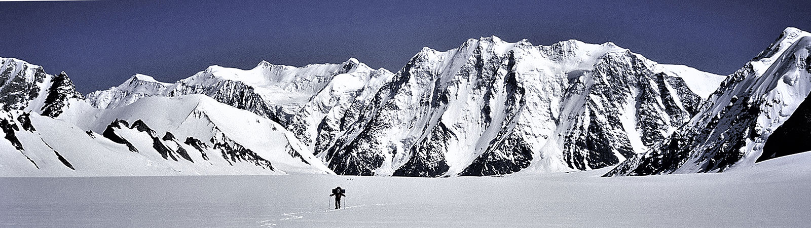
Exploring Teram Shehr Plateau
Share on Social
A BRIEF HISTORY OF SIACHEM GLACIER
Contrary to the popular belief, the Siachen glacier has been visited by many since more than a Century. The glacier, originally known as ‘Saicher Gharni’ was place of interest and several Baltis from the western valleys visited the glacier. Many decades ago it is believed that a small Yarkandi village existed at the entrance of the Teram Shehr glacier. (Bullock-Workman found the walls of such a settlement in 1912). Here on the glacier Yarkandis met the Baltis and traded with them. Once some of the Yarkandis descended the Ghyari nala and took away a Balti woman with them to their glacier village. To take revenge, Baltis contacted an important mullah, who gave them a tawiz (amulet) which was to be placed on the Bilafond la. Mullah instructed them to return via the Nubra valley. However the Baltis, after placing the tawiz on the pass returned the way they had come. Soon afterwards a great storm visited the Siachen glacier and destroyed the settlements and only the rocky desolation remained. The priests say that the calamity would have been greater had they followed the directions fully. Because of this lapse in following the instructions wild roses were not destroyed by the storm. Today roses grow in plenty near the snout and in the lower valleys. The glacier is called Siachen (Sia-rose, chen-place of) – the place of roses.
First Explorers
For explorers the existence, length and location of the Siachen glacier was a matter of discussions. In 1821, W. Moorcroft passed near its snout and first acknowledged its existence. In 1835 G.T. Vigne approached it from the west trying to reach the Bilafond la, but he never guessed the existence of such a large glacier across the divide. In 1848 Henry Starchy was the first to discover the existence of the ‘Saichar’ glacier and ascended it for two miles from the snout in the Nubra valley. In the same year, Dr. Thomas Thompson also reached the glacier followed by F. Drew in 1849-50. E.C. Ryall of the Survey of India sketched the lower part in 1861. But he ascribed to it a length of only sixteen miles.
During his famous second Karakoram journey in 1889, Sir Francis Younghusband (then Colonel) approached the area over the Urdok valley. He was exploring the area to locate a crossing into the Indian Sub-continent. Following a side valley of the Urdok glacier, he reached foot of Turkestan la (North). He felt that this was the main axis of the Karakoram. His explorer’s instincts were correct but, in absence of maps, he was not sure where he was standing. His belief was finally confirmed by Dr. T.G. Longstaff in 1909. In fact, it was Dr. Longstaff with Dr. Arthur Névé and Lt Slingsby who were the first real explorers to traverse this great glacier. At first, they crossed over the Bilafond la (or, Saltoro pass, as Dr. Longstaff would have preferred to call it) and named the glacier in the east as ‘Teram Shehr’ (destroyed city) and peaks as Teram Kangri group. After retreating by the same route, he went down the valley and approached the Siachen via the Nubra valley. Dr. Longstaff climbed up from the Siachen snout in the south and observed the same peaks, as he had identified them from Bilafond la. Thus, he conclusively proved the length of Siachen glacier and the actual location of the Turkestan la (North). This was an important discovery as it now established the true boundaries of the Karakoram. What he wrote is quoted often:
Younghusband was a true prophet. Col Burrand of the Survey had suspected the truth. The avalanche-swept pass, whose foot Younghusband had reached 20 years before, was on the main axis of the Karakoram range which thus lay miles farther north than had been believed. We had stolen some 500 sq miles from the Yarkand river systems of Chinese Turkestan, and joined it to the waters of the Indus and the Kingdom of Kashmir.
The Workman Expeditions, 1911 and 1912
The next most important explorers to the Siachen glacier were the famous Workman couple, in 1911-12. Fanny Bullock-Workman and William Hunter Workman were Americans who had special interest in the exploration of the Karakorams. They focused their attention on the exploration of the Siachen glacier.
They entered the glacier crossing over the Bilafond la and camped on the glacier with a large entourage of porters and two Alpine guides. They climbed many peaks and visited almost all the corners of the upper Siachen. Grant Peterkin was a surveyor attached to this expedition. He surveyed the glacier thoroughly and named a few peaks, particularly Teram Kangri, Apsarasas and Ghent. This expedition spent more than two months on the glacier and they visited almost all the major side valleys. Names like Sia la, Junction Peak, Hawk, Tawiz and few others were given by this expedition. They also visited and named Indira Col, after Goddess Laxmi.
Europeans on the glacier
In 1929 Dr. Ph.C. Visser of the Netherlands was on his fourth trip to the Karakoram. They explored the two Terong glaciers and the Shelkar Chorten glacier which were unknown till then. Dr. Rudolf Wyss and surveyor Khan Sahib Afraz Gul stayed in the Terong valley and mapped the area. Thus they completed surveying the lower part of this great glacier.
At the same time, in 1929, the Duke of Spoleto expedition (Italian) crossed the Karakoram by Muztagh pass and reached Turkestan La from north. They descended from Turkestan la (East) after discovering Staghar and Singhi glaciers.
In 1930 Professor Giotto Dainelli completed the survey and exploration of the Siachen Glacier. He reached the glacier from the southern approaches, from the Nubra valley. He established himself at the Teram Shehr glacier junction in early June. He wrote : ‘. . . . thus reaching the Siachen tongue with all my baggage, a caravan of seventy coolies and six and a half tons of food for the men, carried by an additional caravan of ponies and supplementary coolies. On the 9th of June–exactly two months after my departure from Florence–I was heading for my first depot up the glacier. I hope my English colleagues will appreciate this rapidity of execution, which I consider a record!’ Compare this with the present timings. One can reach the snout in 3 days from Delhi without taking a step on foot ! Dainelli, with his only companion Miss Kalau, stayed at the Teram Shehr junction and carried out various geological surveys. Due to the flooding of the Nubra valley in the lower reaches, he could not return by the same route and hence crossed a 6200 m pass to Rimo glaciers in the east. He named this Col Italia (Italy Col). With this, the survey and exploration of the Siachen in major respects was over.
Middle Years and Politics
The Second World War put an end to all climbing activities in this area for a few decades. This was followed by the turmoil of the Indian Independence and the glacier was left alone for a long time. With the India-China War of 1962 in the east of the Siachen glacier, the entire area was now ‘restricted’, even for the Indian mountaineers and no record of any visits exists. It is known that some parties from the Indian security agencies visited Bilafond la.
In the 1971 war Indian troops defeated the Pakistani forces. The Shyok valley in Ladakh was also scene of action. After the war, talks were held in Shimla to sign an agreement about the demarcation of borders. In this “Shimla Agreement”, the ‘Line of Control’ was demarcated till the Shyok river, to what is known as ‘Border Stone NJ 9842’. For the areas to the north of this point, it was agreed that ‘the Line of Control shall follow the lines of the glaciers’. It was not specified which glacier line will be the border. This ambiguity about exact definition of the border is the reason for today’s conflict.
The conflict in the Siachen glacier may not have taken place at all if Mrs. Indira Gandhi has pressurised Zulfikar Ali Bhutto, Prime Minister of Pakistan to sign an agreement demarcating the borders along the Siachen glacier, as it is now. She was advised to do so by the Secretaries. A besieged Bhutto pleaded with Mrs.Gandhi that his word be trusted to do this at a later date, as did not want to come under attack from his military generals. Aap muz par bharosa kijiye, he said. (You must trust me). The ambiguity about the borders was left. But soon maps appeared encompassing the Siachen under Pakistan territory.
To support their claim, from 1972 to 1983, Pakistan promoted and permitted many expeditions on the Siachen glacier. These expeditions generally crossed over either Gyong la, Bilafond la or Sia la to enter the glacier. These expeditions of foreign nationalities were accompanied by Pakistani liaison officers. They climbed many peaks on the glacier. Singhi Kangri, Teram Kangri, Apsarasas, Ghent and Saltoro Kangri I were climbed. Thus mountaineers became political pawns and their climbs, originating from Pakistan created a precedent of its de facto control over the glacier. During this period, three expeditions from the Indian Army climbed on the glacier. The first expedition was in 1978, when a team led by Col. N. Kumar arrived on the glacier and climbed Teram Kangri II. Col. Kumar returned to the glacier in 1981 to climb Saltoro Kangri I with many other peaks. He reached the true Indira Col (west) at the head of the glacier. In between these climbs an army team had climbed Apsarasas.
India Takes Control
By now maps were published in Europe which showed the extended Line of Control to join the Karakoram Pass in the east, thus surreptitiously supporting the Pakistan claim line to the east of the glacier. This would encompass the entire Siachen glacier, conceding it on maps to Pakistan, forming a long common border between Pakistan and China.
Pakistan gave permission to a Japanese expedition to attempt Rimo peak in 1984. This peak is located in the side valley, east of Siachen. It overlooks the eastern areas of the Aksai Chin. Such an expedition would have firmly linked the western routes with the eastern routes, — the trade route leading to Karakoram Pass and China. The Indian army decided to take action and to prevent such an expedition from proceeding.
The first group of the Indian army landed on the glacier on 14th April 1984 to defend the territory and the war on the glacier began, which is still raging today.
Soon the first expedition arrived from India to counter the policy adopted by Pakistan in the past. Next year, in 1985, an Indo-British expedition (led by Harish Kapadia with Dave Wilkinson) was given permission to climb Rimo peak, approaching it from the Nubra valley in India. It became the first civilian expedition to climb on the glacier after starting of the Siachen war, countering any precedents created by climbs initiated from Pakistan. Their successful climb and the international publicity it generated created an awareness of it as an Indian territory. An American team followed in 1986 reaching the Indira Col (West). Since then though a Japanese and British expeditions were allowed to climb in the Terong valley no team entered the main glacier.
After a gap of a decade, in 1996, an Indian team from Bombay, led by Harish Kapadia, arrived on the glacier with all the clearance from the Government of India. At first they climbed in the Terong valley but as they were about to enter the upper glacier they were stopped from proceeding. Someone in the army hierarchy had decided not to allow the team to proceed ahead. They had to return. This reflected rather poorly on the Indian army. However after protests and a critical report, within a year the situation was rectified with change of Commanders. It was decided to allow the Indian mountaineers on the glacier. Thus in 1997 an Indian ladies team (led by Ms. Bachendri Pal) traversed the glacier and stood on India Saddle. The Bombay team, again led by Harish Kapadia, returned to the glacier in 1998 to complete their unfinished venture. They reached Indira Col (West), India Saddle, Turkestan La (East) and climbed the first peak on the Teram Shehr Plateau : Bhujang (6560 m). Indian mountaineers had arrived on the glacier for good.
Indian Army on the Siachen Glacier
For the past 18 years now valiant soldiers of the Indian Army defends the heights of this glacier. The altitude, severe winter and harsh weather conditions have taken its toll. Almost 800 soldiers have died on this glacier while more than 12,000 soldiers have been injured, many by the harsh conditions. The army has established camps upto 22,000 feet and it takes more than mountaineering skills, even to reach some of the high camps. Soldiers have to cross snow-tunnels, go up almost 2000 ft vertical cliffs on jumars and go across huge crevasses over ladders — most of these to be covered in night to avoid being caught in enemy fire. The stay of the army jawans at such altitudes for long periods has changed many notions about man at high altitudes and are adding new chapters to high altitude mountaineering. Many of the camps are supplied by helicopters adding up to a staggering Rs. 4.8 crore daily expense.
To help the army several new innovations are installed. Snow-scooters, fitted with skis, move on the upper glacier carrying men and material. Wire-cables with winches lead to some posts situated high on vertical cliffs.. Kerosene oil is pumped on the glacier in large quantity to supply fuel. But above all the courage of the jawans are tested to the full. Each has to acclimatise for along period and undergo a pre-induction training of three weeks which is severe. Mountaineering skills with skills required for the war are thoroughly instilled. Still the snow, cold, wind and the enemy fire– all takes it toll. Almost all regiment that go up the glacier for posting lose men. There is heavy exchange of fire. For example in one year, 1998 alone, the Indian side was bombarded with 43,000 artillery shell and 230,000 rounds of small arm fire from Pakistan. The Indian army bombarded the Pakistani side in equal measure.
The mullah, who had given the tawiz which destroyed the glacier in the first instance, had made another prediction. When the storm did not cause total destruction of the glacier due to human folly, he said that another ‘storm’ may visit the glacier in a Century to complete the job. Perhaps this war is fulfilling his prediction !
History of the Siachen Glacier (1821-1998)
Year Expedition
1821 W. Moorcroft passed near the snout of the Siachen glacier and reported its existence.
1835 G. T. Vigne approached it from the west over Bilafond la but never guessed its existence.
1848 Henry Strachey discovered and established the existence of Siachen glacier and ascended it for two miles.
1848 Dr. T. Thompson visited the snout.
1849-50 F. Drew approached the glacier and wrote about it in his famous book Ladakh.
1862 E.C. Ryall of Survey of India, sketched the lower part of the glacier and ascribed it a length of only 16 miles.
1889 Sir F. Younghusband reached foot of Turkestan la (North) from north. He felt that the glacier was long and that this pass was the major Central Asian divide.
1907 Sir Sidney Burrard published a map on the Himalaya. It did not include Siachen though he mentioned the possibility of existence of a large glacier at the head of the Nubra valley.
1908 Dr. Arthur Névé and D.G. Oliver reached the snout and explored Mamostong Kangri.
1909 Dr. Tom Longstaff, Dr Arthur Névé and Lt A.M. Slingsby, later joined by Capt D.G. Oliver, first came over Bilafond la and later over the Siachen snout to establish the length of the Siachen glacier and exact location of various passes. This was the pioneering effort which established the true length and nature of the glacier.
1911-12 The Workman Expedition came over Bilafond la in the west and spent almost 2 months on the glacier. They named many peaks and passes, and climbed a few peaks. Grant Peterkin, attached to this expedition, surveyed the glacier thoroughly.
1911 V.D.B. Collins and C.S. McInnes of Survey of India surveyed Teram Kangri and other peaks.
1913-14 Sir Filippo De Filippi surveyed Rimo glacier system and published a map.
1929 Dr Ph.C. Visser, Netherlands expedition, surveyed Terong valleys and crossed the snout to Gyong la. He was accompanied by the Surveyor Khan Sahib Afraz Gul who completed the detailed survey of the entire glacier.
1929 Duke of Spoleto expedition reached Indira Col (East) from the north and discovered Staghar and Singhi glaciers.
1930 G. Dainelli, Italian expedition, stayed two months at Teram Shehr junction. He approached it starting from Bombay and through the Nubra valley. As the Nubra river was flooded later, he crossed Col Italia and returned via Saser la.
1934 G.O. Dyhrenfurth, International expedition, made the first ascent of Sia Kangri.
1935 British Expedition led by J. Waller with John Hunt attempted Saltoro Kangri. They camped on the Peak 36 glacier.
1939 Lt Peter Young visited Gyong la on shikar.
1956 Austrian expedition led by F. Moravec climbed Sia Kangri West.
1957 Imperial College British expedition led by Eric Shipton climbed Tawiz and visited several passes.
1961 Austrian expedition led by E. Waschak made the first ascent of Ghent.
1962 Japanese-Pakistan expedition led by T. Shidei made the first ascent of Saltoro Kangri I.
1972 ‘Shimla Agreement’ was signed between India and Pakistan. It failed to clearly demarcate the border along this glacier.
1974 Japanese expedition led by T. Tanaka attempted Sherpi Kangri II via S ridge. This was the first expedition allowed from Pakistan after the ‘Shimla Agreement’.
1974 Austrian expedition led by W. Stefan climbed Sia Kangri from SW.
1974 Japanese expedition led by G. Iwatsubo approached K12 from the west. Two members reached the summit but died during the return and disappeared without any trace.
1975 British expedition led by D. Alcock attempted Sherpi Kangri.
1975 Japanese expedition led by Y. Yamamoto climbed K12 by the same route to search for the missing summitters. The search failed.
1975 Japanese expedition led by H. Katayama made first ascents of Teram Kangri I and II, coming over Bilafond la. This was the first expedition to cross over into the Siachen glacier from Bilafond la with permits from Pakistan.
1975 Japanese expeditions led by S. Yamamoto attempted Saltoro Kangri I.
1976 Japanese expedition made first ascent of Sherpi Kangri, led by H. Hirai.
1976 Japanese expedition led by H. Misawa made the first ascent of Apsarasas I, crossing over Bilafond la.
1976 Japanese expedition led by H. Saito came over Bilafond la, crossed Staghar Pass and made the first ascent of Singhi Kangri from north.
1976 An Austrian expedition led by Gunther Schutz crossed over Bilafond la and attempted Saltoro Kangri II.
1977 Austrian expedition climbed Ghent NE from the Kondus glacier.
1978 Indian Army expedition led by Col N. Kumar approached from Nubra and climbed Teram Kangri II. This was the first Indian expedition to enter the glacier from the Nubra valley after the 1930 Italian expedition by G.Dainelli (though Indian security parties have reportedly visited the glacier till Bilafond la).
1978 Japanese expedition led by H. Kobayashi climbed Ghent NE from the Kondus glacier.
1979 Japanese expedition led by S. Hanada crossed over Bilafond la and made the first ascent of Teram Kangri III.
1979 Japanese expedition led by R. Hayashibara climbed Sia Kangri from the Conway Saddle, descended its S face to the Siachen glacier. They trekked out via Bilafond la.
1980 Indian Army expedition led by Brig K.N. Thandani climbed Apsarasas I.
1980 West German team led by B. Scherzer climbed Ghent.
1980 An American team led by Galen Rowell traversed the Siachen glacier during the Karakoram Ski Traverse of major glaciers.
1981 Dutch expedition attempted Saltoro Kangri II from the west.
1981 Indian Army expedition led by Col. N. Kumar reached the upper glacier via the Nubra valley. They climbed Saltoro Kangri I, Sia Kangri I, reached Indira Col (West), Sia la, Turkestan la and Saltoro Pass (PK 36 glacier pass).
1983 Few trekking parties crossed over Bilafond la from the west.
1984 Indian Army expedition led by Col. Prem Chand climbed K12 from the Siachen glacier traversing from the west.
1984 The Indian Army controlled the western heights on the Saltoro ridge to take firm control to defend the area on 14th April. This was the beginning of the ‘Glacier War’ now in its 14th year.
1985 The first expedition after the beginning of action was allowed soon. The Indo-British expedition led by Harish Kapadia (with Dave Wilkinson), explored and climbed peaks in Terong group. They approached from the Siachen glacier, climbed Rimo III and attempted Rimo I.
1986 Sia Kangri was climbed by the Indo-American expedition led by Maj. K.V. Cherian and Leo Lebon. They traversed the glacier. Seven Indians reached the summit and Americans reached Indira Col (West).
1988 Rimo I, the first ascent was made by the Indo-Japanese team led by Hukam Singh and Yoshio Ogata. They approached from the Terong valley and Ibex Col.
1988 Apsarasas I was climbed by the Indian Army Team. Leader and details not known.
1989 Rimo II first ascent, and Rimo IV second ascent. These peaks were climbed by an Indo-British team led by Sonam Palzor and Doug Scott. They approached from the Siachen snout and the Terong glacier.
1992 An Indian army team led by Col. M.S. Gill climbed Teram Kangri I. No details available.
1996 After closer of almost ten years (since1986) the first civilian team was given permission to climb on the upper Siachen glacier. A team from Bombay, led by Harish Kapadia climbed in the Terong valley at first. As they were about to enter the upper Siachen glacier, army cancelled their permits without assigning any reason and they were turned back. Their critical report made a serious impact.
1997 The Indian Women’s team, with Ms. Bachendri Pal as leader, traversed the Siachen glacier and reached the India Saddle in early September.
1998 The Indian team, led by Harish Kapadia, returned to the glacier. They reached Indira Col (West), India Saddle and Turkestan la (East). The team also made the first ascent of Bhujang Peak (6560 m) on the Teram Shehr Plateau, the first ever peak to be climbed on this vast plateau.
2002 The Indian-Japanese Expedition (Harish Kapadia and Hiroshi Sakai) treversed the Shyok valley and reached Karakoram Pass. They crossed ‘Col Italia’ (first crossing after 1930) to reach the Siachen Glacier and made the first ascent of peak Padmanabh (7030 m) on the west of the Siachen Glacier. They explored the Teram Shehr Ice-Plateau fuly reaching its head.
ENVIRONMENT
The entire area of Ladakh and the East Karakoram seems to be undergoing a changing weather pattern. East Karakoram is no longer a rain shadow area and it receives several inches of rainfall. In 1995 there were heavy downpours and the Manali-Leh road could not be opened in 1996 due to landslides.
The Siachen glacier snout has receded by about 800 m in last 13 years. The glacier looked more barren and without snow cover in 1998. The Terong glaciers, particularly the North Terong glacier seemed to be receding fast and most of the ice-penitents and lakes had disappeared
during the last decade. Icefalls of the Safina valley (which we had crossed in 1985) and the Shelkar Chorten valley seemed to be more broken and difficult.
The Sias, (roses) from which the glacier takes its name, were seen in plenty near the snout and in the Nubra valley. Inside the Terong valleys they grew even higher up on the rocky slopes. Some herds of ibexes were noticed in the Terong valleys, but none on the main glacier.
The army lives on the glacier with many constraints and resource crunch. Supplies are taken up by helicopters and there is always shortage of air transport, sometimes even to bring down an injured. Under such trying circumstances it was hardly surprising that the glacier was not in best of the environmental condition. With so many humans living on the glacier the accumulation of garbage was in abundance. Much of garbage was put into crevasses or dumped on rocks and snow. In winters all this as covered under at least 40 feet of snow and the entire area appears a beautiful white sheet. But in summer all the cans, drums and human waste surface and litter is seen everywhere. Worst offenders are tetrapacks in which fruit juices are delivered on the glacier. These aluminium foils, which cannot be burnt or destroyed, line the routes which are traversed and are a major eye-sore.
Army cannot burn the garbage on the glacier, it cannot be destroyed there or be brought down. At the same time the area has to be defended. What should be the solution to this environmental problem ?
Rose plants, which are strong and grow near the snout have also suffered. Many were cut and their stems used as decorative pieces or even as tent-pegs ! Attention of the army was drawn to this and they have assured that the rose plants will be declared as a rare species and no harm will be done to them in future. This will be a wonderful beginning and the army can build on this for full environmental protection of the glacier. The ultimate solution will of course be to end the war but till then under the present situation utmost care must be taken not to damage the environment further.
Some serious thinking needs to be done about the environment concerns on the Siachen glacier.
POWER OF THE DREAM
The Glacier war has taken a heavy toll of men and material on both sides. It is almost an impasse and no side seem to be gaining in anyway. Perhaps now the time has come to consider ways and means to end such an stalemate. One of the ways this glacier can be saved is by declaring it as a ‘National Park of Rose’.
The 1996 Atlanta Olympics has adopted the theme, ‘Power of the Dream’. Let us share the dream about which Aamir Ali has written. It is hoped, someday soon there will be peace on the Siachen glacier. Roses (Sias) will grow wild, ibexes will roam freely and mountaineers can explore and climb.
What is ineffably sad is that the Siachen glacier should now be the stage for a stand-off between the armies of India and Pakistan. Soldiers face each other, both sides have artillery, though the rarefied atmosphere makes nonsense of ballistic data; millions of rupees are spent daily to maintain these forces where causalities due to the altitude and cold are nine times higher than those due to combat. (‘Elements torture man and machine in battle for glacier’, by Christopher Thomas, The Times, 13 February 1993). And when we complain about the garbage dumps at mountaineering expedition base camps, can we imagine what dumps must be like in these high altitude army camps ?
To the layman, all these seems like utmost folly – but then, when did warfare not seem like utmost folly?
Men must harbour dreams sometimes, even foolish foolish dreams, ‘ I have a dream,’ said Martin Luther King in the greatest of his speeches 30 years ago. So let us also dream that the mountaineers of the world persuaded India and Pakistan to withdraw their armies and to establish an ‘International Park of the Rose’(Sia). This was placed under guardianship of the United Nations and the International Union of Alpine Associations. And the ibex and roses are reintroduced and they flourished.
Transnational parks of ‘Transboundry Protected Areas, to use the language of the specialists, are not just an airy-fairy dream. The first was probably the Waterton Glacier International Peace Park established by the US and Canada in 1932. In the same year, Czechoslovakia – which now has third of its frontier covered by protected areas – established nature reserve on the Dunajec river to match the Polish one on the other side. Indonesia and Malaysia have transboundry reserves in Kalimantan; there is an international area for peace along the San Juan river between Nicaragua and Costa Rica; a peace park on both sides of the Evros river boundary between Greece and Turkey.
Recently the Belovezhskaya in Belarus was added to the Bialowieza in Poland, to form an extensive World Heritage Site. The demilitarised zone between North and South Korea has become a wildlife refuge; a park adjoining Pakistan and China has been under consideration. Efforts have been underway for some years by France, Italy and Switzerland to establish an International Mont Blanc Park. All in all, there are some 70 border parks in 65 countries; some of them have served as ‘peace parks’ and have decreased political tensions and national conflicts. (Report of the IVth World Congress on National Parks and Protected Area. International Union for Conservation of Nature, 1992. IUCN has offices in New Delhi and Rawalpindi also).
From The Himalayan Journal, Volume 50 (1993). Aamir Ali
This is a matter for Governments of India and Pakistan to consider. IUCN can act only if both the sides desires peace and intervention. As a mountaineer and lovers of this glacier we can hope that it will be realised that some steps are required to conclude this never-ending war and save the glacier from destruction. It is hoped that powers-that-be will listen to the anguish of the glacier and soldiers serving on it. We can only ask questions which both governments must resolve.
How many deaths will it take till he knows
that too many people have died?
The answer my friend,
is blowing in the wind.
The answer is blowing in the wind.
(Bob Dylan)